geo.wikisort.org - River
The Geba is a river of West Africa that rises in the northernmost area of Guinea in the Fouta Djallon highlands, passes through southern Senegal, and reaches the Atlantic Ocean in Guinea-Bissau. It is about 550 kilometres (340 mi) in total length.[1]
This article needs additional citations for verification. (May 2016) |
| Geba | |
|---|---|
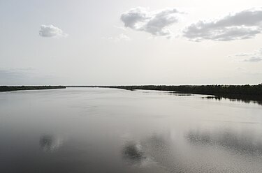
 Geba River in Guinea-Bissau | |
 Map of Senegal, Guinea and Guinea-Bissau with the catchment area of Geba (light green) | |
| Location | |
| Countries |
|
| Physical characteristics | |
| Source | |
| • location | Fouta Djallon highlands, Guinea |
| Mouth | |
• location | Atlantic Ocean |
• coordinates | 11°43′20″N 15°38′40″W |
| Length | 550 km (340 mi) |

In Senegal, the river is locally known as the Kayanga.
Its tributary the Colufe River joins the Geba at Bafatá. After passing by Geba town and Bambadinca, the river broadens into a wide estuary below Xime (where it is joined by the Corubal River), with a total width of about 15 kilometres (9.3 mi) at Bissau.[1] The estuary widens further as the river flows into the Atlantic, forming the Bissagos Islands archipelago.
The Geba River, along with the Corubal River, drains the Bafatá Plateau. It also drains the Gabú Plain, along with the Farim River (also known as the Cacheu River), and their tributaries.[2]
It has long been an important trade route connecting into the interior; it is accessible to 2,000-ton ships some 140 kilometres (87 mi) in, and shallow-draft vessels even further.
References
- "Golden Sediments from Geba River, Guinea Bissau". Earth Snapshot. Chelys. Archived from the original on 27 September 2020. Retrieved 8 October 2015.
- Pélissier, René. "Guinea-Bissau". Encyclopædia Britannica. Retrieved 8 October 2015.
Bibliography
- Salif Diop, La côte ouest-africaine. Du Saloum (Sénégal) à la Mellacorée (Rép. de Guinée), ORSTOM, Paris, 1990, p. 380
На других языках
[de] Geba (Fluss)
Der Rio Geba ist der größte Fluss Guinea-Bissaus. Im Oberlauf ist er als die Kayanga bekannt.- [en] Geba River
[es] Río Geba
El río Geba es un río costero del África occidental que nace en Guinea, pasa al sur de Senegal y en su mayor parte de recorrido transita por Guinea-Bisáu para desembocar en el océano Atlántico, formando un gran estuario, donde se encuentra Bisáu, y donde desagua otro gran río, el río Corubal, que a veces se considera afluente suyo. Tiene una longitud de 540 kilómetros. Las mareas, muy fuertes, alcanzan hasta 7 metros de altura, haciéndolo navegable hasta Bafatá (Guinea-Bisáu).[it] Geba
Il Geba è un fiume dell'Africa occidentale che nasce in Guinea, passa lungo il Senegal e sfocia nell'Oceano Atlantico in Guinea-Bissau.[ru] Геба (река)
Геба — река в Западной Африке.Другой контент может иметь иную лицензию. Перед использованием материалов сайта WikiSort.org внимательно изучите правила лицензирования конкретных элементов наполнения сайта.
WikiSort.org - проект по пересортировке и дополнению контента Википедии