geo.wikisort.org - River
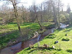
Gat mort is a left tributary of the Garonne, in southwest France. It is 37 km (23 mi) long.[3]
| Gat mort | |
|---|---|
 | |
| Physical characteristics | |
| Source | |
| • location | Hostens |
| • coordinates | 44°29′20″N 0°36′35″W |
| • elevation | 77 m (253 ft)[1] |
| Mouth | |
• location | Garonne |
• coordinates | 44°42′14″N 0°26′18″W |
• elevation | 5 m (16 ft)[2] |
| Length | 37 km (23 mi) |
| Basin features | |
| Progression | Garonne→ Gironde estuary→ Atlantic Ocean |
Geography
Gat mort rises in the Landes de Gascogne Regional Natural Park, in the commune of Hostens, generally drains in a north-easterly direction through the Graves wine-growing region and flows into the Garonne as a left tributary after about 37 km (23 mi)[3] at the municipal boundary of Beautiran and Castres-Gironde.
Department and towns
Gat mort flows through the following department and towns:
- Gironde (33) : Hostens, Saint-Magne, Louchats, Cabanac-et-Villagrains, Saint-Morillon, Saint-Selve, Castres-Gironde, Beautiran.
References
На других языках
[de] Gat-Mort
Der Gat-Mort ist ein Fluss in Frankreich, der im Département Gironde in der Region Nouvelle-Aquitaine verläuft. Er entspringt im Regionalen Naturpark Landes de Gascogne, im Gemeindegebiet von Hostens, entwässert generell in nordöstlicher Richtung durch das Weinbaugebiet Graves und mündet nach rund 37[3] Kilometern an der Gemeindegrenze von Beautiran und Castres-Gironde als linker Nebenfluss in die Garonne.- [en] Gat mort
Текст в блоке "Читать" взят с сайта "Википедия" и доступен по лицензии Creative Commons Attribution-ShareAlike; в отдельных случаях могут действовать дополнительные условия.
Другой контент может иметь иную лицензию. Перед использованием материалов сайта WikiSort.org внимательно изучите правила лицензирования конкретных элементов наполнения сайта.
Другой контент может иметь иную лицензию. Перед использованием материалов сайта WikiSort.org внимательно изучите правила лицензирования конкретных элементов наполнения сайта.
2019-2025
WikiSort.org - проект по пересортировке и дополнению контента Википедии
WikiSort.org - проект по пересортировке и дополнению контента Википедии

