geo.wikisort.org - River
The Esla is a river in the provinces of León and Zamora in the northwest of Spain. It is a tributary of the Duero River that starts in the Cantabrian Mountains and is 275 kilometres (171 mi) long.[1] Its direction of flow is from north to south. It is the largest tributary of the Duero in terms of discharge; in fact, at its mouth at the confluence with the Duero, it has a greater discharge than the volume in the main river.[1]
| Esla | |
|---|---|
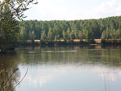
 View of the Esla River | |
 | |
| Location | |
| Country | Spain |
| Physical characteristics | |
| Source | |
| • elevation | 1,500 metres (4,900 ft) |
| Mouth | |
• location | Duero River |
| Length | 275 kilometres (171 mi) |
| Basin size | 16,081 square kilometres (6,209 sq mi)[1] |
| Discharge | |
| • average | 135 cubic metres per second (4,800 cu ft/s)[2] |
| Basin features | |
| Progression | Douro→ Atlantic Ocean |
The most official source of the river is the “Fuente del Naranco” in Valdosín (near La Uña in León province).[3][4]
This river was known as the Astura to the ancient Romans, from which the Asturian people took their name. They were ancestors of the modern inhabitants of Asturias and León, living on both sides of the Cantabrian Mountains. Many of the toponyms in the area owe their name to the river; for example, Villafalé (Villa Fértil a orillas del Río Astura), Vega del Esla, Mansilla del Esla, etc.
In the 19th century, the Canal del Esla was built to irrigate the Vega de Toral. In the 1980s, a dam and reservoir project to generate hydroelectric power required the submersion of seven villages along the Esla in León, including Riaño. New villages were built along the reservoir to replace these historic towns.
The principal tributaries of the Esla are:
- Bernesga River
- Cea River
- Órbigo River
- Porma River
- Tera River
- Aliste River
See also
- List of rivers of Spain
- Ricobayo Arch Bridge
References
- Fernández-Aláez, M.; Fernández-Aláez, C.; de Luis Calabuig, E. (1992). "The Esla River Basin: From the Cantabrian Mountain to the Duero" (PDF). Limnetica. 8: 131–40. Retrieved 20 August 2014.
- Discharge of the Esla according to CHD
- Ministerio de Fomento. Instituto Geográfico Nacional. http://signa.ign.es/signa/
- Atlas de España (1992). El Pais. Aguilar S.A. de Ediciones. ISBN 84-86459-39-7
На других языках
[de] Esla
Der ca. 285 km lange Río Esla ist ein rechter Nebenfluss des Duero in Nordspanien. Er entspringt im Kantabrischen Gebirge am Peña Prieta und fließt durch die Provinzen Léon und Zamora. Schließlich mündet er bei Muelas del Pan (ca. 30 km westlich von Zamora) in den Duero.- [en] Esla (river)
[it] Esla
L'Esla è uno dei più importanti fiumi della Spagna nordoccidentale. È un affluente del Duero, nasce nella Cordigliera Cantabrica ed attraversa da nord a sud le provincie di León e Zamora. È l'affluente di maggior portata del Duero e alla confluenza ha una portata maggiore che lo stesso Duero[1]. È lungo 286 km e drena un bacino di 16.163 km². Il suo letto è sbarrato dalla diga di Ricobayo, per la cui costruzione si dovette spostare la chiesa di San Pedro de la Nave, che sarebbe altrimenti stata sommersa dalle acque.[ru] Эсла
Э́сла (исп. Río Esla) — река на северо-западе Испании, правый приток Дуэро[1]. Берёт начало в Кантабрийских горах на южных склонах. Наиболее полноводна с ноября по май. Вблизи устья создано водохранилище, воды которого используются для выработки электроэнергии и орошения.Другой контент может иметь иную лицензию. Перед использованием материалов сайта WikiSort.org внимательно изучите правила лицензирования конкретных элементов наполнения сайта.
WikiSort.org - проект по пересортировке и дополнению контента Википедии