geo.wikisort.org - River
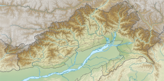
Dibang River, also known as Sikang by the Adi and Talo in Idu,[1] is an upstream tributary river of the Brahmaputra in the Indian state of Arunachal Pradesh. It originates and flows through the Mishmi Hills in the (Upper) Dibang Valley and Lower Dibang Valley districts.[2]
| Dibang river | |
|---|---|
 | |
 | |
  | |
| Native name |
|
| Physical characteristics | |
| Source | Dri |
| • coordinates | 28.7807°N 95.8603°E |
| 2nd source | Tangon |
| Mouth | Lohit River |
• location | Sadiya, Assam |
• coordinates | 27.8012°N 95.5173°E |
| Length | 223 kilometres (139 mi) |
| Basin size | 13,933 sq km |
| Discharge | |
| • location | Kobo Chapori (into the Brahmaputra) |
| Basin features | |
| River system | Brahmaputra River |
| Tributaries | |
| • left | Emra, Anelih |
| • right | Tangon, Angolin, Amli |
Course
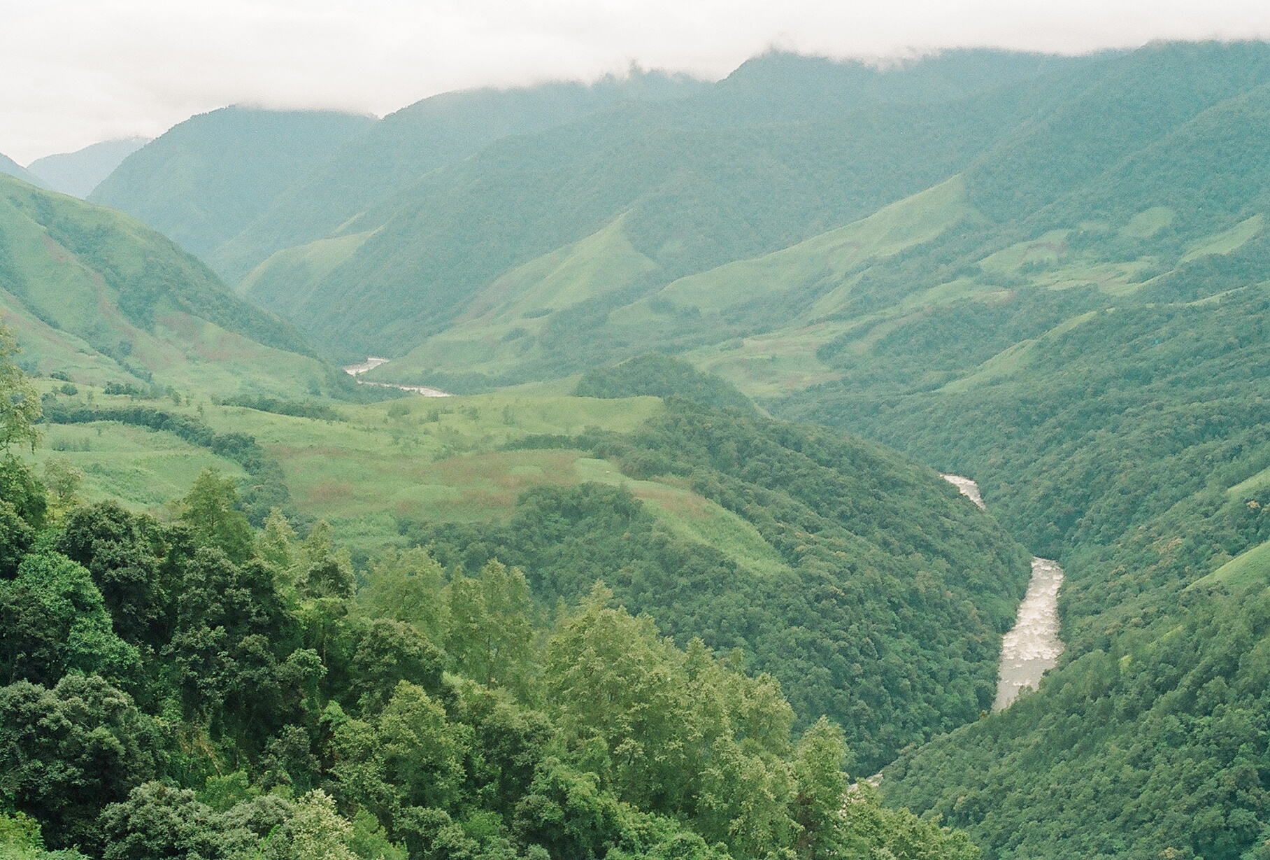
The Dibang originates near Keya pass on the Indo-Chinese border in the Upper Dibang Valley district of Arunachal Pradesh. The drainage basin of the river within Arunachal Pradesh covers the districts of Upper Dibang Valley and Lower Dibang Valley.[3] The Mishmi Hills lie in the upper course of the Dibang which enters the plains at Bomjir, Dambuk etc.
Between Bomjir (Nizamghat) and Sadiya the Dibang has a steep river gradient and exhibits braided channel morphology, with its width varying from 4 to 9 kilometres (2 to 6 mi). It often changes its course, resulting in flooding and destruction of cultivable land and forests along its banks.[4] The Dibang, with a total length of 195 kilometres (121 mi), enters the River Lohit north of the Dibru-Saikhowa sanctuary near the Assamese town of Sadiya.[5][6]
Tributaries
The Sisar, Mathun, Tangon, Dri, Ithun and Emra are the major tributaries of the Dibang. The Dibang is also joined by a number of tributaries such as the Airi, Ilu, Imu, Ahi, Ashu, Epipani and Eze (Deopani) rivers during its course. Most of these rivers join it in the upper course in the hills thus giving it a wide fan shaped catchment region.[3][4]
Hydro projects
As of 2016 there were 18 hydro-electric projects at different stages of proposal and planning in the Dibang basin.[2]
In 2008, Prime Minister Manmohan Singh laid the foundation stone for a 3000 MW dam as part of the Dibang Multipurpose Project the district of Lower Dibang Valley. Seventeen other dams with power potential between 20 and 4500 MW have also been proposed for the Dibang. The proposed Dibang dam, at 288 metres (945 ft), on completion would be among the largest dams in India and among the world's tallest gravity dams has since run into opposition from the Adi, Idu and the Assamese who live downstream of the project.[3][7][8]
On 18 July 2019, the Prime Minister chaired Cabinet Committee on Economic Affairs gave the greenlight to continue with the Dibang hydropower project.[1] The renewal has been backed by the electricity the project has the capacity to generate, help with flood control in the region and as a control measure against Chinese hydro projects.[1]
See also
- Dibang River Bridge
- Dibang Dam
References
- Pisharoty, Sangeeta Barooah (22 July 2019). "Explainer | The Controversy Surrounding Dibang Dam, India's Largest Hydropower Project". The Wire. Archived from the original on 22 July 2019. Retrieved 16 June 2021.
- R. S. Envirolink Technologies (July 2016). Cumulative Impact & Carrying Capacity Study of Dibang Sub Basin on Brahmaputra River Valley. Volume I. Prepared for Ministry of Environment, Forest and Climate Change. Accessed on 16 June 2021. Archived on 16 June 2021.
- "Damming Dibang River: Mishmi's resistance against 3000 MW Dibang Multipurpose Project". Archived from the original on 7 December 2013. Retrieved 14 September 2013.
- "Dibang Multipurpose Project - Chapter-4: Water Resources" (PDF). WAPCOS Limited. Retrieved 14 September 2013.
- "Restoration Proposal for Dibang & Lohit Rivers". Archived from the original on 17 March 2014. Retrieved 14 September 2013.
- "Dibang sub basin of Brahmaputra Basin". National Institute of Hydrology. Archived from the original on 1 August 2014. Retrieved 14 September 2013.
- "Disquiet in Dibang". Down to Earth. 15 May 2008. Retrieved 14 September 2013.
- "Protests against public hearing on Dibang dam". The Assam Tribune. 5 March 2013. Retrieved 14 September 2013.
На других языках
[de] Dibang (Fluss)
Der Dibang ist ein linker Nebenfluss des Brahmaputra in den indischen Bundesstaaten Arunachal Pradesh und Assam.- [en] Dibang River
[ru] Дибанг (река)
Дибанг (англ. Dibang) — река бассейна Брахмапутры, является притоком Лухита, бассейн реки целиком расположен в пределах штата Аруначал-Прадеш Индии. Кроме общепринятого названия реки, Дибанг в различных этнических группах называется также Сикангом (англ. Sikang) и Талоном (англ. Talon).[1]Другой контент может иметь иную лицензию. Перед использованием материалов сайта WikiSort.org внимательно изучите правила лицензирования конкретных элементов наполнения сайта.
WikiSort.org - проект по пересортировке и дополнению контента Википедии