geo.wikisort.org - River
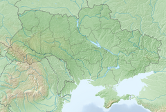
Dhzurla (Ukrainian: Джурла) waterfall is located on the Dhzurla river in the Crimean Mountains of Crimea. Waterfall height is about 6 metres (20 ft). Waterfall has a few cascades. The word “Dhzurla” from Crimean Tatar language which means “her, who runs."[unreliable source?]
This article needs additional citations for verification. (May 2017) |
| Dhzurla | |
|---|---|
 | |
| Location | Crimean Mountains, Crimea, Disputed between Russia and Ukraine[1] |
| Coordinates | 44°46′4.73″N 34°25′31.04″E |
| Elevation | 820 metres (2,690 ft) |
| Total height | 6 metres (20 ft) |
| Watercourse | Dhzurla river |
Downstream river is called Soter.[2]
See also
- Waterfalls of Ukraine
References
- This place is located on the Crimean peninsula, most of which is the subject of a territorial dispute between Russia, which administers the contested area, and Ukraine, whose internationally recognised boundaries include the contested area. According to the political division of Russia, there are federal subjects of the Russian Federation (the Republic of Crimea and the federal city of Sevastopol) located on the peninsula. According to the administrative-territorial division of Ukraine, there are the Ukrainian divisions (the Autonomous Republic of Crimea and the city with special status of Sevastopol) located on the peninsula.
- Гончаров, Владлен Петрович (1971). Демерджи. Симферополь: Крым. p. 28.
На других языках
- [en] Dhzurla
[ru] Джурла (водопад)
Джурла — водопад на реке Джурла (другие названия Алака, Сотера, Биюк-Дере) в одноимённом урочище в Крымских горах. Водопад представляет собой серию невысоких каскадов общей высотой около 6 м[2]. Неподалёку расположен вход в одноимённую пещеру.Текст в блоке "Читать" взят с сайта "Википедия" и доступен по лицензии Creative Commons Attribution-ShareAlike; в отдельных случаях могут действовать дополнительные условия.
Другой контент может иметь иную лицензию. Перед использованием материалов сайта WikiSort.org внимательно изучите правила лицензирования конкретных элементов наполнения сайта.
Другой контент может иметь иную лицензию. Перед использованием материалов сайта WikiSort.org внимательно изучите правила лицензирования конкретных элементов наполнения сайта.
2019-2025
WikiSort.org - проект по пересортировке и дополнению контента Википедии
WikiSort.org - проект по пересортировке и дополнению контента Википедии

