geo.wikisort.org - River
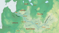
Daugava (Latgalian: Daugova, German: Düna) or Western Dvina (Russian: Западная Двина (Západnaya Dviná); Belarusian: Заходняя Дзвіна; Estonian: Väina; Finnish: Väinäjoki) is a large river rising in the Valdai Hills of Russia that flows through Belarus then Latvia into the Gulf of Riga of the Baltic Sea. It rises close to the source of the Volga. Its length is 1,020 km (630 mi),[1] of which 352 km (219 mi) are in Latvia[2] and 325 km (202 mi) are in Russia. It is a westward-flowing river, tracing out a great curve towards its south which means it passes through northern Belarus.
| Daugava Western Dvina, Russian: Западная Двина (Západnaya Dviná), Belarusian: Заходняя Дзвіна ([zaˈxodnʲaja dzʲvʲiˈna]), Livonian: Vēna, Estonian: Väina, German: Düna | |
|---|---|
 The drainage basin of the Daugava | |
| Location | |
| Country | Belarus, Latvia, Russia |
| Physical characteristics | |
| Source | |
| • location | Valdai Hills, Russia |
| • elevation | 221 m (725 ft) |
| Mouth | |
• location | Gulf of Riga, Baltic Sea |
• coordinates | 57°3′42″N 24°1′50″E |
• elevation | 0 m (0 ft) |
| Length | 1,020 km (630 mi)[1] |
| Basin size | 87,900 km2 (33,900 sq mi)[1] |
| Discharge | |
| • average | 678 m3/s (23,900 cu ft/s) |
Latvia's capital, Riga bridges the estuary four times, lying on both banks, the city centre being 15 kilometres (9.3 mi) from the mouth and being a significant port.
Geography
The total catchment area of the river is 87,900 km2 (33,900 sq mi), 33,150 km2 (12,800 sq mi) of which are within Belarus.[1]
Tributaries
The following rivers are tributaries to the river Daugava (from source to mouth):
Etymology

According to Max Vasmer's Etymological Dictionary, the toponym Dvina clearly cannot stem from a Uralic language, and it possibly comes from an Indo-European word which used to mean river or stream.[3] The name Dvina resembles strongly Danuvius which itself derived from the Proto-Indo-European *dānu, "large river".
The Finno-Ugric names Vēna (Livonian), Väinajogi (Estonian) and Väinäjoki (Finnish) all stem from Proto-Finnic *väin, "a large, peacefully rolling river".

Environment
The river began experiencing environmental deterioration in the era of Soviet collective agriculture (producing considerable adverse water pollution runoff) and a wave of hydroelectric power projects.[4]
Cities, towns and settlements
Russia
Andreapol, Zapadnaya Dvina and Velizh.
Belarus
Ruba, Vitebsk, Beshankovichy, Polotsk with Boris stones strewn in the vicinity, Navapolatsk, Dzisna, Verkhnedvinsk, and Druya.
Latvia
Krāslava, Daugavpils, Līvāni, Jēkabpils, Pļaviņas, Aizkraukle, Jaunjelgava, Lielvārde, Kegums, Ogre, Ikšķile, Salaspils and Riga.
History

Humans have settled at the mouth of the Daugava and around the other shores of the Gulf of Riga for millennia, initially participating in a hunter-gatherer economy and utilizing the waters of the Daugava estuary as fishing and gathering areas for aquatic biota. Beginning around the sixth century AD, Viking explorers crossed the Baltic Sea and entered the Daugava River, navigating upriver into the Baltic interior.[5]
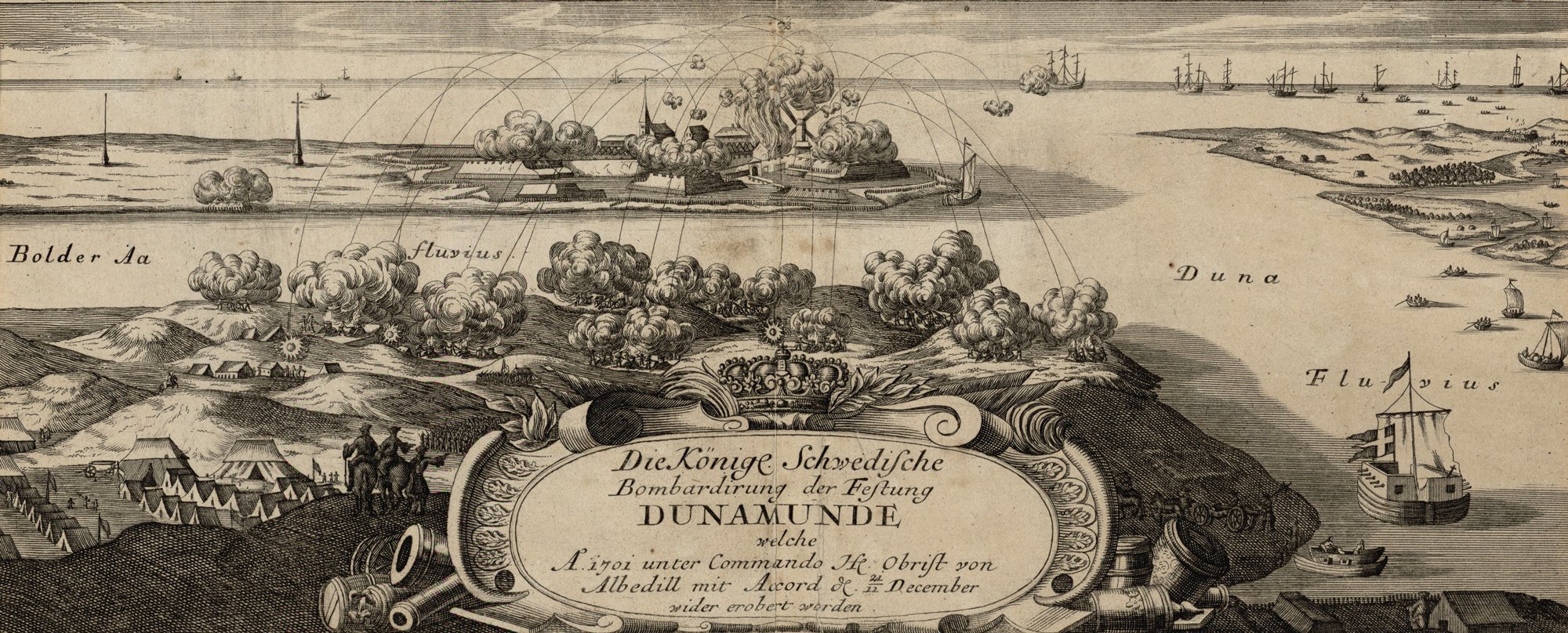
In medieval times the Daugava was an important area of trading and navigation - part of the trade route from the Varangians to the Greeks - for transport of furs from the north and of Byzantine silver from the south. The Riga area, inhabited by the Finnic-speaking Livs, became a key element of settlement and defence of the mouth of the Daugava at least as early as the Middle Ages, as evidenced by the now destroyed fort at Torņakalns on the west bank of the Daugava at present day Riga. Since the Late Middle Ages the western part of the Daugava basin has come under the rule of various peoples and states; for example the Latvian town of Daugavpils, located on the western Daugava, variously came under papal rule as well as Slavonic, Polish, German and Russian sway until restoration of the Latvian independence in 1990 at the end of the Cold War.[citation needed]
Water quality
Upstream of the Latvian town of Jekabpils the pH has a characteristic value of about 7.8 (slight alkaline); in this reach the calcium ion has a typical concentration of around 43 milligrams per liter; nitrate has a concentration of about 0.82 milligrams per liter (as nitrogen); phosphate ion is measured at 0.038 milligrams per liter; and oxygen saturation was measured at eighty percent. The high nitrate and phosphate load of the Daugava is instrumental to the buildup of extensive phytoplankton biomass in the Baltic Sea; other European rivers contributing to such high nutrient loading of the Baltic are the Oder and Vistula Rivers.[citation needed]
In Belarus, water pollution of the Daugava is considered moderately severe, with the chief sources being treated wastewater, fish-farming and agricultural chemical runoff (e.g. herbicides, pesticides, nitrate and phosphate).[6][7]
References
- "Main Geographic Characteristics of the Republic of Belarus. Main characteristics of the largest rivers of Belarus". Land of Ancestors. Data of the Ministry of Natural Resources and Environmental Protection of the Republic of Belarus. 2011. Retrieved 27 September 2013.
- "Gruberts D. "Daugava". Nacionālā enciklopēdija". Nacionālā enciklopēdija. Retrieved 11 August 2022.
- Фасмер, Макс. Этимологический словарь Фасмера (in Russian). p. 161.
- C.Michael Hogan (2012). "Daugava River". Encyclopedia of Earth. National Council for Science and the Environment.
-
Compare:
Frucht, Richard C. (2005-01-01). Eastern Europe: An Introduction to the People, Lands, and Culture. ABC-CLIO. ISBN 9781576078006. Retrieved 2017-07-06.
The Daugava was an important transit river (carrying everything from Vikings to floating lumber) for centuries [...].
- "Towards water security in Belarus: a synthesis report". OECDiLibrary. pp. 19–20. doi:10.1787/488183c4-en. Retrieved 27 June 2021.
- "Water Report 15". fao.org. Food and Agriculture Organization of the United Nations. Retrieved 27 June 2021.
Further reading
- Richard C. Frucht; Aldis Purs (2005). Latvia. Eastern Europe. ABC-CLIO. p. 115. ISBN 9781576078006. Retrieved 2009-08-01.
- Francis W. Carter and David Turnock. 2002. Environmental problems of East Central Europe. 442 pages Google eBook
- Kropotkin, Peter Alexeivitch; Bealby, John Thomas (1911). . Encyclopædia Britannica. Vol. 8 (11th ed.). p. 738.
External links
- Daugava River photos at flickr
Authority control | |
|---|---|
| General | |
| National libraries | |
На других языках
[de] Düna
Die Düna (lettisch Daugava, polnisch Dźwina, belarussisch Дзвіна .mw-parser-output .Latn{font-family:"Akzidenz Grotesk","Arial","Avant Garde Gothic","Calibri","Futura","Geneva","Gill Sans","Helvetica","Lucida Grande","Lucida Sans Unicode","Lucida Grande","Stone Sans","Tahoma","Trebuchet","Univers","Verdana"}Dswina, russisch Западная Двина Sapadnaja Dwina) ist ein in die Ostsee mündender, 1020 km langer Strom.- [en] Daugava
[it] Daugava
La Daugava o Dvina occidentale[1] (lettone: Daugava, Bielorusso: Дзвіна, Заходняя Дзьвіна, in russo: Западная Двина́?, polacco: Dzwina, Tedesco: Düna, finlandese: Väinä, estone: Väina, livone: Vēna) è un fiume che nasce nel Rialto del Valdaj nell'oblast russo di Tver. Attraversa la Russia, la Bielorussia e la Lettonia, sfocia nel golfo di Riga, Mar Baltico. La lunghezza totale del fiume è di 1.020 Km (633,7 miglia) ed è collegata da un canale con i fiumi Dnepr e Beresina. Non deve essere confusa con la Dvina settentrionale.[ru] Западная Двина
За́падная Двина́[1] (белор. Заходняя Дзвіна, в Латвии — Да́угава[1], латыш. Daugava, латг. Daugova, лив. Väinäjoki, Väinajõgi, Väina, Viina, Veena, Vēna, Vina, Duna[2]) — река на севере Восточной Европы, протекающая по территории России, Белоруссии и Латвии. Соединена недействующей Березинской водной системой с рекой Днепр[3]. Древние названия — Эрида́н, Рудо́н, Бубо́н, Рубо́н, Судо́н, Хесин[4].Другой контент может иметь иную лицензию. Перед использованием материалов сайта WikiSort.org внимательно изучите правила лицензирования конкретных элементов наполнения сайта.
WikiSort.org - проект по пересортировке и дополнению контента Википедии