geo.wikisort.org - River
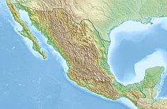
The Culiacán River is a river that is formed at the confluence of the Tamazula River and Humaya River, located in Culiacán city of Sinaloa state, in northwestern Mexico.[1]
| Culiacán River Rio Culiacán | |
|---|---|
 'Culiacan River | |
| Location | |
| Country | Mexico |
| State | Sinaloa |
| Physical characteristics | |
| Source | |
| • location | Culiacán |
| Mouth | |
• location | Gulf of California, Pacific Ocean |
• coordinates | 24°29′32″N 107°43′55″W |
• elevation | Sea level |
The river flows from the Sierra Madre Occidental headwaters confluence generally westwards and down into the Gulf of California of the Pacific Ocean.
See also
- Mexican golden trout — endemic to the headwaters area of this and several other rivers in the Sierra Madre Occidental.
- List of longest rivers of Mexico
References
- "Rio Culiacán". GeoNames. Retrieved July 26, 2021.
На других языках
- [en] Culiacán River
[es] Río Culiacán
El río Culiacán es un río en el Estado de Sinaloa, México. Su curso mide 87.5 km de largo, y su cuenca abarca 17 200 km², siendo su flujo anual 3 280 millones de hm³.Текст в блоке "Читать" взят с сайта "Википедия" и доступен по лицензии Creative Commons Attribution-ShareAlike; в отдельных случаях могут действовать дополнительные условия.
Другой контент может иметь иную лицензию. Перед использованием материалов сайта WikiSort.org внимательно изучите правила лицензирования конкретных элементов наполнения сайта.
Другой контент может иметь иную лицензию. Перед использованием материалов сайта WikiSort.org внимательно изучите правила лицензирования конкретных элементов наполнения сайта.
2019-2025
WikiSort.org - проект по пересортировке и дополнению контента Википедии
WikiSort.org - проект по пересортировке и дополнению контента Википедии

