geo.wikisort.org - River
The Courantyne/Corentyne/Corantijn River is a river in northern South America in Suriname and Guyana. It is the longest river in the country and creates the border between Suriname and the East Berbice-Corentyne region of Guyana.
| Courantyne River Corentyne, Corantijn River | |
|---|---|
 Wonotobo Middle Fall in the Corentyne Basin from Canoe and Camp Life in British Guiana by Charles Barrington Brown | |
 Courantyne River course | |
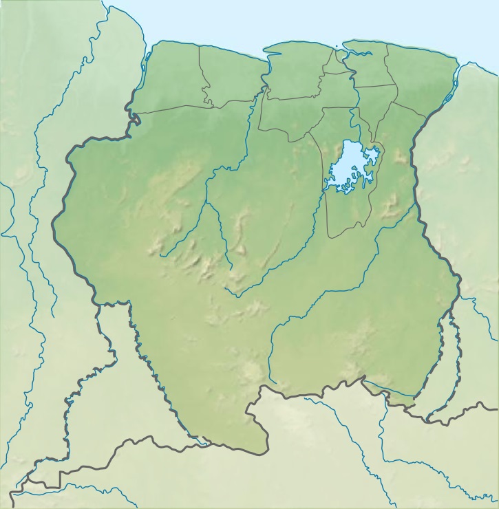 Location of mouth | |
| Location | |
| Country | Suriname, Guyana |
| Physical characteristics | |
| Mouth | Atlantic Ocean |
• coordinates | 5°57′N 57°06′W |
| Length | 724 km (450 mi) |
| Basin size | 69,000 km2 (27,000 sq mi) |
| Discharge | |
| • location | mouth |
| • average | 2,300 m3/s (81,000 cu ft/s) |
Its tributaries include Kutari River, Coeroeni River, New River, and Zombie Creek.[1] In Suriname; Kabalebo River, Lucie River, Sipaliwini River, Kutari River.
Course
The river runs through the Guianan moist forests ecoregion.[2] It originates in the Acarai Mountains and flows northward via the Boven (Upper) Courantyne which is the source river for approximately 724 km (450 mi) between Guyana and Suriname, emptying into the Atlantic Ocean near Corriverton, Guyana and Nieuw Nickerie, Suriname. A ferry service operates between these two towns.
Small ocean-going vessels are able to navigate the river for about 120 km (75 mi) to Apura, Suriname.
Waterfalls
The Wonotobo Falls, Frederik Willem IV (Anora) Falls, and the King Edward VI Falls[3] are on the Courantyne River. Other falls include the Barrington Brown Falls, the Drios Falls and the Maopityan Falls.
Territorial dispute
Between the upper reaches of the Courantyne, the Upper Courantyne, the Coeroeni and the Koetari rivers lay the controversial Tigri Area claimed by both Suriname and Guyana. The Guyanese–Surinamese border is the Guyanese river bank (the west bank of the river), Suriname regarded the left bank of the Courantyne as a border, but Guyana disputes this and viewed the center of the river as a frontier, based on the Thalweg Doctrine. This conflict, which has been fueled since the colonial era, was solved in 2007 by a verdict by the Hague Arbitration Court, which settles the border between Guyana and Suriname on the left bank of the river, and the river water body belonging to Suriname. The tribunal that defined the maritime boundary between Suriname and Guyana in 2007 confirmed Surinamese sovereignty over the full width of the Courantyne River.[4][5] Suriname has control over all ship traffic from the mouth of the Courantyne.
See also
- Corantijn Basin
- Borders of Suriname
- List of rivers of Guyana
- List of rivers of Suriname
- List of rivers of the Americas by coastline
References
- "Zombie Creek, Guyana - Geographical Names, map, geographic coordinates". geographic.org. Retrieved 2021-01-21.
- Schipper, Jan; Teunissen, Pieter; Lim, Burton, Northern South America: Guyana, Suriname, French Guiana, northern Brazil, and eastern Venezuela (NT0125), retrieved 2017-04-03
- "King Edward VIII Falls". World Water Fall Database. Retrieved 16 December 2021.
- Permanent Court of Arbitration - Guyana/Suriname Archived 2013-02-08 at the Wayback Machine
- Award of the Tribunal Archived 2011-01-02 at the Wayback Machine
На других языках
[de] Corantijn
Der Corantijn (englisch Courantyne) ist ein 457 km langer Fluss in Südamerika. Er bildet die Grenze zwischen Guyana und Suriname, gehört aber laut Schiedsgerichtspruch vollständig zum surinamischen Staatsgebiet. Einschließlich der Quellflüsse Coeroeni und Sipaliwini beträgt die Gesamtlänge 873 km.- [en] Courantyne River
[es] Río Courantyne
El río Corentyne (o también Courantyne o Corantijn) es un río costero del norte de Sudamérica. El río tiene sus orígenes en las montañas Acarai y fluye en dirección norte por aproximadamente 724 km entre Guyana y Surinam, desembocando en el océano Atlántico cerca a Corriverton, Guyana y Nieuw Nickerie, Surinam. Un servicio de transbordador opera entre estas dos poblaciones.[it] Corentyne
Il Corentyne (francese Courantyne, olandese Corantijn) è un fiume situato in Guyana. Il fiume ha le sue origini nelle montagne Acarai e scorre verso nord per circa 724 km tra la Guyana e il Suriname, con la foce che sbocca nell'Oceano Atlantico presso le città di Corriverton e Nieuw Nickerie. Il fiume determina il confine tra le due nazioni. Le piccole barche sono in grado di navigare per un tratto di 70 km fino alle prime rapide presso Orealla.[ru] Корантейн
Коранте́йн (устар. Корентин; англ. Courantyne, нидерл. Corantijn) — река на севере Южной Америки.Другой контент может иметь иную лицензию. Перед использованием материалов сайта WikiSort.org внимательно изучите правила лицензирования конкретных элементов наполнения сайта.
WikiSort.org - проект по пересортировке и дополнению контента Википедии