geo.wikisort.org - River
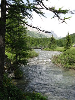
The Clarée is a river in southeastern France, a right tributary to the Durance. It is 31.9 km (19.8 mi) long.[1] Its drainage basin is 189 km2 (73 sq mi).[2] Its source is in the Cottian Alps, near Mont Thabor and Valloire. It flows for all of its course in the Hautes-Alpes department. Its confluence with the Durance is near the hamlet of Les Alberts not far from the source of the Durance in the ski resort of Montgenevre.
| Clarée | |
|---|---|
 | |
| Location | |
| Country | France |
| Physical characteristics | |
| Source | |
| • location | Cottian Alps |
| • elevation | 2,200 m (7,200 ft) |
| Mouth | |
• location | Durance |
• coordinates | 44.9246°N 6.6795°E |
| Length | 32 km (20 mi) |
| Basin size | 189 km2 (73 sq mi) |
| Basin features | |
| Progression | Durance→ Rhône→ Mediterranean Sea |
The upper reaches of the river are in a military exercise range. This is where the French army from their base in Briançon train in the mountains.
Tourism
In the summer the Vallée de la Clarée is visited by cyclists, walkers and horse riders. The river is used for water sports especially in spring as the snow melts. There are sections of white water, which are used by kayaks and white water rafts. There is a dramatic waterfall at Fontcouverte.
Settlements
The settlements along the Clarée include:
- Névache:
- Plampinet
- Le Serre
- Val-des-Prés
- Le Rosier
- Les Alberts
See also
- Vallée de la Clarée
References
- Sandre. "Fiche cours d'eau - La Clarée (X0000500)".
- Bassin versant : Clarée (La), Observatoire Régional Eau et Milieux Aquatiques en PACA
На других языках
[de] Clarée
Die Clarée ist ein Fluss in Frankreich, der im Département Hautes-Alpes in der Region Provence-Alpes-Côte d’Azur verläuft. Sie entspringt in den Cottischen Alpen, nahe dem Mont Thabor (3178 m), im Gemeindegebiet von Névache. Die Quelle befindet sich unterhalb des Col de l’Aiguille Noire, hart an der Grenze zum benachbarten Département Savoie in der Region Auvergne-Rhône-Alpes; der Quellbach nennt sich zunächst Ruisseau des Rochilles. Die Clarée entwässert generell in südöstlicher Richtung, immer parallel zur italienischen Grenze, und mündet nach rund 32[2] Kilometern an der Gemeindegrenze von Val-des-Prés und Montgenèvre als rechter Nebenfluss in die Durance.- [en] Clarée
[es] Río Clarée
El río Clarée (en occitano Clarèia) es un río de Francia, afluente del río Durance por la derecha. Nace en los Alpes a 2400 m sobre el nivel del mar, en el Lac de la Clarée, también llamado Mère de l’Eau (madre del agua), en departamento de Altos Alpes. Desemboca en el Durance junto a La Vachette, tras un curso de sólo 30 km, pero en el que desciende 1000 m de altura.[it] Clarée
Il torrente Clarée è un corso d'acqua a carattere torrentizio francese che sgorga nel dipartimento delle Alte Alpi nella Regione Provenza-Alpi-Costa Azzurra, è affluente della Durance e fa parte del bacino idrografico del Rodano.Другой контент может иметь иную лицензию. Перед использованием материалов сайта WikiSort.org внимательно изучите правила лицензирования конкретных элементов наполнения сайта.
WikiSort.org - проект по пересортировке и дополнению контента Википедии

