geo.wikisort.org - River
Chittenango Creek is a small river in central New York, United States.[1] The creek partially forms the boundary between Onondaga County and Madison County.
This article needs additional citations for verification. (January 2016) |
| Chittenango Creek | |
|---|---|
 Chittenango Creek, looking downstream at Chittenango Falls State Park | |
 Location of the mouth of Chittenango Creek in New York State  Chittenango Creek (the United States) | |
| Location | |
| Country | United States |
| State | New York |
| Region | Central New York |
| Physical characteristics | |
| Source | Nelson Swamp |
| • location | Town of Fenner, Madison County |
| • coordinates | 42°57′31″N 75°45′13″W[1] |
| Mouth | Oneida Lake |
• location | Bridgeport |
• coordinates | 43°11′01″N 75°59′36″W[1] |
| Basin features | |
| Progression | Chittenango Creek → Oneida Lake → Oneida River → Oswego River → Lake Ontario → St. Lawrence River → Gulf of St. Lawrence → Atlantic Ocean |
| Tributaries | |
| • left | Cazenovia Lake, Limestone Creek |
| Waterfalls | Chittenango Falls |
The Chittenango Creek watershed comprises about 290 square miles (750 km2) of drainage in Onondaga and Madison counties. The median annual flow is estimated at about 300 cubic feet per second (8.5 m3/s).
Course
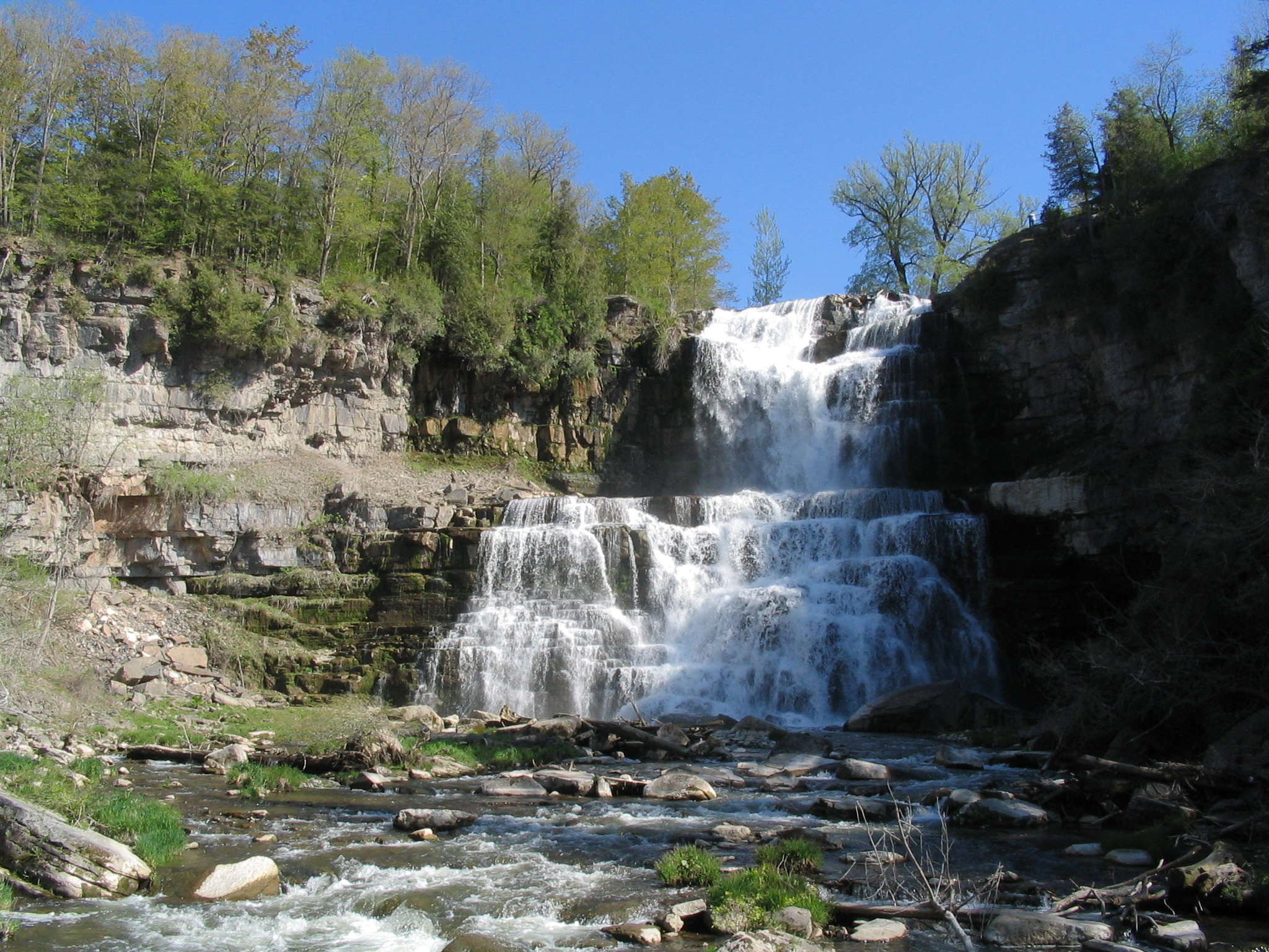
Chittenango Creek originates in Nelson Swamp in the town of Fenner in Madison County.[2][1] It receives the outflow for Cazenovia Lake near the village of Cazenovia. From there it flows northward, passing over a 167-foot (51 m) waterfall in Chittenango Falls State Park[3] before flowing through the village of Chittenango. The creek flows out into Oneida Lake near the community of Bridgeport.
Tributaries
- Limestone Creek
- Meadow Brook
See also
- List of rivers in New York
References
- "Chittenango Creek". Geographic Names Information System. United States Geological Survey. Retrieved January 25, 2016.
- "Chittenango Creek". NYS Department of Environmental Conservation. Retrieved January 26, 2016.
- "Chittenango Falls State Park". NYS Office of Parks, Recreation & Historic Preservation. Retrieved January 25, 2016.
External links
 Media related to Chittenango Creek at Wikimedia Commons
This article about a location in Onondaga County, New York is a stub. You can help Wikipedia by expanding it. |
This article about a location in Madison County, New York is a stub. You can help Wikipedia by expanding it. |
На других языках
[de] Chittenango Creek
Der Chittenango Creek ist ein Fluss in Upstate New York in den Vereinigten Staaten. Er entspringt etwa 10 km östlich des Cazenovia Lake, an dessen Südende er vorbeifließt und dessen Abfluss er dort im Ort Cazenovia aufnimmt. Von dort fließt er nach Norden und durchquert den Chittenango Falls State Park, in dem er nördlich der Ortschaft Chittenango einen aus mehreren Kaskaden bestehenden 51 m hohen Wasserfall bildet. Er mündet schließlich im Oneida Lake, zu dessen Wasserzufuhr er zusammen mit dem Oneida Creek etwa 25 % beiträgt.[1]- [en] Chittenango Creek
Другой контент может иметь иную лицензию. Перед использованием материалов сайта WikiSort.org внимательно изучите правила лицензирования конкретных элементов наполнения сайта.
WikiSort.org - проект по пересортировке и дополнению контента Википедии