geo.wikisort.org - River
Chaa Creek is a tributary of the Macal River in the Cayo District in western Belize. One of the official gauging stations of the Macal is located near the confluence with Chaa Creek.[1]
| This article is part of a series on the |
| Maya civilization |
|---|
 |
|
| History |
| Preclassic Maya |
| Classic Maya collapse |
| Spanish conquest of the Maya |
|
|
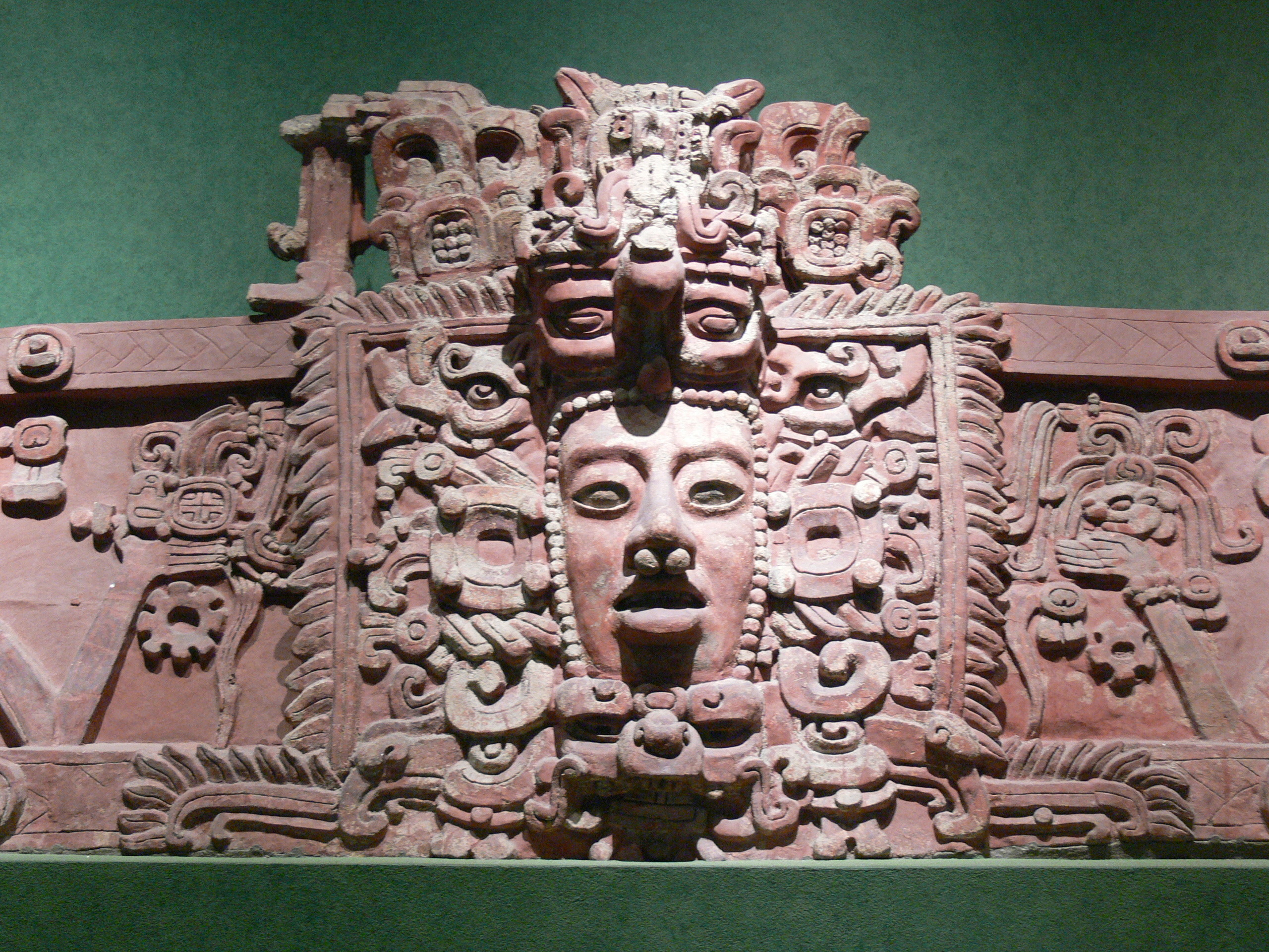
There are Maya ruins that remain largely unexcavated in the Chaa Creek catchment basin; certain early research was conducted on the archaeology at Chaa Creek in 1997 by Harvard University.[2] Significant pottery finds and other artifacts have been recovered at the Chaa Creek site, which is posited to be a satellite site of Xunantunich.[2][3]
The Chaa Creek Nature Reserve is a noted area for birdwatching. Over 300 species of birds have been sighted there.[4]
The underlying geology of this watershed can be characterised as limestone associations of foothills of the Maya Mountains.[5]
See also
- Cahal Pech - another Maya site in the vicinity
- The Lodge at Chaa Creek - an eco-resort and 365 acre private nature reserve located in the Cayo District of Belize, Central America.
References
- Belize hydrological stations Archived August 21, 2007, at the Wayback Machine
- Harvard University: Archaeological research at Xunantunich and nearby areas[permanent dead link]
- C.Michael Hogan, Chaa Creek, Megalithic Portal, ed. A. Burnham, 2007
- "Central America, Belize". Surfbirds. Retrieved 23 March 2017.
With 308 species of resident and migratory birds, the Chaa Creek Nature Reserve offers some of the best bird watching in Belize.
- Arvito, Rosita et al., Geology and ecology of the Chaa Creek Nature Reserve (2004)
Maya sites | ||
|---|---|---|
| Belize |
|  |
| Guatemala |
| |
| Honduras |
| |
| Mexico |
| |
| El Salvador |
| |
На других языках
- [en] Chaa Creek
[it] Chaa Creek
Chaa Creek è un affluente del fiume Macal, nel distretto di Cayo, nel Belize occidentale. Una delle stazioni di monitoraggio ufficiali del Macal si trova in prossimità della confluenza con il Chaa Creek. Nel letto del Chaa Creek vi sono molti resti maya non ancora portati alla luce. Le prime ricerche archeologiche nell'area furono condotte dall'Università di Harvard nel 1997. Ceramiche significative e altri manufatti sono stati rinvenuti nel sito archeologico di Chaa Creek, ritenuto sito satellite di Xunantunich. La riserva naturale di Chaa Creek è celebre per il birdwatching e per altri studi di storia naturale. Questo bacino idrografico può essere descritto come un'associazione calcarea delle colline pedemontane dei Monti Maya.Другой контент может иметь иную лицензию. Перед использованием материалов сайта WikiSort.org внимательно изучите правила лицензирования конкретных элементов наполнения сайта.
WikiSort.org - проект по пересортировке и дополнению контента Википедии