geo.wikisort.org - River
The Capilano River flows from north to south through the Coast Mountains on Vancouver's North Shore between West Vancouver and North Vancouver (district municipality) and empties into Burrard Inlet, opposite Stanley Park. The river is one of three primary sources of drinking water for residents of Greater Vancouver, and flows through the Capilano watershed. The Cleveland Dam, built in 1954, impounds a reservoir for this purpose. The entire area of the reservoir and watershed area upstream of the dam is closed to the public to ensure the quality of the drinking water. Prior to construction of the Cleveland Dam, the Capilano River deposited large amounts of sediment into Burrard Inlet. A dredge was needed to remove this sediment build-up in order to keep Burrard Inlet open for ship traffic.
| Capilano River | |
|---|---|
 Capilano River | |
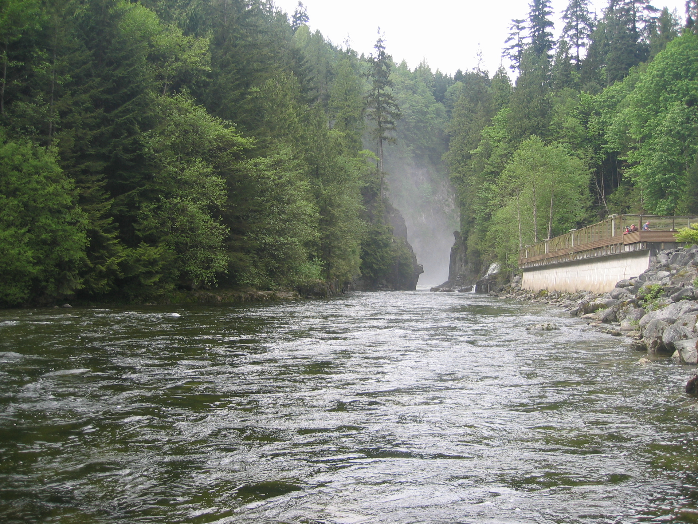
 Mouth of Capilano River | |
| Location | |
| Country | Canada |
| Province | British Columbia |
| District | New Westminster Land District |
| Physical characteristics | |
| Source | Capilano Mountain |
| • location | North Shore Mountains |
| Mouth | Burrard Inlet |
• location | Lower Mainland |
• coordinates | 49°19′16″N 123°8′22″W[1] |
• elevation | 0 m (0 ft)[2] |
The Capilano has a historic salmon run which was impacted by the dam construction. In 1971 the Capilano Fish hatchery was opened. It was built 1/2 kilometre (km) downstream of the dam to ensure the survival of the run. Beyond strengthening the salmon stocks from the aftermath of the dam, the hatchery’s work also introduced chinook to the system in an attempt to establish a self-sustaining run.
The river flows through coastal rainforest and, in its lower stretches, follows a granite canyon with walls in excess of 40 metres tall in places.
The Capilano flows during periods of snow melt and rainfall mainly and slows to a trickle at other times.
The origin of the name Capilano River is obscure. The name is thought to be an anglicized form of names that were Squamish and Musqueam. The last man known as Chief Capilano died in 1870.[3]: 38
Route

Capilano River's headwaters are at the top of Capilano Mountain, near Furry Creek. The river then continues down in a valley where many tributaries flow into the river like Eastcap Creek. The river then bends towards its tributary Sister's Creek which has its source at The Lions. Shortly past that confluence, the Capilano River flows into Capilano Lake, created by Cleveland Dam. When the river flows out of the dam it enters Capilano Canyon which it stays for about 4 km. After that it enters into its lowland and enters its mouth at Burrard Inlet, near Ambleside Park.
Recreation

When the river is running, whitewater kayakers in boats and apparel can often be seen. The river is rated as class III though at high water it can be much more challenging.[citation needed]
The Capilano River Regional Park, which surrounds the river and incorporates the fish hatchery, provides several kilometres of easy to moderate hiking trails alongside the river.
Every year in March the Capilano River is host to an annual charity duck race. Thousands of yellow rubber ducks are purchased ahead of time by the public. They float down the river in a sea of yellow. The first ducks to reach the mouth of the river win prizes for their owners.
Accidents
There have been occasional accidents involving the surge of water released from Cleveland Dam. The operator of Cleveland Dam and Capilano River Regional Park, Metro Vancouver, does not have a public alarm system to warn visitors of a rapid water release from the dam.
See also
- Capilano River Regional Park
References
- "Capilano River". BC Geographical Names.
- Elevation derived from ASTER Global Digital Elevation Model, using GeoLocator, BCGNIS coordinates, and topographic maps.
- Akrigg, G.P.V.; Akrigg, Helen B. (1986), British Columbia Place Names (3rd, 1997 ed.), Vancouver: UBC Press, ISBN 0-7748-0636-2
Authority control | |
|---|---|
| General | |
| National libraries | |
На других языках
[de] Capilano (Fluss)
Der Fluss Capilano in British Columbia, Kanada, fließt von Norden nach Süden durch die Coast Mountains und mündet in das Burrard Inlet, gegenüber Stanley Park. Er ist eine der drei Hauptquellen von Trinkwasser für die Einwohner des Großraums Vancouver. Mit dem 1954 errichtete Cleveland-Damm wurde zu diesem Zweck ein Reservoir geschaffen.- [en] Capilano River
[it] Capilano (fiume)
Il Capilano è un fiume del Canada nord-orientale, che scorre lungo le Montagne Costiere, nei dintorni della città di Vancouver, nella provincia della Columbia Britannica, e che sfocia nel Burrard Inlet.[1]Другой контент может иметь иную лицензию. Перед использованием материалов сайта WikiSort.org внимательно изучите правила лицензирования конкретных элементов наполнения сайта.
WikiSort.org - проект по пересортировке и дополнению контента Википедии