geo.wikisort.org - River
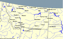
The Blackfoot River, sometimes called the Big Blackfoot River to distinguish it from the Little Blackfoot River, is a snow-fed and spring-fed river in western Montana. The Blackfoot River begins in Lewis and Clark County at the Continental Divide, 10 miles (16 km) northeast of the town of Lincoln (4536 feet, 1382 m). The river's headwaters are between Rogers Pass (5610 ft, 1710 m) to the north and Stemple Pass (6376 ft, 1943 m) to the south. It flows westward through the town of Milltown and enters the Clark Fork River approximately five miles (8 km) east of the city of Missoula (3210 ft, 978 m).
| Blackfoot River | |
|---|---|
 The Blackfoot River two miles east of Lincoln, Montana. | |
| Location | |
| Country | United States |
| State | Montana |
| Physical characteristics | |
| Source | Continental Divide |
| • coordinates | 47°2′6″N 112°21′34″W[1] |
| Mouth | Clark Fork |
• coordinates | 46°52′17″N 113°53′18″W[1] |
| Length | 120 km (75 mi)[2] |
The Blackfoot River is renowned for its recreational opportunities, most notably fly fishing, but also rafting, canoeing, and inner tubing. The Blackfoot is a fast, cold river with many deep spots, making it prime habitat for several varieties of trout.[3]
The river's canyon and the valleys were formed by the Missoula Floods, cataclysmic glacial lake outburst floods which occurred at the end of the last ice age.
The Blackfoot River and the Clark Fork experienced a record flood in 1908.[4]
The river is featured in the 1976 novella A River Runs Through It by Norman Maclean, as well as the 1992 film starring Brad Pitt, directed by Robert Redford.
The Blackfoot is a Class I river from the Cedar Meadow fishing access site west of Helmville to its confluence with the Clark Fork River for public access for recreational purposes.[5]
See also
- Montana Stream Access Law
- List of rivers of Montana
Further reading
- Sullivan, Gordon (2008). Saving Homewaters: The Story of Montana's Streams and Rivers. Woodstock, VT: The Countryman Press. ISBN 978-0-88150-679-2.
References
- U.S. Geological Survey Geographic Names Information System: Blackfoot River
- Blackfoot River Archived January 15, 2005, at the Wayback Machine, The Columbia Gazetteer of North America
- http://www.theflystop.com/hatch-guide-fly-fishing/montana/blackfoot-river, The TheFlyStop.com
- "The Great Flood of 1908". Archived from the original on 2013-11-12. Retrieved 2014-01-05.
- Stream Access in Montana Archived 2009-03-10 at the Wayback Machine
- McLean, Bryce. "Drone Shot of the Blackfoot River". guide-x.io. Archived from the original on 2021-05-06. Retrieved 2021-05-06.
External links
Helena (capital) | ||
| Topics |
|  Seal of Montana |
| Society |
| |
| Regions |
| |
| Largest cities | ||
| Counties |
| |
Missoula, Montana | |||||||||
|---|---|---|---|---|---|---|---|---|---|
| |||||||||
| Suburbs |
|  | |||||||
| Education |
| ||||||||
| Geography |
| ||||||||
| History |
| ||||||||
| Media |
| ||||||||
| Breweries |
| ||||||||
| Services |
| ||||||||
| Sports |
| ||||||||
| University of Montana |
| ||||||||
| |||||||||
Authority control | |
|---|---|
| General |
|
| National libraries | |
На других языках
[de] Blackfoot River (Clark Fork)
Der Blackfoot River ist ein etwa 200 km langer rechter Nebenfluss des Clark Fork im US-Bundesstaat Montana.- [en] Blackfoot River (Montana)
Другой контент может иметь иную лицензию. Перед использованием материалов сайта WikiSort.org внимательно изучите правила лицензирования конкретных элементов наполнения сайта.
WikiSort.org - проект по пересортировке и дополнению контента Википедии