geo.wikisort.org - River
The Biobío River (also known as Bío Bío[2] or Bio-Bio[3][4]) is the second largest river in Chile. It originates from Icalma and Galletué lakes in the Andes and flows 380 km to the Gulf of Arauco (in Spanish) on the Pacific Ocean.
| Biobío River | |
|---|---|
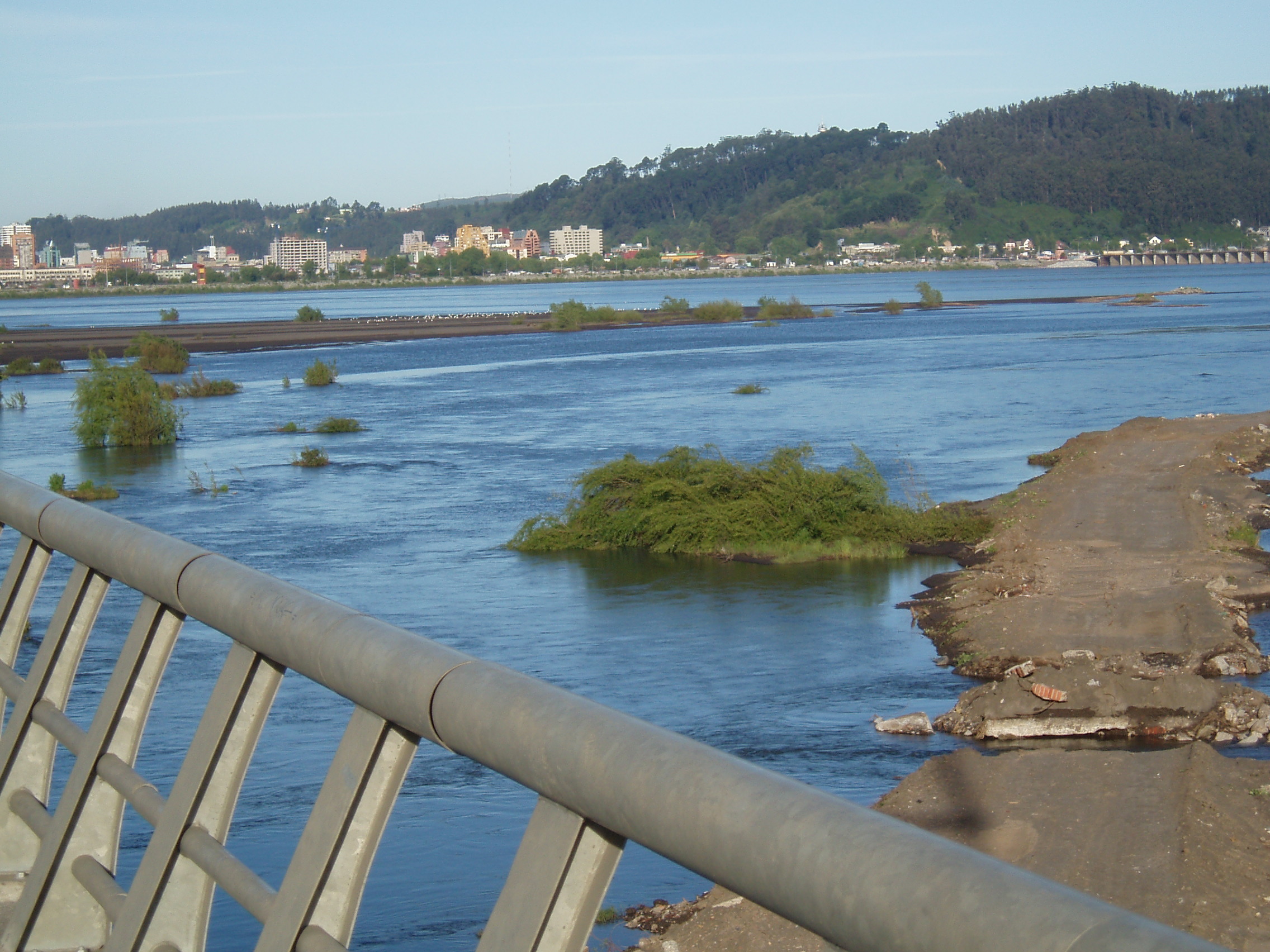
 View of the confluence of Biobío and Laja rivers at Laja | |
 Map of Biobío River showing its main tributaries | |
| Location | |
| Country | Chile |
| Physical characteristics | |
| Source | |
| • location | Galletué Lake |
| • elevation | 1,160 m (3,810 ft)[1] |
| Mouth | |
• location | Gulf of Arauco (in Spanish), Pacific Ocean |
• coordinates | 36°48′50″S 73°10′14″W |
| Length | 380 km (240 mi)[1] |
| Basin size | 24,264 km2 (9,368 sq mi)[1] |
| Discharge | |
| • average | 899 m3/s (31,700 cu ft/s) |
The major tributaries of the river are the Malleco and the Laja. The river is Chile's second-longest river (the longest being the Loa River) and the Biobío basin is Chile's third largest watershed, after the Loa and Baker basins. The river is also the widest river in Chile, with an average width of 1 km. In the Metropolitan area of Concepción, the river is crossed by four bridges: Biobío Railroad Bridge (1889), Juan Pablo II Bridge (1973), Llacolén Bridge (2000) and Bicentennial Bridge (2010).
Course
The Biobío River originates at the east shore of Galletué Lake. The river flows east for a few kilometers to the point where it receives the waters of the near Icalma Lake, through a short stream. It then turns its course northwestward, meandering through a broad Andean valley and merging with some minor tributaries, such as the Lonquimay and the Rahue. The Lonquimay is fed by some glaciers of Sierra Nevada and passes close to the town of the same name. Just downstream from the confluence with the Rahue, the upper course of the river-locally known as Alto Bío Bío-begins to run rapidly through a narrow valley surrounded by mountains, the path becoming increasingly sloped. Then the river, along the lower course of its tributaries in this area, is impounded by Ralco Dam. Below the dam, the river skirts a southwestern spur of Callaqui volcano before falling into Pangue Reservoir.
After reaching the Intermediate Depression, the river flows through a mostly flat area, being joined by the Duqueco and Bureo Rivers, increasing its width between 60 and 120 meters and reducing its speed, allowing navigation in some zones. In the middle course, the Vergara River joins the Biobío near Nacimiento, draining a substantial part of southern river basin after receiving the waters of the Malleco, Renaico and Rahue Rivers, which constitute a northwest-oriented and parallel drainage network to the Biobío of a great part of the northern Andean portion of the Araucanía Region.
Below the Vergara River, the Biobío is joined by the Tavolevo River, flowing east from the Nahuelbuta Range, the Guaqui River coming from the east in the Andes foothills, and the small Rele River coming from the west from the northern part of the eastern slopes of the Nahuelbuta Range.
To the east of the Chilean Coastal Range, near the cities of San Rosendo and La Laja, the Biobío River is joined by the Laja River, its major tributary in terms of volume of water. From here, the river follows its course increasing its width considerably, reaching 2 km wide at its mouth on Pacific Ocean, near San Pedro de la Paz, Gran Concepción.[5] Along the way, the Quilacoya River joins the Biobío River on its north bank 9 km above the town of Hualqui.
Diego Díaz Island
| Geography | |
|---|---|
| Adjacent bodies of water | Biobío River |
| Region | Biobío |
| Province | Biobío |
| Commune | Los Ángeles |
Diego Díaz Island (Spanish: Isla Diego Díaz) is a river island in Biobío River located near Colonia Santa Fe.[6][7][8] The river next to the island was navigated, upstream and downstream, in colonial times.[7] In 1610, during the Arauco War, Mapuches attacked the Spanish in the island killing 13 soldiers.[9]
History
The name "Biobío" comes from Mapudungun, the Mapuche language. The Biobío was the traditional borderline, or "La Frontera", during the later part of the War of Arauco between La Araucanía, the southern Mapuche self-ruled areas and northern Spanish-ruled Captaincy General of Chile. The territory south of the river was not incorporated into the Chilean state until the 1880s after the campaigns of the "Pacification of Araucanía".
In the past, the river was navigable by ship up to the city of Nacimiento. However, deforestation during the 1900s led to heavy erosion that choked the river with silt and made it untraversable to boats.
In the early 1980s, it was renowned as being one of the world's best whitewater rafting venues, with a trip that lasted seven days through some of Chile's wilderness areas. Endesa, the Chilean state-run power company at that time, constructed the Pangue Dam, despite strong protests by environmentalists. With the loss of the whitewater rafting venue, displacement of indigenous Pehuenche people, who had lived in the area for centuries, also occurred.
References
- "Cuenca del río Biobío" (PDF). Archived from the original (PDF) on 2015-05-13. Retrieved 2007-07-17.
- Bío Bío River Archived September 21, 2008, at the Wayback Machine, Encyclopædia Britannica Online
- Chisholm, Hugh, ed. (1911). . Encyclopædia Britannica. Vol. 3 (11th ed.). Cambridge University Press. p. 952.
- The Bio-Bio River Case, Chile Archived May 13, 2016, at the Wayback Machine, The Inventory of Conflict & Environment (ICE), American University
- EVALUACION DE LOS RECURSOS HIDRICOS SUPERFICIALES EN LA CUENCA DEL RIO BIO BIO[permanent dead link]
- Solano Astaburuaga, Francisco (1899) [1867]. Diccionario Geográfico de la República de Chile (in Spanish) (2nd ed.). p. 255.
- Gay, Claudio (2009). "Relación del modo y orden de militar que había en este reino de Chile en campaña, fronteras y fuertes hasta la llegada del Gobernador Alonso de Ribera,que fue el 9 de febrero del año de 1601". Historia físicay política de Chile (PDF) (in Spanish). p. 103. ISBN 9789568306083.
- Claudio Gay (1845). Historia fisica y politica de Chile segun documentos adquiridos en esta republica durante doce años de residencia en ella y publicada bajo los auspicios del supremo gobierno. En casa del autor. p. 534. Retrieved 17 April 2021.
- Sánchez Aguilera, Víctor (1953). "Angol de Alonso García Ramón". Angol, la ciudad de los confines (in Spanish). Santiago, Chile: Atenea. p. 127.
Sources
- This article draws partially on the corresponding article in the Spanish-language Wikipedia, accessed July 10, 2007.
- EVALUACION DE LOS RECURSOS HIDRICOS SUPERFICIALES EN LA CUENCA DEL RIO BIO BIO[permanent dead link]
Hydrography of La Araucanía Region | ||
|---|---|---|
| Rivers |  | |
| Waterfalls |
| |
| Lakes | ||
Hydrography of Bío Bío Region | ||
|---|---|---|
| Rivers |  | |
| Waterfalls |
| |
| Lakes | ||
| Authority control |
|
|---|
На других языках
[de] Río Bío Bío
Der Río Bío Bío, auch Biobío, ist der zweitlängste Fluss in Chile. Er ist 380 Kilometer lang.- [en] Biobío River
[es] Río Biobío
El río Biobío es un curso natural de agua que atraviesa y divide la zona centro y la Zona sur de Chile y es uno de los principales de dicho país, tanto por sus características geográficas como por su importancia económica e histórica.[it] Bío Bío (fiume)
Il Bío-Bío è uno dei fiumi più importanti del Cile. Per lunghezza è il secondo maggior fiume del paese e, per estensione di bacino, il terzo dopo il Loa e il Baker.[ru] Био-Био (река)
Би́о-Би́о (исп. Río Bío-Bío) — вторая по величине река в Чили. Длина — 380 км, площадь бассейна — 23 920 км². Протекает примерно в 500 км к югу от Сантьяго.Другой контент может иметь иную лицензию. Перед использованием материалов сайта WikiSort.org внимательно изучите правила лицензирования конкретных элементов наполнения сайта.
WikiSort.org - проект по пересортировке и дополнению контента Википедии