geo.wikisort.org - River
Beverley Brook is a minor English river 14.3 km (8.9 mi) long in south-west London. It rises in Worcester Park and joins the River Thames to the north of Putney Embankment at Barn Elms.
| Beverley Brook | |
|---|---|
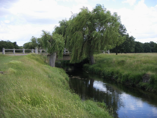 Beverley Brook in Richmond Park | |
 Map of the Beverley and Pyl Brooks showing surrounding parkland and access from settlements | |
| Location | |
| Country | United Kingdom |
| Physical characteristics | |
| Source | |
| • location | Cuddington Recreation Park, Worcester Park, Greater London |
| Mouth | |
• location | Barn Elms, River Thames |
• coordinates | 51°28′18.48″N 0°13′22.8″W |
| Length | 14.3 km (8.9 mi) |
| Basin features | |
| Tributaries | |
| • left | Pen Ponds overflow, Keswick Avenue ditch, Coombe Brook |
| • right | Kingsmere Stream, Queensmere Stream, Cannizaro Park stream, Pyl Brook, East Pyl Brook, Old Pyl ditch, Merton ditch culvert, Grand Drive ditch |
 | |
Course
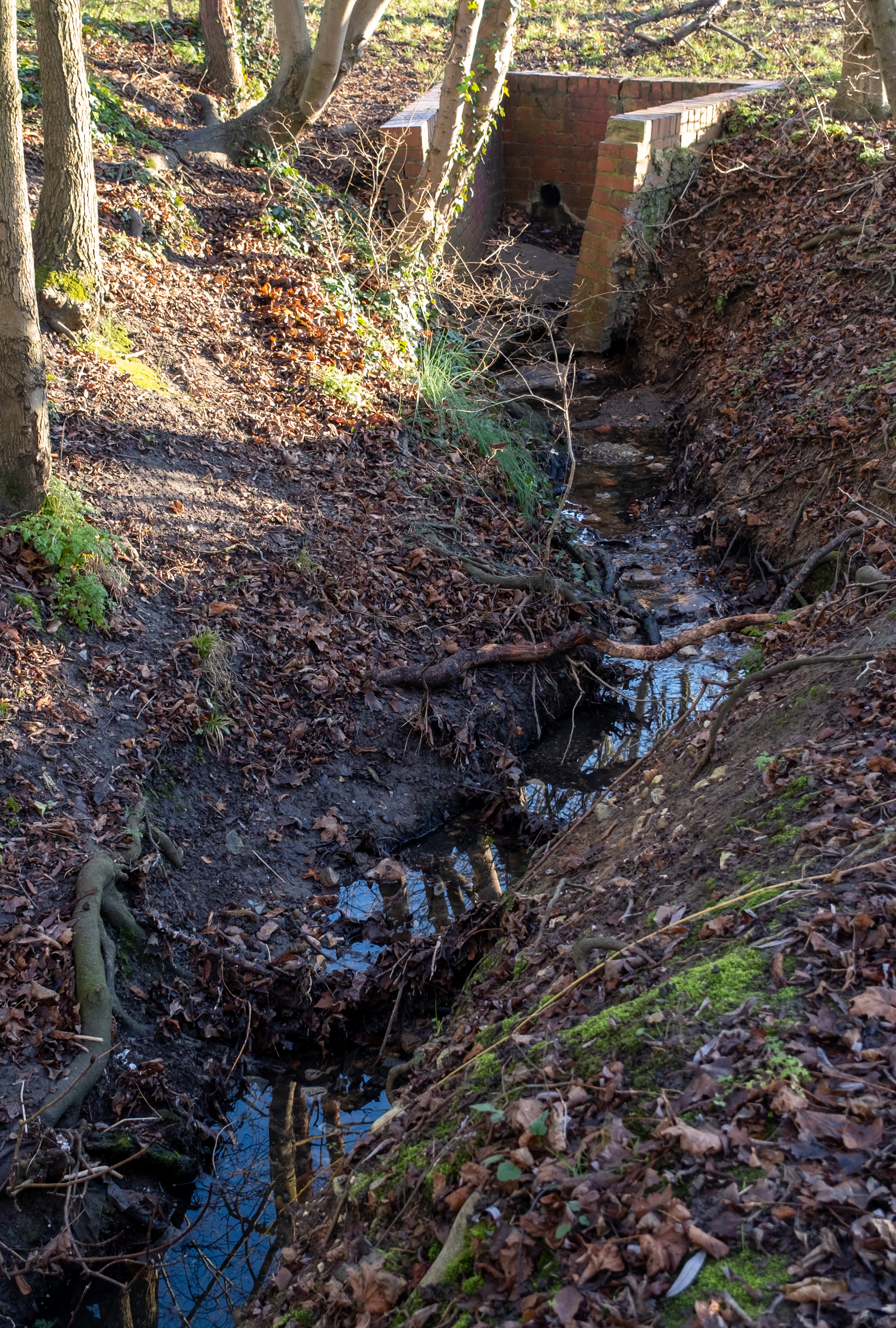
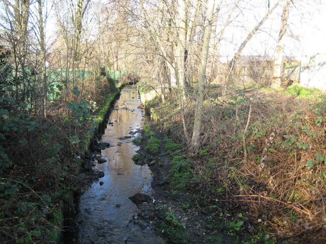
Beverley Brook rises at the top of a hill in a shady area at Cuddington Recreation Ground in Worcester Park then flows north in a culvert under the A2043 road, emerging in waste land next to Worcester Park Station. It then flows northeast through Motspur Park, New Malden, Wimbledon Common, Richmond Park, forms the brief boundary of East Sheen and Roehampton near Priest's Bridge, flows through the south of Barnes (bounding the Barnes playing fields to the north and Putney Common to the south) and joins the River Thames above Putney Embankment between Barn Elms, Barnes and Leader's Gardens, Putney.[1][2]
Its basin has a catchment area of 64 km2 (25 sq mi).[3]
Uses


Beverley Brook creates a water feature used by deer, smaller animals and water grasses and some water lilies in Richmond Park (where it is followed by the Tamsin Trail and Beverley Walk). Then for the next 7 km (4.3 mi) upstream of Richmond Park, the Beverley Brook forms the historic South West London boundary,[4] now the boundary between the London Borough of Merton and the Royal Borough of Kingston upon Thames.
For the first 5 km (3.1 mi) south of Richmond Park, the six lane A3 trunk road from London to Portsmouth runs always within 300 m (980 ft) of the stream, crossing it three times. Although there is no point where the stream itself can be seen when driving along the road, the bridge parapets are visible and, for 2 km (1.2 mi), where the road runs along the edge of Wimbledon Common, the trees flanking the stream can be glimpsed across playing fields, with the lightly managed "natural" woodland of the common rising beyond. Except for the playing fields, the whole of the common, including Beverley Brook, is both a Site of Special Scientific Interest (SSSI)[5][6] and a Special Area of Conservation (SAC).[7] Towards the south (upstream) end of the common, Fishpond Wood and Beverley Meads nature reserve lies a few metres east of the stream.[8]
South of Wimbledon Common, the stretch of the A3 running near the stream is named Beverley Way after it.[2]
Etymology
The name is derived from the former presence in the river of the European beaver (Castor fiber),[9] a species extinct in Britain since the sixteenth century.[10] The Middle English word for beaver was bever, the word for meadow was ley (or lei or various other spellings, still rarely used today as lea) and brook meant stream, as it does today. Beverley Brook was thus the Beaver-Meadow Stream.
Tributaries
Beverley Brook's longest tributary is Pyl Brook, 5.3 km (3.3 mi) long,[3] which is a Local Nature Reserve.[11] It flows from Sutton through Lower Morden to join it at Beverley Park in New Malden.[1] Both brooks are on the Environment Agency's watchlist of rivers susceptible to flooding.
Environmental improvements
For much of the twentieth century Beverley Brook was joined by poorly treated sewage from a sewage works in Green Lane, Worcester Park. Since some pipe redirection enabling the removing of the works and the introduction of improved treatment methods in 1998, the range of wildlife species in the river has steadily increased.
At Wimbledon Common, Beverley Brook has banks reinforced with wooden "toe-boarding", which prevents use by water voles,[12] and there is scope for further such improvements.
In fiction
Beverley Brook is a regular character in the Ben Aaronovitch series of urban fantasy police procedural novels Rivers of London. She describes her kind thus: "'Orisa', said Beverley. 'We're Orisa. Not spirits, not local geniuses – Orisa'."[13]
See also
- Tributaries of the River Thames
- List of rivers of England
References
- Inwood, Stephen (2008). Historic London: An Explorer's Companion. Pan Macmillan. p. 382. ISBN 0-230-70598-7.
- Open Street Map
- "HA16 Rivers and Streams" (PDF). Gateway to WildPRO. Wildlife Information Network. 2004. Archived from the original (PDF) on 22 September 2015. Retrieved 8 October 2012.
- "AIM25 collection description". Aim25.ac.uk. Retrieved 27 December 2013.
- "Natural England, Wimbledon Common citation" (PDF). Archived from the original (PDF) on 24 October 2012. Retrieved 27 December 2013.
- "Map of Wimbledon Common SSSI". Natural England.
- "Wimbledon Common". UK Special Areas of Conservation site list. DEFRA Joint Nature Conservation Committee. Retrieved 20 October 2014.
- "Map of Fishpond Wood and Beverley Meads". Local Nature Reserves. Natural England. Retrieved 9 January 2014.
- Field, John (1980). Place-names of Greater London. Batsford. pp. 30, 166. ISBN 0-7134-2538-5.
- Martin, Horace T. (1892). Castorologia: Or The History and Traditions of the Canadian Beaver. W. Drysdale. p. 26. ISBN 0-665-07939-7.
- "Pyl Brook". Local Nature Reserves. Natural England. Archived from the original on 12 May 2014.
- "London Water Vole Project" (PDF). London Biodiversity Partnership. 2004. p. 4. Archived from the original (PDF) on 6 January 2009.
- Aaronovitch, Ben (2011). Rivers of London. Gollancz. p. 150.
External links
- Beverley Brook Catchment
- Royal Parks press release on the improving water quality of the river, 1 January 2004
- The Beverley Brook waymarked walk
- Beverley Brook Walk
- Beverley Brook Walk map
- Flow measurements
| Districts |   | |
|---|---|---|
| Railway stations |
| |
| Streets and roads |
| |
| River Thames bridges, islands and river services |
| |
| Other rivers and streams | ||
| Sports venues |
| |
| Events |
| |
| Breweries and pubs |
| |
| Theatres, cinemas and music venues |
| |
| Film and recording studios |
| |
| Media and publishing |
| |
| Public art | ||
| Historical royal palaces |
| |
| Other places of interest |
| |
| Tragedy and disaster |
| |
| Other history topics |
| |
| Parliamentary constituencies |
| |
| Other topics |
| |
Parks, open spaces and nature reserves in the London Borough of Richmond upon Thames | ||
На других языках
[de] Beverley Brook
Der Beverley Brook ist ein Wasserlauf in Greater London. Er entsteht im Cuddington Park im London Borough of Merton und wird dann unterirdisch bis zum Worcester Park östlich des Bahnhofs Worcester Park geführt. Er fließt in nördlicher Richtung und bildet dabei zunächst die Grenze zwischen dem Wimbledon Common in Merton und Coombe und dem Royal Borough of Kingston upon Thames. Er durchquert den Richmond Park und stellt dann die Grenze zwischen East Sheen und dem London Borough of Richmond upon Thames und Roehampton und dem London Borough of Wandsworth dar. Nach dem Unterqueren der Hounslow Loop Line, östlicher des Bahnhofs Barnes Bridge Station wendet sich der Beverley Brook nach Osten, um in Barnes auf der Grenze zwischen Richmond upon Thames und Wandsworth in die Themse zu münden.- [en] Beverley Brook
Другой контент может иметь иную лицензию. Перед использованием материалов сайта WikiSort.org внимательно изучите правила лицензирования конкретных элементов наполнения сайта.
WikiSort.org - проект по пересортировке и дополнению контента Википедии