geo.wikisort.org - River
Bayou De View is an 83-mile-long (134 km)[2] waterway that flows through parts of Poinsett, Woodruff, Monroe and Prairie counties in northeastern Arkansas. The bayou is part of the Cache and White River basins, ultimately flowing into the Mississippi River.
| Bayou De View | |
|---|---|
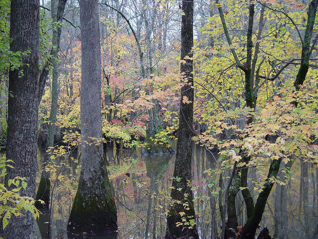 Bayou De View in the Cache River National Wildlife Refuge | |
| Location | |
| Country | United States |
| State | Arkansas |
| Physical characteristics | |
| Source | |
| • location | Craighead County |
| • coordinates | 35°42′33″N 90°54′20″W[1] |
| Mouth | Confluence with the Cache River |
• location | Monroe County |
• coordinates | 34°47′30″N 91°17′51″W[1] |
• elevation | 157 ft (48 m)[1] |
| Length | 83 mi (134 km) |
Several miles of the lower portion of Bayou de View is within the Cache River National Wildlife Refuge. In 2012, the Fish and Wildlife Service proposed an expansion of the refuge, purchasing land as available from willing sellers, to include an additional 30 miles (48 km) of Bayou De View in the refuge.[3]
The land area bordering the bayou supports dense vegetation in the form of tupelo, bald cypress, hickory, pine and other native trees of the hardwood and softwood families. This area used to be known as part of the "Big Woods" of Arkansas, but most of the standing timber was cleared for farming by the second half of the 20th century. Now, however, there are many reforestation projects underway around the edges of the bayou, including moist-soils projects and hardwood planting projects.
Recently, Bayou De View and the town of Brinkley have gained international attention from possible sightings of the ivory-billed woodpecker, which was thought to be extinct since the 1940s.[4]
See also
References
- U.S. Geological Survey Geographic Names Information System: Bayou De View
- U.S. Geological Survey. National Hydrography Dataset high-resolution flowline data. The National Map Archived 2012-03-29 at the Wayback Machine, accessed March 9, 2011
- "Cache River expansion Proposal" http://www.fws.gov/southeast/cacheriverexpansion/overview.html, accessed 8 July 2013
- "Bayou de View State Wildlife Management Area, an Arkansas State Wildlife Management Area located near Jonesboro, Newport and Jonesboro".
На других языках
- [en] Bayou De View
[ru] Байю-де-Вью
Байю-де-Вью (англ. Bayou De View) — река, протекает в северо-восточном Арканзасе, пересекая части округов Вудрафф, Монро и Прери. Бассейн Байю-де-Вью является частью бассейнов рек Кэш и Уайт-Ривер. Длина Байю-де-Вью — 134 км[1].Другой контент может иметь иную лицензию. Перед использованием материалов сайта WikiSort.org внимательно изучите правила лицензирования конкретных элементов наполнения сайта.
WikiSort.org - проект по пересортировке и дополнению контента Википедии