geo.wikisort.org - River
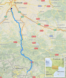
The Ariège (French pronunciation: [aʁjɛʒ] (![]() listen); Occitan: Arièja; Catalan: Arieja) is a 163 km long river in southern France, right tributary of the Garonne.[1] Its source is in the Pyrenees, near El Pas de la Casa, where it forms part of the border with Andorra. It flows north through the following towns in two departments:
listen); Occitan: Arièja; Catalan: Arieja) is a 163 km long river in southern France, right tributary of the Garonne.[1] Its source is in the Pyrenees, near El Pas de la Casa, where it forms part of the border with Andorra. It flows north through the following towns in two departments:
- In Ariège: Ax-les-Thermes, Les Cabannes, Tarascon-sur-Ariège, Montgailhard, Foix, Varilhes, Pamiers, Saverdun.
- In Haute-Garonne: Cintegabelle, Auterive, Pinsaguel.
| Ariège | |
|---|---|
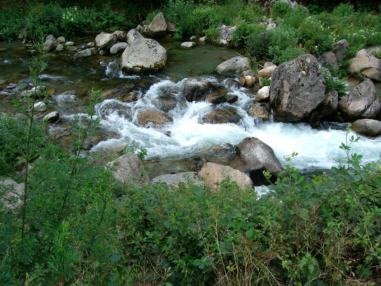 The Ariège near Ax-les-Thermes | |
 | |
| Location | |
| Countries |
|
| Physical characteristics | |
| Source | |
| • location | Pyrenees |
| • elevation | ± 2,400 m (7,900 ft) |
| Mouth | |
• location | Garonne |
• coordinates | 43°31′2″N 1°24′36″E |
| Length | 163 km (101 mi) |
| Basin size | 3,860 km2 (1,490 sq mi) |
| Discharge | |
| • average | 65 m3/s (2,300 cu ft/s) |
| Basin features | |
| Progression | Garonne→ Gironde estuary→ Atlantic Ocean |
Its longest tributaries are the Hers-Vif and the Lèze. It flows into the Garonne in Portet-sur-Garonne, south of Toulouse.[1] Taken literally, the Latin origin of the river's name, Aurigera, indicates it to be a source of gold.
References
External links
Wikimedia Commons has media related to Ariège River.
Authority control | |
|---|---|
| General | |
| National libraries | |
| Other |
|
This Occitania geographical article is a stub. You can help Wikipedia by expanding it. |
На других языках
[de] Ariège
Die Ariège ist ein Fluss im Süden Frankreichs, in der Region Okzitanien, mit einer Länge von rund 163[2] Kilometern. Sie entspringt in den Pyrenäen an der Grenze zu Andorra, knapp südlich des Pas de la Casa und mündet im Département Haute-Garonne gegenüber von Portet-sur-Garonne in der Nähe von Toulouse als rechter Nebenfluss in die Garonne. Ihr Einzugsgebiet umfasst 4.135 km², der mittlere Durchfluss liegt bei 65 m³/s.- [en] Ariège (river)
[es] Río Ariège
El río Ariège (en catalán: Arieja; en occitano, Arièja) es un río de Andorra y Francia, afluente por la derecha del Garona, en el que desemboca cerca de Portet-sur-Garonne (Alto Garona). Nace a unos 2150 m sobre el nivel del mar, en el lago de Font-Nègre (en catalán: Fontnegra), en los Pirineos, en el departamento de Pirineos Orientales. Tiene una longitud de 163,5 km y una cuenca de 4120 km².[it] Ariège (fiume)
L'Ariège (in catalano Arieja) è un fiume del sud della Francia, lungo 164 km,[1] affluente di destra della Garonna. Nel suo corso iniziale segna il confine fra Francia e Andorra.[ru] Арьеж (река)
Арье́ж (фр. Ariège) — река на юге Франции, правый приток Гаронны[1]. Длина — 170 км, площадь бассейна — 3860 км². Средний расход воды — 65 м³/с.[источник не указан 557 дней]Текст в блоке "Читать" взят с сайта "Википедия" и доступен по лицензии Creative Commons Attribution-ShareAlike; в отдельных случаях могут действовать дополнительные условия.
Другой контент может иметь иную лицензию. Перед использованием материалов сайта WikiSort.org внимательно изучите правила лицензирования конкретных элементов наполнения сайта.
Другой контент может иметь иную лицензию. Перед использованием материалов сайта WikiSort.org внимательно изучите правила лицензирования конкретных элементов наполнения сайта.
2019-2026
WikiSort.org - проект по пересортировке и дополнению контента Википедии
WikiSort.org - проект по пересортировке и дополнению контента Википедии