geo.wikisort.org - River
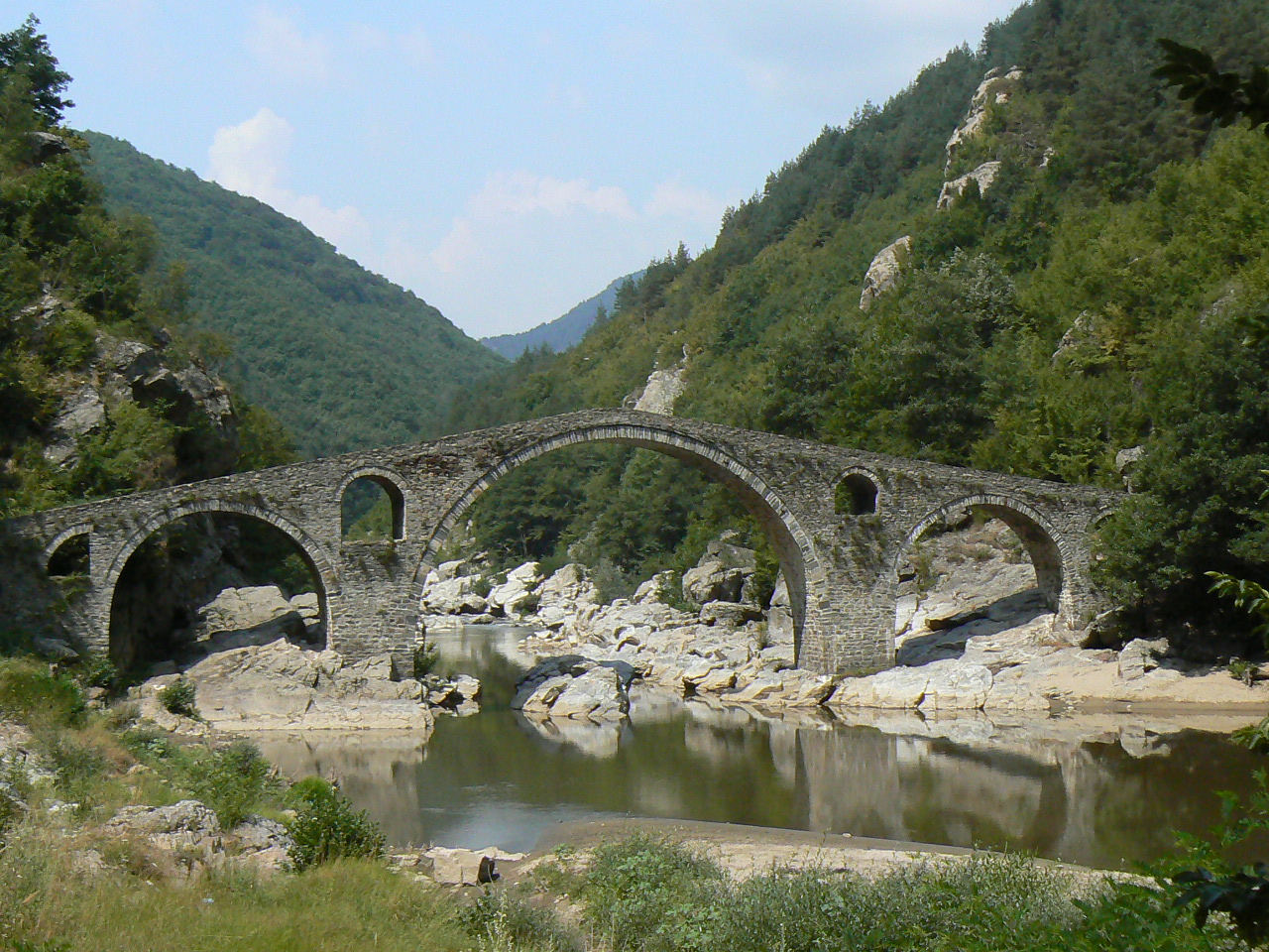
The Arda (Bulgarian: Арда [ˈardɐ], Greek: Άρδας [ˈarðas], Turkish: Arda [ˈaɾda]) is a 290-kilometre-long (180 mi) river in Bulgaria and Greece. It is a tributary of the Maritsa (or Evros). Its source lies in the Bulgarian Rhodope Mountains near the village Arda, part of the municipality of Smolyan. It flows eastward past Rudozem, Kardzhali and Ivaylovgrad and enters Greece in the northern part of the Evros regional unit. It flows into the Maritsa on the border of Greece and Turkey, between the Greek village Kastanies and the Turkish city Edirne. In the Bulgarian section there are three hydroelectric and irrigation dams, Kardzhali Dam, Studen Kladenets and Ivaylovgrad Dam. The Bulgarian section is 229 kilometres (142 mi) long,[1] making the Arda the longest river in the Rhodopes. The medieval Dyavolski most arch bridge crosses the river 10 kilometres (6 mi) from Ardino.
| Arda (Арда), Ardas (Άρδας) | |
|---|---|
 The Arda at Valchi dol, Bulgaria | |
 Map of Arda River and Maritsa river | |
| Location | |
| Countries | Bulgaria and Greece |
| Physical characteristics | |
| Source | |
| • location | near Smolyan, Rhodopes, Bulgaria |
| • elevation | 1,455 m (4,774 ft) (Ardin vrah) |
| Mouth | |
• location | Maritsa, near Edirne |
• coordinates | 41°39′39″N 26°29′42″E |
| Length | 290 km (180 mi); 229 km (142 mi) in Bulgaria[1] |
| Basin size | 5,795 km2 (2,237 sq mi); 5,213 km2 (2,013 sq mi) in Bulgaria[1] |
| Basin features | |
| Progression | Maritsa→ Aegean Sea |
The three floods of February 18, 2005, when the water level was at 4.8 metres (16 ft), March 1 and March 7, 2005, flooded the low-lying areas, especially in the Kastanies area which turned the area into a lagoon. The merging of the waters of the Maritsa (Evros/Meriç) caused streets and buildings including homes to be flooded and people to be stranded in their homes.
Arda Peak on Livingston Island in the South Shetland Islands, Antarctica and the mineral ardaite are named after the Arda river.
Archeology and places of interest
The Arda valley and the valleys of its tributaries have been a preferred place for habitation since ancient times. A settlement from 6,000 BC was discovered during the construction works in the area of the town of Kardzhali. Many archeological sites were discovered in the region, including the famous Thracian cult complexes Perperek, known as Perperikon for the last 20 years, as well as the sacred site of Tatul. To cross the ancient roads to the Aegean, several stone bridges were built on the river, impressive in size and architecture. One fully preserved bridge is the Devil's Bridge in the area of the village of Dyadovtsi (Ardino municipality). There are remnants of bridges in several places in the region: near the villages of Suhovo and Borovitsa, and another three have remained under the waters of the dams.
Gallery
 Devil's bridge near Ardino
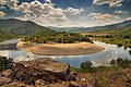 Arda's Meander in Bulgaria
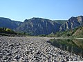 Near Madzharovo
 Near Madzharovo


References
- Statistical Yearbook 2017, National Statistical Institute (Bulgaria), p. 17
Authority control | |
|---|---|
| General |
|
| National libraries | |
This Eastern Macedonia and Thrace location article is a stub. You can help Wikipedia by expanding it. |
This article related to a river in Greece is a stub. You can help Wikipedia by expanding it. |
This article about a Marmara Region of Turkey location is a stub. You can help Wikipedia by expanding it. |
This article related to a river in Turkey is a stub. You can help Wikipedia by expanding it. |
На других языках
[de] Arda (Mariza)
Die Arda (bulgarisch Арда, griechisch Άρδας .mw-parser-output .Latn{font-family:"Akzidenz Grotesk","Arial","Avant Garde Gothic","Calibri","Futura","Geneva","Gill Sans","Helvetica","Lucida Grande","Lucida Sans Unicode","Lucida Grande","Stone Sans","Tahoma","Trebuchet","Univers","Verdana"}Ardas, lateinisch Artiscus) ist ein Fluss in Südbulgarien und Nordostgriechenland im alten Thrakien. Sie ist etwa 300 km lang, davon fließen 241 km auf bulgarischem Territorium.- [en] Arda (Maritsa tributary)
[es] Río Arda
El río Arda (en búlgaro, Арда, en griego Άρδας, Ardas, en latín Artiscus) es un río europeo que discurre por Bulgaria, Grecia y Turquía, el principal afluente del río Maritsa (Evros). Tiene una longitud de 290 km y drena una pequeña cuenca de 5 795 km².[it] Arda (Evros)
L’Arda (in bulgaro: Арда?, in turco: Arda, in greco: Άρδας) è un fiume di 290 km che scorre tra Bulgaria e Grecia, affluente dell'Evros.[ru] Ардас
А́рдас[1] (Арда[2], греч. Άρδας, болг. Арда) — река на юге Болгарии и северо-востоке Греции. Правый приток реки Марица[2].Другой контент может иметь иную лицензию. Перед использованием материалов сайта WikiSort.org внимательно изучите правила лицензирования конкретных элементов наполнения сайта.
WikiSort.org - проект по пересортировке и дополнению контента Википедии