geo.wikisort.org - Réservoir
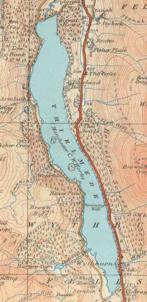
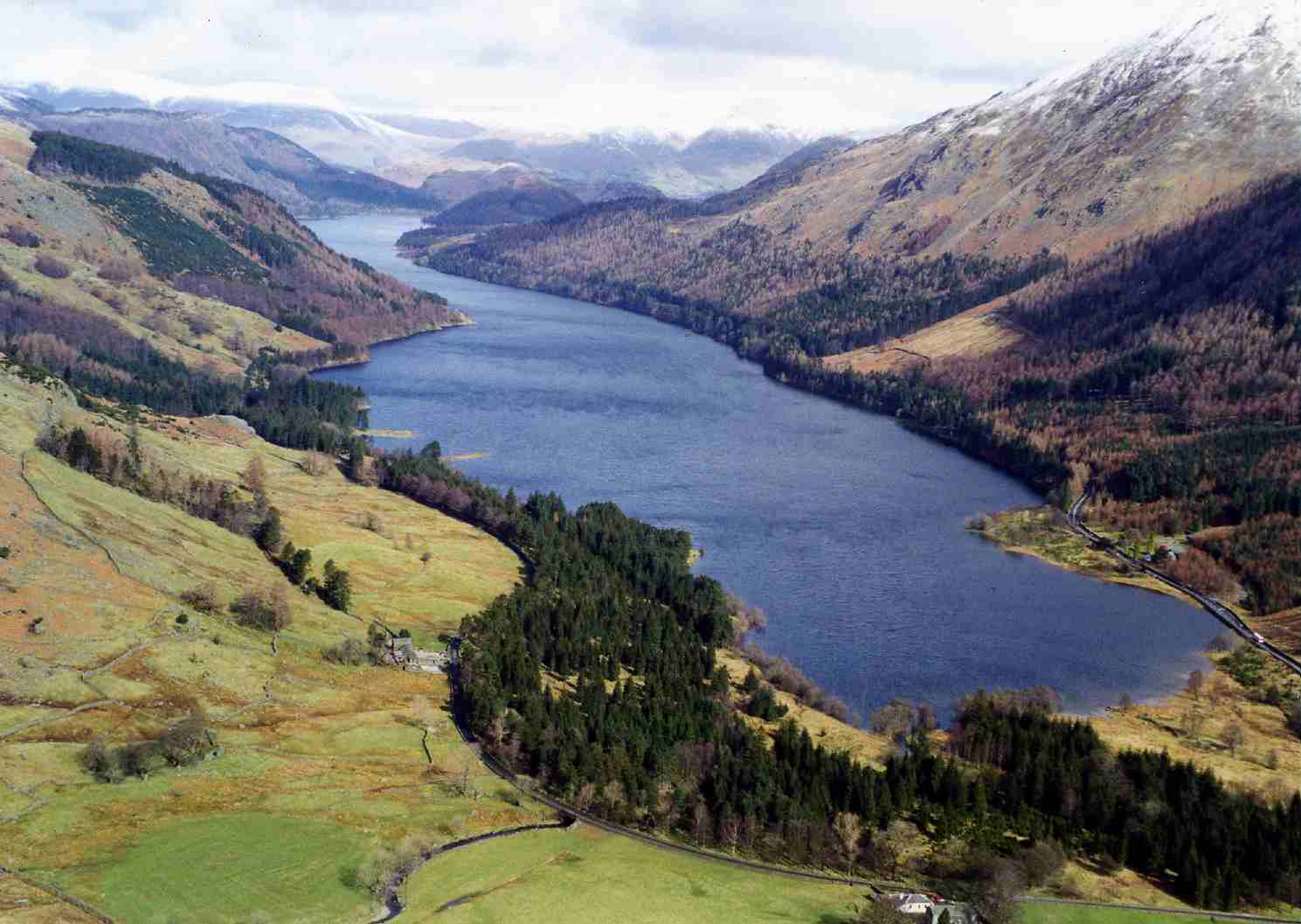
Le Thirlmere est un lac de barrage situé en Cumbria dans le Lake District.
Cet article est une ébauche concernant l’Angleterre.
Vous pouvez partager vos connaissances en l’améliorant (comment ?) selon les recommandations des projets correspondants.
| Thirlmore | |||
| |||
| Administration | |||
|---|---|---|---|
| Pays | |||
| Comté | Cumbria | ||
| Parc national | Lake District | ||
| Géographie | |||
| Coordonnées | 54° 32′ N, 3° 04′ O | ||
| Type | lac de barrage | ||
| Montagne | Lake District | ||
| Superficie | 3,25 km2 |
||
| Longueur | 6,05 km | ||
| Largeur | 178 m | ||
| Périmètre | 15 km | ||
| Altitude | 178 m | ||
| Profondeur · Maximale |
40 m |
||
| Hydrographie | |||
| Alimentation | Launchy Gill, Dob Gill, Wyth Burn, Birkside Gill | ||
| Émissaire(s) | St John's Beck | ||
| Îles | |||
| Nombre d’îles | 2 | ||
| Divers | |||
| Commentaire | périmètre=15 km | ||
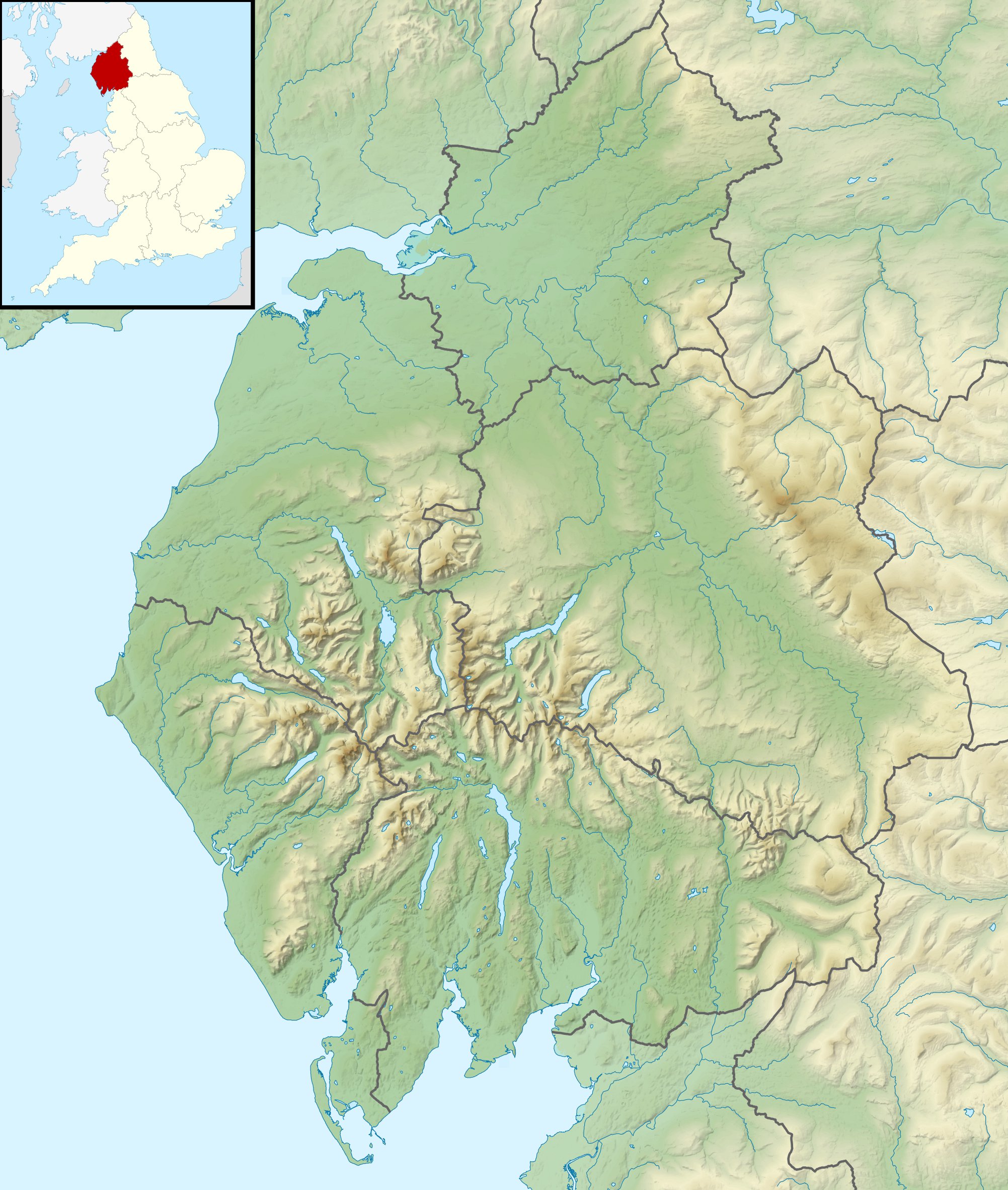
| Géolocalisation sur la carte : Cumbria
Géolocalisation sur la carte : Angleterre
| |||
| modifier |
|||

Histoire
Le lac a été constitué aux XIXe siècle à la suite de la construction par le Manchester City Council d'un barrage au nord de la vallée. Malgré l'opposition rencontrée localement, les travaux commencent en 1890 et se terminent en [1]. Aujourd'hui encore, le réservoir alimente en eau les habitants de Manchester par l'intermédiaire du Thirlmere Aqueduct.
Géographie
Cette section est vide, insuffisamment détaillée ou incomplète. Votre aide est la bienvenue ! Comment faire ?
Voir aussi
Notes et références
- (en) Beth Pipe et Steve Pipe, Historic Cumbria : Off the Beaten Track, Amberley Publishing Limited, , 96 p. (ISBN 978-1-4456-4572-8, lire en ligne)
 Portail des lacs et cours d'eau
  Portail de l’Angleterre
На других языках
[de] Thirlmere
Der Thirlmere ist ein See im nordenglischen Nationalpark Lake District. Er ist etwa sechs Kilometer lang und 300 Meter breit.[en] Thirlmere
Thirlmere is a reservoir in the Borough of Allerdale in Cumbria and the English Lake District. The Helvellyn ridge lies to the east of Thirlmere. To the west of Thirlmere are a number of fells; for instance, Armboth Fell and Raven Crag both of which give views of the lake and of Helvellyn beyond. It runs roughly south to north and is bordered on the eastern side for much of its length by the A591 road and on the western side by a minor road. It occupies the site of a former natural lake: this had a fordable waist so narrow that it was (and is) sometimes regarded as two lakes. In the 19th century Manchester Corporation constructed a dam at the northern end, raising the water level, flooding the valley bottom, and creating a reservoir to provide the growing industrial city of Manchester with water supplies via the 96 mile-long Thirlmere Aqueduct. The reservoir and the aqueduct still provide water to the Manchester area, but under the Water Act 1973 ownership passed to the North West Water Authority; as a result of subsequent privatisation and amalgamation they (and the catchment area surrounding the reservoir) are now owned and managed by United Utilities, a private water and waste water company.- [fr] Thirlmere
[it] Thirlmere
Il Thirlmere è un lago artificiale di 3,25 km² dell'Inghilterra nord-occidentale, situato nel Lake District National Park, nella contea della Cumbria.Текст в блоке "Читать" взят с сайта "Википедия" и доступен по лицензии Creative Commons Attribution-ShareAlike; в отдельных случаях могут действовать дополнительные условия.
Другой контент может иметь иную лицензию. Перед использованием материалов сайта WikiSort.org внимательно изучите правила лицензирования конкретных элементов наполнения сайта.
Другой контент может иметь иную лицензию. Перед использованием материалов сайта WikiSort.org внимательно изучите правила лицензирования конкретных элементов наполнения сайта.
2019-2026
WikiSort.org - проект по пересортировке и дополнению контента Википедии
WikiSort.org - проект по пересортировке и дополнению контента Википедии