geo.wikisort.org - Réservoir
Le lac Tawakoni est un lac de barrage situé sur le cours de la Sabine, dans les comtés de Hunt, Rains et Van Zandt, dans l’État du Texas, aux États-Unis.
| Lac Tawakoni | ||

| ||
| Administration | ||
|---|---|---|
| Pays | ||
| État | ||
| Comtés | Hunt, Rains et Van Zandt | |
| Géographie | ||
| Coordonnées | 32° 48′ 29″ N, 95° 55′ 14″ O | |
| Type | Lac de barrage | |
| Superficie | 149 km2 |
|
| Volume | 1,142 km3 | |
| Hydrographie | ||
| Émissaire(s) | Sabine | |
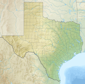
| Géolocalisation sur la carte : Texas
| ||
| modifier |
||
Source de la traduction
- (en) Cet article est partiellement ou en totalité issu de l’article de Wikipédia en anglais intitulé « Lake Tawakoni » (voir la liste des auteurs).
Liens externes
- Ressource relative à la géographie :
 Portail des lacs et cours d'eau
  Portail du Texas
На других языках
[en] Lake Tawakoni
Lake Tawakoni (/təˈwɑːkəni/ tə-WAH-kə-nee) is a 37,879-acre (15,329 ha) reservoir located in Northeast Texas, approximately 48 miles (77 km) east of Dallas, Texas. It lies within three Texas counties, Hunt, Rains, and Van Zandt. It is used for water supply and recreation. It is under the Sabine River Authority of Texas and the original headwaters of the Sabine are converged under the lake surface.- [fr] Lac Tawakoni
Текст в блоке "Читать" взят с сайта "Википедия" и доступен по лицензии Creative Commons Attribution-ShareAlike; в отдельных случаях могут действовать дополнительные условия.
Другой контент может иметь иную лицензию. Перед использованием материалов сайта WikiSort.org внимательно изучите правила лицензирования конкретных элементов наполнения сайта.
Другой контент может иметь иную лицензию. Перед использованием материалов сайта WikiSort.org внимательно изучите правила лицензирования конкретных элементов наполнения сайта.
2019-2025
WikiSort.org - проект по пересортировке и дополнению контента Википедии
WikiSort.org - проект по пересортировке и дополнению контента Википедии