geo.wikisort.org - Reservoir
Toronto Lake is a flood control lake in southeast Kansas, primarily in Woodson County. It is located on the Verdigris River about 4 miles southeast of Toronto, Kansas. The lake is maintained by the U.S. Army Corps of Engineers.[3]
| Toronto Lake | |
|---|---|
 Toronto Lake  Toronto Lake | |
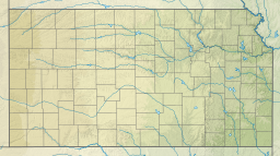
 KDOT map of Woodson County (legend) | |
| Location | Woodson / Greenwood counties in Kansas |
| Coordinates | 37°45′49″N 95°56′10″W[1] |
| Type | Reservoir |
| Primary outflows | Verdigris River |
| Basin countries | United States |
| Managing agency | U.S. Army Corps of Engineers |
| Built | 1960 |
| Settlements | Toronto, Coyville |
| References | [2] |
History
Toronto Lake was authorized in the Flood Control Act of 1941. Construction started on the lake in November 1954 and it was completed in February 1960.[3] In addition to flood control, the lake serves for recreational purposes, to improve water quality, and potentially to supply water.
See also
- Cross Timbers State Park
- Fall River Lake, southwest of Toronto Lake
- List of Kansas state parks
- List of lakes, reservoirs, and dams in Kansas
- List of rivers of Kansas
References
- "Toronto Lake". Geographic Names Information System. United States Geological Survey. Retrieved Jan 17, 2021.
- "Toronto Dam". Geographic Names Information System. United States Geological Survey. July 1, 1984. Retrieved January 15, 2021.
- Toronto Reservoir 50th Anniversary
External links
- Toronto Lake
- Woodson County Maps: Current, Historic, KDOT
- Greenwood County Maps: Current, Historic, KDOT
Текст в блоке "Читать" взят с сайта "Википедия" и доступен по лицензии Creative Commons Attribution-ShareAlike; в отдельных случаях могут действовать дополнительные условия.
Другой контент может иметь иную лицензию. Перед использованием материалов сайта WikiSort.org внимательно изучите правила лицензирования конкретных элементов наполнения сайта.
Другой контент может иметь иную лицензию. Перед использованием материалов сайта WikiSort.org внимательно изучите правила лицензирования конкретных элементов наполнения сайта.
2019-2025
WikiSort.org - проект по пересортировке и дополнению контента Википедии
WikiSort.org - проект по пересортировке и дополнению контента Википедии