geo.wikisort.org - Reservoir
Omuk-Kyuyol or "Omuk-Kyuyel" (Russian: Омук-Кюёль or Омук-Кюель; Yakut: Омук-күөлэ) is a freshwater lake in the Sakha Republic (Yakutia), Russia.[1]
| Omuk-Kyuyol | |
|---|---|
| Омук-Кюёль / Омук-күөлэ | |
 Omuk-Kyuyol Sentinel-2 image | |
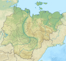 Omuk-Kyuyol Location in the Sakha Republic, Russian Far East | |
| Location | Kolyma Lowland |
| Coordinates | 68°40′N 152°08′E |
| Primary outflows | Omuk-Kyuyol-Seen |
| Catchment area | 258 square kilometres (100 sq mi) |
| Basin countries | Russia |
| Max. length | 11 km (6.8 mi) |
| Max. width | 9 km (5.6 mi) |
| Surface area | 53.5 square kilometres (20.7 sq mi) |
| Frozen | October to June |
| Islands | None |
The nearest inhabited place is Andryushkino, Lower Kolyma District, located about 100 km (62 mi) to the northeast.[2]
Geography
Omuk-Kyuyol lies north of the Arctic circle, in the southwestern part of the Kolyma Lowland. It is located in an area of lakes between the basin of the Indigirka to the west and the Alazeya to the east. The main outflowing river is the Omuk-Kyuyol-Seen (Омук-Кюёль-Сээн), a small tributary of the 129 km (80 mi) long Bulgunnakhtaakh-Seene of the Alazeya basin. The lake begins to freeze in early October and stays under ice until early June.[2][3]
See also
References
- "Озеро Омук-Кюёль in the State Water Register of Russia". textual.ru (in Russian).
- "R-55_56 Topographic Chart (in Russian)". Retrieved 6 June 2022.
- Google Earth
External links
 Media related to Omuk-Kyuyol at Wikimedia Commons
- Fishing & Tourism in Yakutia
This Sakha Republic location article is a stub. You can help Wikipedia by expanding it. |
Другой контент может иметь иную лицензию. Перед использованием материалов сайта WikiSort.org внимательно изучите правила лицензирования конкретных элементов наполнения сайта.
WikiSort.org - проект по пересортировке и дополнению контента Википедии