geo.wikisort.org - Reservoir
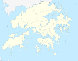
Lau Shui Heung Reservoir, built in 1968 as part of the Plover Cove Reservoir engineering programme, is a reservoir located within the boundary of Pat Sin Leng Country Park in the eastern part of North District, New Territories, Hong Kong, located at the northeast area of Bird's Hill, at the northeast end of Sheung Shui-Fanling Plain. It covers an area of 3.5 hectares (8.6 acres) and a water storage capacity of 170,000 m3.[1] It is responsible for collecting water from the northwestern part of Pat Sin Leng and supplying it to the Plover Cove Reservoir through a water conveyance tunnel, while Lau Shui Heung Reservoir is an irrigation reservoir used to irrigate nearby farmland. The Lau Shui Heung Country Trail passes through the reservoir.[2][3] The main concrete dam is 24 m high and 54.9 m long, the secondary dam is 7.3 m high and 39 m long and the scale of the reservoir is small. The reservoir is the main source of Kwan Tei River, and the water from the reservoir flows into Kwan Tei and then the Ng Tung River.
| Lau Shui Heung Reservoir | |
|---|---|
 Lau Shui Heung Reservoir | |
 Lau Shui Heung Reservoir | |
| Location | North District, New Territories, Hong Kong |
| Coordinates | 22.4956244°N 114.1667994°E |
| Type | reservoir |
| Built | 1968 |
| Surface area | 3.5 hectares (8.6 acres) |
| Water volume | 170,000 cubic metres (6,000,000 cu ft) |
| Lau Shui Heung Reservoir | |||||||||
|---|---|---|---|---|---|---|---|---|---|
| Traditional Chinese | 流水響水塘 | ||||||||
| |||||||||
History
The reservoir was formed at the head of a valley with a construction of a 12m concrete gravity dam and a 10m earth filled dam to connect with a tunnel to provide water transfer to Hok Tau Reservoir. Construction started in 1966 and was completed in 1968.[4]
In April 2018, mountain hikers discovered that the Lau Shui Heung Reservoir had been severely dried up recently, and cracks were seen at the bottom of the reservoir. They can walk down the reservoir to the opposite bank. The Water Supplies Department stated that the lack of rainfall in the past winter caused the water storage in the reservoir to be depleted due to irrigation by nearby villagers. However, the nearby Hok Tau Reservoir, which is also an irrigation pond and of the same size, did not dry up. It was suspected that the nearby Lung Shan Tunnel Project had drained the groundwater.[5] Until the beginning of June that year, due to the influence of the outer rainbands associated with Tropical Storm Ewiniar, nearly 100 mm of rainfall had fallen in the past 3 days, which was more than 10 mm more than the total rainfall of the past two months. At the same time, more than 200 mm of rainfall was recorded in the past 24 hours in the northern New Territories, enough to fill the reservoir with a capacity of 170,000 m3 and restore the title of "mirror of the sky".[6]
Environment and ecology
The entire reservoir is surrounded by tree-lined valleys and surrounded by mature woodlands, with rows of Melaleuca trees growing by the reservoir having full of greenery, very poetic and picturesque.[7]
The reservoir is quite deep, so the color of the reservoir is green, known as mirror of the sky in Hong Kong; the bottom of the reservoir is covered with sand and rocks of various sizes, providing a diverse habitat for different fishes. Many fish species can be found in the reservoirs, including Channa asiatica, which is uncommon in Hong Kong.[8] Because of its location in a deep valley, it became a popular place for people to go out and barbecue there.
See also
- List of reservoirs of Hong Kong
- Lau Shui Heung
References
- "Fun of Fishing" (PDF). Water Supplies Department. Retrieved 8 April 2021.
- "Experience abundant nature and wildlife on the Lau Shui Heung to Fung Yuen hike | Hong Kong Tourism Board". Hong Kong Tourism Board. Retrieved 8 April 2021.
- "Lau Shui Heung Reservoir & Country Trail > Cloudy Hill > Lau Shui Heung - HikeNow! Asia". HikeNow! Asia. Retrieved 8 April 2021.
- "Hong Kong Water Supply – Irrigation Reservoirs – The Industrial History of Hong Kong Group". The Industrial History of Hong Kong Group. 2 August 2020. Retrieved 8 April 2021.
- "【流水響乾塘】天空之鏡乾到裂 山友:基建影響 水署:冬季雨少 | 香港01 | 突發". HK01. 22 April 2018. Retrieved 8 April 2021.
- "【破鏡重圓】一場黃雨重修天空之鏡 流水響水塘龜裂變滿水 | 香港01 | 突發". HK01. 7 June 2018. Retrieved 8 April 2021.
- "Hong Kong Live Eco-map Species Distribution - Freshwater Fish Lau Shui Heung Reservoir". Hong Kong Live Eco-map. Retrieved 8 April 2021.
- "Agriculture, Fisheries and Conservation Department - HK Biodiversity Database". Agriculture, Fisheries and Conservation Department. Retrieved 8 April 2021.
External links
| Wikimedia Commons has media related to Lau Shui Heung Reservoir. |
Другой контент может иметь иную лицензию. Перед использованием материалов сайта WikiSort.org внимательно изучите правила лицензирования конкретных элементов наполнения сайта.
WikiSort.org - проект по пересортировке и дополнению контента Википедии