geo.wikisort.org - Reservoir
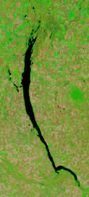
Last Mountain Lake,[4] also known as Long Lake, is a prairie lake formed from glaciation 11,000 years ago. It is located in south central Saskatchewan, Canada, about 40 km (25 mi) north-west of the city of Regina. It flows into the Qu'Appelle River via Last Mountain Creek,[5] which flows past Craven. It is approximately 93 km long, and 3 km wide at its widest point. It is the largest naturally occurring body of water in southern Saskatchewan. Only Lake Diefenbaker, which is man-made, is larger. The lake is a popular resort area for residents of south-eastern Saskatchewan.
| Last Mountain Lake | |
|---|---|
 Last Mountain Lake | |
 Last Mountain Lake  Last Mountain Lake | |
| Location | |
| Coordinates | 51°10′N 105°15′W |
| Lake type | prairie lake[1] |
| Primary inflows | Lanigan Creek, Lewis Creek, Arm River, Saline Creek |
| Primary outflows | Last Mountain Creek |
| Basin countries | |
| Max. length | 93 km (58 mi) |
| Max. width | 3 km (2 mi) |
| Surface area | 215 km2 (83 sq mi)[2] |
| Average depth | 35 m (115 ft) |
| Max. depth | 40 m (130 ft) |
| Surface elevation | 490 m (1,610 ft) |
| Islands | Bird Island, Royal Island |
| Settlements | Regina Beach, Saskatchewan Beach, Wee Too Beach, Buena Vista |
Ramsar Wetland | |
| Designated | 24 May 1982 |
| Reference no. | 239[3] |
History
In the late 1800s, access to the area for farming and settlement was opened up by the Qu'Appelle, Long Lake and Saskatchewan Railroad and Steamboat Company which also operated steamships on the lake.[6]
Until 1974, the lake was known as Long Lake. It was renamed Last Mountain Lake in honour of a Plains Cree legend about the Great Spirit shovelling dirt from the valley the lake now occupies and forming Last Mountain Hills, east of Duval and Strasbourg.[7]
Last Mountain House
"Last Mountain House" was a Hudson's Bay Company (HBC) trading post from 1869 to 1871. It was a branch of Fort Qu'Appelle 75 km east and was about 85 km south-west of Touchwood Hills Post. It was founded in part to compete with the increasing number of independent traders in the area and because the buffalo had moved south from Touchwood Hills. Some time after the second season the post was completely destroyed by fire and was not rebuilt. The House was located on the east side of Last Mountain Lake, about a mile north of the lake's outlet, 7 km north-west of Craven, Saskatchewan, and about 40 km north-west of Regina. The area is now part of Last Mountain House Provincial Park[8] and on the Canadian Register of Historic Places.[9]
Geographical features
Several creeks and rivers flow into the lake, including Arm River, Lewis Creek, and Lanigan Creek. Saline Creek flows into Lanigan Creek. Last Mountain Creek flows out of the lake at the southern most point and into the Qu'Appelle River. During years in which the Qu'Appelle River's level is high, the Last Mountain Creek can reverse direction and flow back into Last Mountain Lake.[10] Also, the gates at Craven Dam on the Qu'Appelle River can be opened or closed for water level control measures. When they're closed, it can backflood water up Last Mountain Creek and into Last Mountain Lake.[11]
Named islands at the northern end of the lake include Royal Island, Bird Island, and Coney Island.[12]
Near the southern end, on the west side of the lake, is Little Arm Bay, of which the Arm River flows into. Directly across from the bay is Pelican Point.[13] The community of Pelican Pointe is located there.[14]
Last Mountain Lake Sub-basin
The Qu'Appelle River watershed is divided into two main basins, the Wascana & Upper Qu’Appelle Watersheds and the Lower Qu'Appelle Watershed. Craven Dam at the village of Craven is the dividing point between the upper and lower watersheds of the Qu'Appelle River. The upper watershed is divided into four sub-basins and the Moose Jaw River Watershed,[15] of which Last Mountain Lake Sub-basin is one. The other three sub-basins include Lanigan-Manitou Sub-basin, Wascana Creek Sub-basin, and Upper Qu’Appelle Sub-basin. Last Mountain Lake Sub-basin includes all the land that drains into the lake from the east and west sides of the lake, including Arm River and Lewis Creek. Lanigan Creek at the north end is part of the Lanigan-Manitou Sub-basin and Last Mountain Creek at the south end is part of the Upper Qu’Appelle Sub-basin. The total size of all four sub-basins and the Moose Jaw River Watershed combined is 23,443 km².[16]
Communities


Eight different rural municipalities border at least part of the lake. Clock-wise from the north, RMs include Wreford, Last Mountain Valley, McKillop, Longlaketon, Lumsden, Dufferin, Sarnia, and Big Arm.
Resort communities such as Kannata Valley, Arlington Beach, Grandview Beach, Eldora Beach, Regina Beach, Saskatchewan Beach, Buena Vista, Glen Harbour, Alice Beach, Wee Too Beach, Colesdale Park, Spring Bay, Pelican Pointe, Sunset Cove, Island View, Sorensen Beach, Etters Beach, Mohr's Beach, North Colesdale Park, and Sarnia Beach are on the shores of the lake.[17]
Beside Regina Beach, around Little Arm Bay, is Last Mountain Lake 80A Indian reserve.[18]
Parks and recreation
About 25 kilometres south-west of the town of Strasbourg, along the lake's eastern shore, lies Rowan's Ravine Provincial Park. This park includes a marina, a full-service campground, restaurant, mini-golf, beach, and an outfitters. The beach is along a point and is one of Saskatchewan's longest, natural sand beaches. The marina at the is often used by recreational boaters travelling from Regina Beach as a stop over or refuelling point and large fishing tournament called Last Mountain Fall Walleye Classic is held there every September.[19] Last Mountain House Provincial Park is located on the south-east shore and provides tours of historical the Last Mountain House, which was built by the Hudson's Bay Company in 1869.
At the northern end of the lake, on the eastern shore is Last Mountain Regional Park. The park offers camping, swimming, and golf. It is located about 15 km west of Govan, off Highway 20.
At the southern end of the lake, where Last Mountain Creek starts, is Valeport Marsh. The area is protected by 900-acre conservation project called Valeport Wildlife Management Area Trails.[20] It is in conjunction with Ducks Unlimited. Along the west side of the Management Area is a Nature Conservancy of Canada property called Big Valley. Big Valley is protected and managed for bird and wildlife habitat.[21]
The United Church of Canada's Lumsden Beach Camp is "[a] short drive from Regina, ... hugging the south shore of Last Mountain Lake." Founded in 1905, it is the oldest summer camp in Western Canada.[22]
Last Mountain Lake Bird Sanctuary
The Last Mountain Lake Bird Sanctuary, the first federal bird sanctuary in North America, was established here in 1887. As the first such wildlife reserve of this kind on the continent, it was designated a National Historic Site of Canada in 1987.[23] Over 280 bird species have been recorded. The lake contains appropriate habitat for 9 of Canada's 36 species of vulnerable, threatened and endangered birds, such as the peregrine falcon, piping plover, burrowing owl, and whooping crane. The northern end of the lake is very shallow and contains wetlands. Part of this area of the lake and surrounding area has been set aside as the Last Mountain Lake National Wildlife Area, which is a site of regional importance in the Western Hemisphere Shorebird Reserve Network.[24][25]
Fish species
The lake contains a host of fish species including walleye, yellow perch, northern pike, burbot, lake whitefish, cisco, bigmouth buffalo, white sucker, and common carp.
See also
- List of lakes of Saskatchewan
- List of protected areas of Saskatchewan
- Tourism in Saskatchewan
- List of historic places in Saskatchewan
- Ramsar site
References
- "Natural Resources Canada-Canadian Geographical Names (Last Mountain Lake)". Retrieved 29 August 2014.
- "Angler's Atlas".
- "Last Mountain Lake". Ramsar Sites Information Service. Retrieved 25 April 2018.
- Government of Canada, Natural Resources Canada. "Place names - Last Mountain Lake". www4.rncan.gc.ca.
- Government of Canada, Natural Resources Canada. "Place names - Last Mountain Creek". www4.rncan.gc.ca.
- "A History of Regina in Photographs". Regina Public Library. Retrieved 5 March 2011.
- "Sunset Acres Resort - Lakefront Properties in Saskatchewan".
- "Last Mountain House Provincial Historic Park | Tourism Saskatchewan".
- "HistoricPlaces.ca - HistoricPlaces.ca".
- "WSA working to raise low water levels in Last Mountain Lake ahead of summer | Globalnews.ca".
- Foster, Scott. "Water diverted to Last Mountain". Reginacity. Regina Leader Post. Retrieved 12 December 2021.
- Government of Canada, Natural Resources Canada. "Place names - Coney Island". www4.rncan.gc.ca.
- Government of Canada, Natural Resources Canada. "Place names - Pelican Point". www4.rncan.gc.ca.
- Government of Canada, Natural Resources Canada. "Place names - Pelican Pointe". www4.rncan.gc.ca.
- "Our Watershed".
- "Our Watershed". WUQWATR. Retrieved 17 September 2021.
- "Atlas of Canada Toporama". Retrieved 29 August 2014.
- Government of Canada, Natural Resources Canada. "Place names - Last Mountain Lake 80A". www4.rncan.gc.ca.
- "Fishing Events | Tourism Saskatchewan".
- "Valeport Wildlife Management Area Trails | Tourism Saskatchewan".
- "Valeport Marsh (SK061)".
- http://www.lumsdenbeachcamp.com/ June 2, 2013.
- Last Mountain Lake Bird Sanctuary. Canadian Register of Historic Places. Retrieved 18 August 2012.
- "Saskatchewan's Environmental Champions (Last Mountain Lake Bird Sanctuary)". Archived from the original on 7 January 2014. Retrieved 29 August 2014.
- "Last Mountain Lake National Wildlife Area: Site Description". Manomet Center For Conservation Sciences. Retrieved 18 February 2008.
- Elizabeth Browne Losey, Let Them be Remembered: The Story of the Fur Trade Forts, 1999, pages 668-672
- Canada's Historic places
- Saskatchewan Parks
External links
- Fish Species of Saskatchewan
- Saskatchewan Watershed Authority
- Encyclopedia of Saskatchewan
- Rowan's Ravine Provincial Park
- Last Mountain House Provincial Park
- Last Mountain Lake National Wildlife Area
| Authority control: National libraries |
|---|
На других языках
- [en] Last Mountain Lake
[fr] Lac de la Dernière-Montagne
Le lac de la Dernière-Montagne (anglais : Last Mountain Lake), également appelé le lac Long, est un lac peu profond formé lors de la glaciation il y a 11 000 ans situé dans le Centre-Sud de la Saskatchewan au Canada à environ 40 km au nord-ouest de la ville de Regina. Il se déverse dans la rivière Qu'Appelle via la crique Last Mountain. Il mesure environ 93 km de long et a une largeur maximale de 3 km. Il s'agit de la plus grande étendue d'eau naturelle dans le Sud de la Saskatchewan. Le lac doit son nom à une légende crie qui dit que le Grand Esprit a pelleté de la terre de la vallée pour former les collines Last Mountain.Другой контент может иметь иную лицензию. Перед использованием материалов сайта WikiSort.org внимательно изучите правила лицензирования конкретных элементов наполнения сайта.
WikiSort.org - проект по пересортировке и дополнению контента Википедии