geo.wikisort.org - Reservoir
Lake Washington is a large freshwater lake adjacent to the city of Seattle.[1] It is the largest lake in King County and the second largest natural lake in the state of Washington, after Lake Chelan. It borders the cities of Seattle on the west, Bellevue and Kirkland on the east, Renton on the south and Kenmore on the north, and encloses Mercer Island. The lake is fed by the Sammamish River at its north end and the Cedar River at its south.
| Lake Washington | |
|---|---|
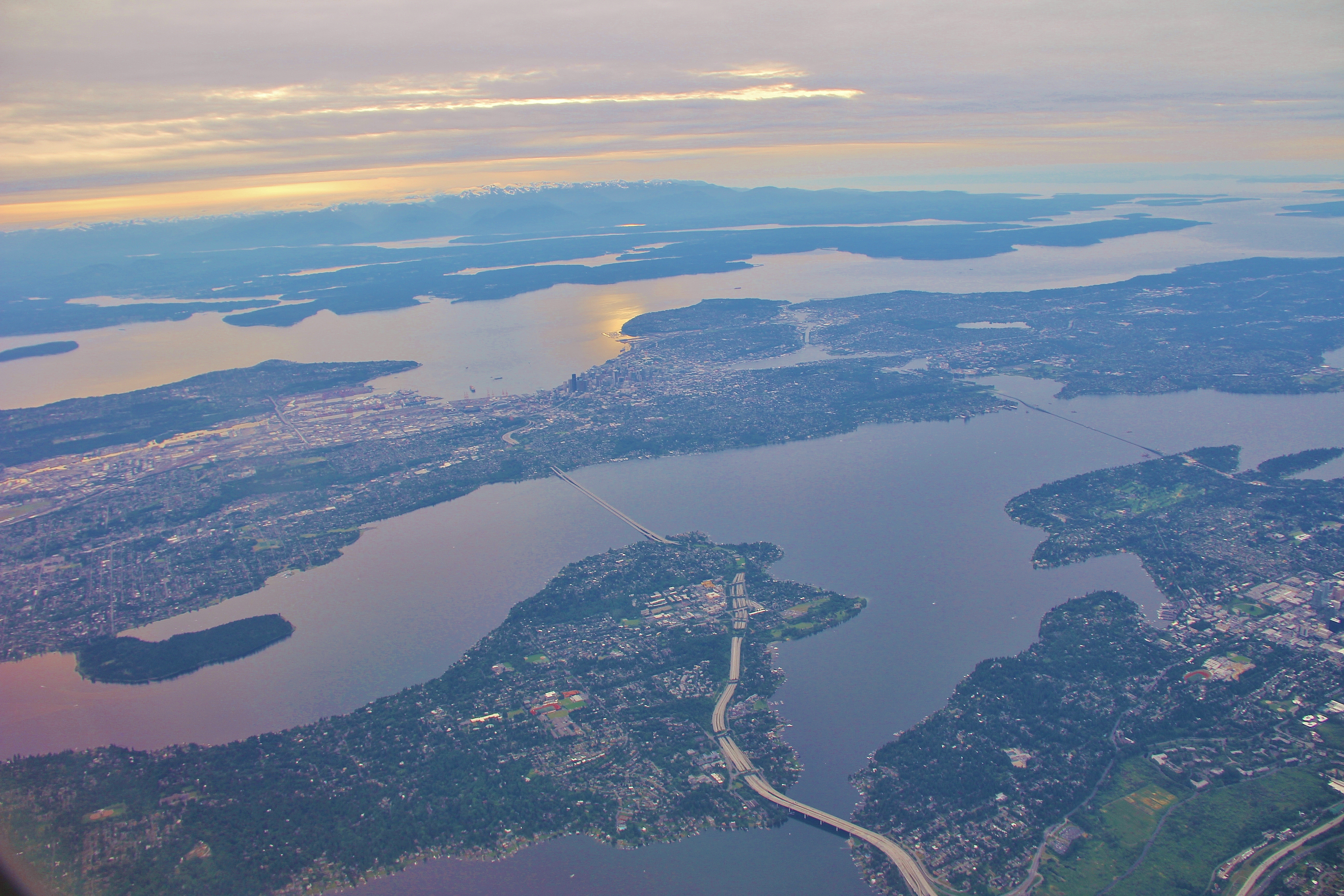 The longest and second longest floating bridges in the world cross Lake Washington | |
 Lake Washington  Lake Washington | |
 Lake Washington and surrounding area | |
| Location | King County, Washington, United States |
| Coordinates | 47°37′N 122°16′W |
| Native name | Xacuabš (Lushootseed) |
| Primary inflows | Sammamish, Cedar Rivers; Ravenna, Thornton, Kelsey, Juanita, Forbes and Coal Creeks |
| Primary outflows | Lake Washington Ship Canal (1916) |
| Catchment area | 315,000 acres (1,270 km2) |
| Basin countries | United States |
| Max. length | 22 mi (35 km) |
| Surface area | 33.8 square miles (88 km2), 33.8 square miles (21,600 acres) |
| Average depth | 108 ft (33 m) |
| Max. depth | 214 ft (65 m) |
| Water volume | 2,842,069 acre⋅ft (3.505640 km3) |
| Surface elevation | 16 ft (4.9 m) above mean sea level, 20.6 ft (6.3 m) above Puget Sound mean lower low tide |
| Islands | Mercer Island, Foster Island, Marsh Island
|
Lake Washington received its present name in 1854 after Thomas Mercer suggested it be named after George Washington, as the new Washington Territory had been named the year before.[2] Earlier names for the lake include the Duwamish name Xacuabš (Lushootseed: literally "xacu" great-amount-of-water + "abš" people), which referred to peoples who stayed along the coastline of Lake Washington,[3] as well as Lake Geneva by Isaac N. Ebey;[1]: 140 Lake Duwamish in railroad surveys under Governor Isaac Stevens;[1]: 174 At-sar-kal in a map sketched by engineer Abiel W. Tinkham;[1]: 10 and the Chinook Jargon name, "Hyas Chuck," or "It-Kow-Chug"[1]: 121 'big lake'.[4]
The lake provides sport fishing opportunities. Some species found in this lake are Coastal Cutthroat Trout, Rainbow Trout, Largemouth Bass, Smallmouth Bass, Yellow Perch, and Black Crappie.[5]
Geography
A ribbon lake, Lake Washington is long, narrow and finger-like. Ribbon lakes are excavated by glaciers. As the Puget lobe of the Cordilleran Ice Sheet flowed south near the end of the Late Pleistocene, it met bands of harder and softer rock. Erosion of the softer rock was faster and a linear depression was created in the flow direction. When the glacier melted, the lake filled with the meltwater, which was retained by moraine deposits. A dam can also be created by the bands of harder rock either side of the softer rock. There is usually a river at both ends of a ribbon lake, one being the inlet, and the other, the outlet—though in the case of present-day Lake Washington, inlet rivers are located at both ends, with a man-made outlet in the middle. Two seaplane bases, Kenmore Air Harbor and Will Rogers – Wiley Post Memorial Seaplane Base, have air travel passenger terminals.
Creeks and rivers

The main inflowing rivers are the Sammamish and Cedar Rivers, with the Cedar supplying most of the water. Seasonal changes in the flow of the Sammamish are moderated by a weir at the Lake Sammamish inlet.[4]
The lake is drained by the Lake Washington Ship Canal.
In addition, there are numerous small creeks and rivers which feed the lake, including:[6]
- Coal Creek
- Denny Creek (O.O. Denny Park)
- Fairweather Creek
- Forbes Creek
- Juanita Creek
- Kelsey Creek
- Little Creek
- Lyon Creek
- Mapes Creek
- May Creek
- McAleer Creek
- Mercer Slough
- Ravenna Creek
- Taylor Creek
- Thornton Creek
- Yarrow Creek
- Yesler Creek
Historically, construction of the Lake Washington Ship Canal drastically changed the inflow and outflow of the lake. Before construction of the canal in 1916, Lake Washington's outlet was the Black River, which joined the Duwamish River and emptied into Elliott Bay. When the canal was opened the level of the lake dropped nearly nine feet (2.7 m).[7] The canal became the lake's sole outlet, causing the Black River to dry up and disappear. Before construction, the Sammamish River was the primary source of water for Lake Washington. The lowering of the lake slightly increased the flow of the Sammamish. As part of the ship canal project, the Cedar River was diverted into Lake Washington, to become the primary source of water for Lake Washington.
Canals and bridges

The Montlake Cut, part of the Lake Washington Ship Canal, connects the lake to Lake Union and ultimately Puget Sound.
Concrete floating bridges are employed to span the lake because Lake Washington's depth and muddy bottom prevented the emplacement of the pilings or towers necessary for the construction of a causeway or suspension bridge. The bridges consist of hollow concrete pontoons that float atop the lake, anchored with cables to each other and to weights on the lake bottom. The roadway is constructed atop these concrete pontoons. Three floating bridges cross Lake Washington: the Evergreen Point Floating Bridge (officially the SR 520 Albert D. Rosellini Evergreen Point Floating Bridge) carries State Route 520 from Seattle's Montlake neighborhood to Medina while the Lacey V. Murrow Memorial Bridge and the Third Lake Washington Bridge (officially the Homer M. Hadley Memorial Bridge) carry Interstate 90 from Seattle's Mount Baker neighborhood to Mercer Island. The East Channel Bridge carries Interstate 90 from Mercer Island to Bellevue. The Evergreen Point, Lacey V. Murrow, and Third Lake Washington bridges are the longest, second longest, and fifth longest floating bridges in the world, respectively.
Many questioned the wisdom of concrete floating bridge technology after the sinking of a portion of the Lacey V. Murrow bridge on November 25, 1990. However, a Washington State Department of Transportation (WSDOT) investigation revealed that the incident resulted from the improper handling of hydrodemolition water being used during bridge renovations, rather than in any basic flaw in the bridge's concept or design. Concrete floating bridges continue to remain a viable means for the conveyance of vehicle traffic over Lake Washington.[8]
In 1950, approximately one year after the tolls were removed from the Murrow bridge, the inland ferry system on the lake came to an end, having operated since the 1880s.[9]
Shoreline cities and towns
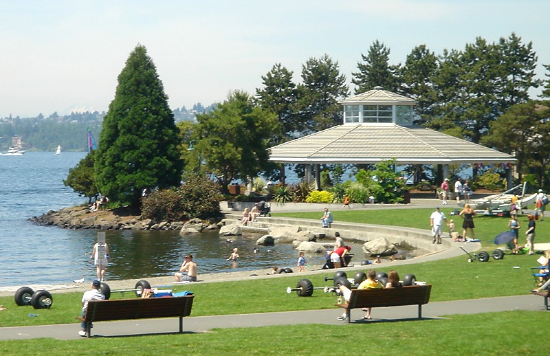
The cities and towns bordering the lake, going clockwise from the west, are Seattle, Lake Forest Park, Kenmore, Kirkland, Yarrow Point, Hunts Point, Medina, Bellevue, Beaux Arts Village, and Renton. The city of Mercer Island occupies the island of the same name, in the southern half of the lake.

Water purity
Around 1900, Seattle began discharging sewage into Lake Washington. During the 1940s and 1950s, eleven sewage treatment plants were sending state-of-the-art treated water into the lake at a rate of 20 million gallons per day. At the same time, phosphate-based detergents came into wide use. The lake responded to the massive input of nutrients by developing unpleasant blooms of noxious blue-green algae (cyanobacteria). The water lost its clarity, the desirable fish populations declined, and masses of dead algae accumulated on the shores of the lake. After significant pollution, the October 5, 1963 issue of the Post Intelligencer referred to the lake as "Lake Stinko". Citizen concern led to the creation of a system that diverted the treatment-plant effluents into nearby Puget Sound, where tidal flushing would mix them with open-ocean water. The diversion was complete by 1968, and the lake responded quickly. The algal blooms diminished, the water regained its clarity, and by 1975, recovery was complete. Careful studies by a group of limnologists from the University of Washington showed that phosphate was the culprit. Since then, Lake Washington has undergone major improvements, drastically improving the ecology and water quality, making the water twice as clear as it was in 1950.[10]
See also
- Mount Baker Crew rowing club
- Seafair Cup hydroplane races
References
- Meany, Edmond S. (1923). Origin of Washington Geographic Names. University of Washington Press. ISBN 9780598974808.
- Phillips, James W. (1971). Washington State Place Names. University of Washington Press. p. 156. ISBN 0-295-95158-3.
- Thrush, Coll (2007). Native Seattle: Histories from the Crossing-Over Place. University of Washington Press. p. 245. ISBN 978-0-295-98700-2.,
- Historical Changes to Lake Washington and Route of the Lake Washington Ship Canal, King County, Washington, Michael Chrzastowski, United States Geological Survey, Department of the Interior
- "Lake Washington – Fish Washington". Washington Department of Fish & Wildlife.
- The Watershed: the geography, Friends of the Cedar River Watershed, archived from the original on December 14, 2014
- Lake Washington Ship Canal, HistoryLink.org
- Dorpat, Paul; Genevieve McCoy (1998). Building Washington: A History of Washington State Public Works. Tartu Publications. p. 124. ISBN 0-9614357-9-8.
- Dorpat, Paul; Genevieve McCoy (1998). Building Washington: A History of Washington State Public Works. Tartu Publications. p. 36. ISBN 0-9614357-9-8.
- "Rescue of "Lake Stinko"". Archived from the original on 2009-02-27.
| Authority control |
|---|
На других языках
[de] Lake Washington
Der Lake Washington ist der zweitgrößte natürliche See im US-Bundesstaat Washington nach dem Lake Chelan und der größte See im King County. Er liegt zwischen Seattle im Westen, Bellevue und Kirkland im Osten, Renton im Süden sowie Kenmore im Norden. In dem See liegt die Insel Mercer Island, darauf die gleichnamige Stadt. In den See münden zwei Flüsse, der Sammamish River am nördlichen und der Cedar River am südlichen Ende. Zusätzlich münden noch verschiedene kleinere Bäche in den Lake Washington. Der See liegt auf einer Höhe von 5 m[1] und ist etwa 20 Kilometer lang. Die mittlere Tiefe des von einem Gletscher geformten Sees beträgt 30 Meter, der tiefste Punkt ist 65 Meter unter der Wasseroberfläche.[2]- [en] Lake Washington
[es] Lago Washington
El lago Washington (en inglés: Lake Washington) es un lago de agua dulce de Estados Unidos, situado en el estado de Washington. Es un lago cintiforme de origen glaciar.[fr] Lac Washington
Le lac Washington est le deuxième plus grand lac naturel de l'État de Washington aux États-Unis après le lac Chelan et le plus grand du comté de King. Il est bordé des villes de Seattle à l'ouest, Bellevue et Kirkland à l'est, Renton au sud et Kenmore au nord. L'île Mercer se trouve dans sa partie sud. Il est alimenté par la rivière Sammamish (en) à l'extrême nord et Cedar au sud.[it] Lago Washington
Il lago Washington (in lingua inglese Lake Washington) è un lago naturale che si trova nel territorio degli Stati Uniti. È, dopo il lago Chelan, il secondo in estensione tra i laghi dello Stato di Washington e il più esteso della contea di King. Tra le principali città che si trovano nelle sue vicinanze troviamo Seattle ad ovest, Bellevue e Kirkland ad est, Renton a sud e Kenmore sul versante nord. Il lago è caratterizzato dalla presenza di un'isola centrale, Mercer Island, e viene alimentato dai suoi due principali immissari, lo Sammamish River da nord e il Cedar River da sud.[ru] Вашингтон (озеро)
Озеро Вашингтон (англ. Lake Washington) — озеро в США, штат Вашингтон, большое пресноводное озеро, смежное с городом Сиэтл, второе по величине озеро в штате после озера Шелан.Другой контент может иметь иную лицензию. Перед использованием материалов сайта WikiSort.org внимательно изучите правила лицензирования конкретных элементов наполнения сайта.
WikiSort.org - проект по пересортировке и дополнению контента Википедии