geo.wikisort.org - Reservoir
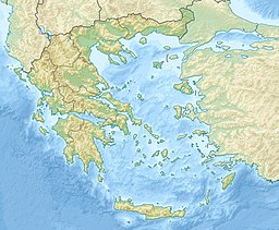
Lake Vouliagmeni ("Sunken Lake") is a small brackish-water lake fed by underground currents seeping through the mass of Mount Hymettus located to the south of Vouliagmeni, Athens, Greece.
| Lake Vouliagmeni | |
|---|---|
 View of the Lake Vouliagmeni | |
| Location | Vouliagmeni, Greece |
| Coordinates | 37.807908°N 23.785610°E |
| Type | brackish lake |
Description
The lagoon formed about 2,000 years ago.[1] It was once a large cavern that collapsed following an earthquake. The outline of the collapsed cavern roof can be clearly discerned from a distance.
The lake has quite unique environmental conditions: it is supplied with warm seawater (28-35°C) via an underground channel spreading through a network of flooded caves, so its temperature never drops below 18 °C (usually ranges around 21-24 °C), whereas a freshwater spring reduces its salinity to brackish levels (14.5-18 psu).[1]
It continues deep inside the mountain in an underwater cave never fully explored, as its end seems impossible to trace even by employing sonar detection. Many underwater expeditions have been carried out in order to chart it, and a few amateur divers have drowned trying.
Because of its constant warm water temperature and its rich content in hydrogen sulphide, the lake functions as a spa since the end of the 19th century.[1]
Ecology
The lake hosts the only existing population of a species of sea anemone, Paranemonia vouliagmeniensis. It has been declared a natural monument by the Greek State and is part of a Natura 2000.[1][2]
References
- Otero, M. del M.; Numa, C.; Bo, m.; Orejas, C.; Garrabou, J.; Cerrano, C.; Kružić, P.; Antoniadou, C.; Aguilar, R.; Kipson, S.; Linares, C.; Terrón-Sigler, A.; Brossard, J.; Kersting, D.; Casado-Amezúa, P.; García, S.; Goffredo, S.; Ocaña, O.; Caroselli, E.; Maldonado, M.; Bavestrello, G.; Cattaneo-Vietti, R.; Özalp, B. (2017), Overview of the Conservation Status of Mediterranean Anthozoa (PDF), IUCN Redlist, IUCN
- "YMITTOS - AISTHITIKO DASOS KAISARIANIS - LIMNI VOULIAGMENIS (GR3000006)". Natura 2000. European Environment Agency. Retrieved 7 October 2022.
На других языках
- [en] Lake Vouliagmeni
[fr] Lac de Vouliagméni
Le lac de Vouliagméni (grec moderne : Λίμνη Βουλιαγμένης) est un petit lac d'eau saumâtre alimenté par des courants souterrains qui s'infiltrent dans la masse rocheuse du mont Hymette. Il est situé au sud de Vouliagméni, en Grèce.[ru] Вулиагмени (озеро)
Вулиагме́ни[4] (греч. λίμνη Βουλιαγμένης[3]) — минеральное[4] озеро в Греции, расположенное у одноимённого малого города, входящего в общину (дим) Вари-Вула-Вулиагмени в Восточной Аттике в Аттике. Минеральные воды поступают в озеро с глубины от 50 до 100 метров и имеют температуру от 22 до 29 °C. Также озеро питается пресной водой из источника на глубине 17 метров[5]. Озеро связано подземной пещерой с морем. Озеро находится в южной части горы Имитос, недалеко от моря. Форма озера овальная, длина 260 м, шириной 145 метров, площадь 1,59 га[2]. Водная поверхность находится на полметра выше поверхности моря[1]. Входит в сеть охранных участков Натура 2000[6].Другой контент может иметь иную лицензию. Перед использованием материалов сайта WikiSort.org внимательно изучите правила лицензирования конкретных элементов наполнения сайта.
WikiSort.org - проект по пересортировке и дополнению контента Википедии
