geo.wikisort.org - Reservoir
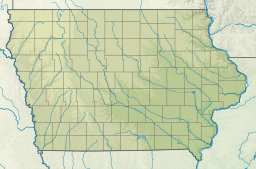
Lake Red Rock, also referred to as Red Rock Reservoir is a reservoir formed by Red Rock Dam on the Des Moines River, about 41 miles southeast of the city of Des Moines, Iowa, U.S. The dam was completed in 1969 as a Flood control project by the United States Army Corps of Engineers, creating the largest lake in Iowa. The lake is essentially confined to Marion County. The damface is a few miles west and south of Pella, and similarly, a few miles northeast of Knoxville.
This article includes a list of general references, but it lacks sufficient corresponding inline citations. (October 2017) |
| Lake Red Rock | |
|---|---|
 (Army Corps of Engineers) | |
 Lake Red Rock  Lake Red Rock | |
| Location | Marion County, |
| Coordinates | 41°24′19″N 93°02′49″W |
| Type | reservoir |
| Primary inflows | Des Moines River |
| Primary outflows | Des Moines River |
| Catchment area | 12,000 sq mi (31,080 km2) |
| Basin countries | United States |
| Max. length | 11 mi (18 km) |
| Surface area | 15,520 acres (62.81 km2) max: 70,000 acres (283.28 km2) |
| Surface elevation | 742 ft (226 m) |


Recreation and points of interest
The lake shore has various recreational activities such as camping, hiking, boating and fishing. The state maintains Elk Rock State Park on both sides of the lake while Roberts Creek Park and Cordova Park (location of Cordova Tower) are managed by the Marion County Conservation Board.
The Army Corps of Engineers maintains several campgrounds as well: White Breast Recreation Area, Ivans Recreation Area, Wallashuck Recreation Area, Howell Station Recreation Area, and the North Overlook Recreation Area. There is also a "water trail", known as the Red Rock Water Trail, where one can float down the Des Moines River from the southeast corner of Polk County to the lake and down to Red Rock Dam. Flotilla 4 of the Coast Guard Auxiliary provides boating safety education and free vessel safety checks to boaters in the area.[1]
A major landmark is what is locally called the "Mile Long Bridge", carrying Iowa Highway 14 at its upstream end.
References
- "U.S. Coast Guard Auxiliary - District 8WR, Division 33, Flotilla 4, Des Moines, Iowa - Home Page". www.flotilla4.org. Retrieved January 26, 2022.
External links
- U.S. Army Corps of Engineers - Lake Red Rock
- U.S. Army Corps of Engineers: Corps Lake Gateway – Lake Red Rock
- Red Rock Dam
- EPA statistics
- Army Corps Map
Protected areas of Iowa | ||||||||
|---|---|---|---|---|---|---|---|---|
| Federal |
| |||||||
| State |
| |||||||
| County |
| |||||||
Iowa Department of Natural Resources | ||||||||
Authority control | |
|---|---|
| General |
|
| Other | |
Другой контент может иметь иную лицензию. Перед использованием материалов сайта WikiSort.org внимательно изучите правила лицензирования конкретных элементов наполнения сайта.
WikiSort.org - проект по пересортировке и дополнению контента Википедии