geo.wikisort.org - Reservoir
Lake Darling State Park is a state park of Iowa, US. It is in Washington County and the park is approximately 3 miles (4.8 km) west of Brighton; 6 miles (9.7 km) east of Richland; and 3 miles (4.8 km) north-west of Pleasant Plain.
This article needs additional citations for verification. (March 2020) |
| Lake Darling State Park | |
|---|---|
 Lake Darling State Park entrance sign. | |
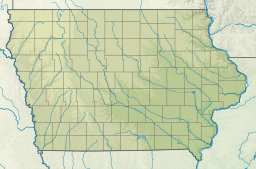
 Location of Lake Darling State Park in Iowa | |
| Location | Washington, Iowa, United States |
| Coordinates | 41°11′30″N 91°53′45″W |
| Area | 1,417 acres (5.73 km2) |
| Elevation | 682 ft (208 m)[1] |
| Established | 1950 |
| Named for | Jay Norwood Darling |
| Governing body | Iowa Department of Natural Resources |
| Website | Lake Darling State Park |
| Lake Darling | |
|---|---|
 Lake Darling | |
| Location | Washington County, Iowa, US |
| Coordinates | 41°12′10″N 91°54′22″W |
| Basin countries | United States |
| Surface area | 302 acres (1.2 km²) |
| Surface elevation | 656 ft (200 m) |
Lake Darling is 302 acres (122 ha) and has approximately 18 miles (29 km) of shoreline. It is located on Honey Creek, a minor tributary of the Skunk River. The park as a whole is 1,417 acres (5.73 km2) in size.
History
Lake Darling State Park was dedicated on September 17, 1950. The park is named after Jay Norwood "Ding" Darling.
Land usage
Lake Darling State Park has a picnic shelter, camping cabins, campsites, restrooms, playground equipment, boat rentals, several trails, and a beach. Lake Darling is also home to a variety of fish.
References
- "Lake Darling State Park". Geographic Names Information System. United States Geological Survey. 1979-04-30. Retrieved 2011-02-27.
External links
Protected areas of Iowa | ||||||||
|---|---|---|---|---|---|---|---|---|
| Federal |
| |||||||
| State |
| |||||||
| County |
| |||||||
Iowa Department of Natural Resources | ||||||||
Другой контент может иметь иную лицензию. Перед использованием материалов сайта WikiSort.org внимательно изучите правила лицензирования конкретных элементов наполнения сайта.
WikiSort.org - проект по пересортировке и дополнению контента Википедии