geo.wikisort.org - Reservoir
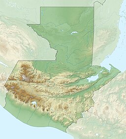
Lake Petén Itzá (Lago Petén Itzá, Spanish pronunciation: [ˈlaɣo peˈten iˈtsa]) is a lake in the northern Petén Department in Guatemala. It is the third largest lake in Guatemala, after Lake Izabal and Lake Atitlán. It is located around 16°59′0″N 89°48′0″W. It has an area of 99 km2 (38 sq mi), and is some 32 km (20 mi) long and 5 km (3.1 mi) wide. Its maximum depth is 160 m (520 ft). The lake area presents high levels of migration, due to the existence of natural resources such as wood, chewing gum, oil, and agricultural and pasture activities. Because of its archaeological richness, around 150,000 tourists pass through this region yearly. The city of Flores, the capital of the Petén Department, lies on an island near its southern shore.
| Lake Petén Itza | |
|---|---|
 Lake view from the Northeastern shore | |
| Coordinates | 16°59′0″N 89°48′0″W |
| Primary inflows | Rio Ixlú, Rio Ixpó |
| Primary outflows | (subterranean) |
| Basin countries | Guatemala |
| Surface area | 99 km2 (38 sq mi)[1] |
| Max. depth | 160 m (520 ft) |
| Surface elevation | 110 m (360 ft) |
| Sections/sub-basins | Main north basin, shallow south basin |
| References | [1] |
Several streams flow into Lake Petén Itzá, but it has no surface outflow.[2] Although it loses water mostly by evaporation, it is not a salt lake.
Notable sites
There are at least 27 Maya sites around this lake and the archaeological remains of Tayasal, located across the lake on a peninsula close to the former Itza Maya capital, the last to be conquered in Mesoamerica in 1697.

Fauna
This lake and its surroundings have more than 100 important indigenous species such as the cichlid fish Mayaheros urophthalmus, Petenia splendida and Vieja melanurus, crocodiles (Crocodylus moreletii and Crocodylus acutus), jaguars (Panthera onca), pumas (Puma concolor), white-tailed deer (Odocoileus virginianus), Central American red brocket (Mazama temama), and several bird species, including parrots such as macaws, and toucans. On its northeast shore is the Cerro Cahui Protected Biotope, a natural reserve for butterflies that covers 1,600-acre (6.5 km2) and is home to toucans, Geoffroy's spider monkey (Ateles geoffroyi), Guatemalan black howler monkeys (Alouatta pigra), and many other rainforest species.
Notes
- INSIVUMEH. "Indice de lagos". Retrieved 13 July 2008.
- Biogeography of the West Indies: Patterns and Perspectives (second ed.). p. 37.
| Wikimedia Commons has media related to Lago Petén Itzá. |
References
- Photos of the lake Peten Itzá
- Central Petén Maya Sites
- ETH Zurich Climate Geology Project: Lago Peten Itza
На других языках
[de] Petén-Itzá-See
Der Petén-Itzá-See (spanisch Lago Petén Itzá) ist nach dem Izabal-See und dem Lago de Atitlán der drittgrößte See Guatemalas. Er liegt inmitten des Departamentos El Petén auf 110 Metern Höhe. Der etwa 32 km lange und 5 km breite See hat eine Fläche von 99 km² und ist bis zu 160 m tief. Flores, die Hauptstadt des Departamentos, liegt auf einer Insel nahe dem Südufer, die über eine Brücke mit den großen Vororten San Benito und Santa Elena verbunden ist. Am nordöstlichen Ufer des Sees befindet sich das Naturschutzgebiet Cerro Cahui mit einem von einer Hochschule unterhaltenen Wildpark. Der Petén-Itzá-See ist von einigen kleineren Seen und etlichen Maya-Ruinen umgeben, darunter Tikal. Dank der gut ausgebauten Fernstraße nach Guatemala-Stadt und des bei Santa Elena liegenden Flughafen Flores konnte sich der Petén-Itzá-See mit der Stadt Flores in den letzten Jahren zu einem Touristenziel entwickeln.- [en] Lake Petén Itzá
[es] Lago Petén Itzá
El lago Petén Itzá es un lago en el departamento de El Petén al norte de Guatemala. El lago tiene una extensión de 99 km²[1] y es el tercer lago natural más grande del país, después del lago de Izabal y el lago de Atitlán. Tiene una profundidad máxima de 160 m y se sitúa a una altura de 110 m s. n. m. en coordenadas geográficas entre latitud 16º54’40” a 17º01’00” y longitud 89°41'30" a 89º55’30”.[2] En uno de sus islotes está ubicada la ciudad de Flores, la cabecera departamental del Petén.[fr] Lac Petén Itzá
Le lac Petén Itzá est un lac situé dans le nord du département du Petén, au Guatemala[1]. C'est le troisième lac du pays par la superficie après le lac Izabal (589 km2) et le lac Atitlan (130 km2), avec 99 km2 (environ 32 kilomètres de long pour 5 de large), et une profondeur maximale de 160 mètres. La ville de Flores, chef-lieu du département du Petén, se trouve sur une île, près de la rive sud du lac[2].[it] Petén Itzá
Il lago Petén Itzá è un lago situato nella parte settentrionale del dipartimento di Petén in Guatemala. È il secondo più grande lago del Guatemala, superato solo dall'Izabal. Ha una superficie di 99 km², con una lunghezza di 32 km. ed una larghezza di 5 km. La sua profondità massima è di 160 m. L'area del lago presenta alti livelli di migrazione, a causa dell'esistenza di risorse naturali quali legno, gomma, olio ed attività agricole e pastorizie. A causa della sua ricchezza archeologica, circa 150 000 turisti lo visitano ogni anno.[ru] Петен-Ица
Петен-Ица (исп. Lago Petén Itzá) — озеро в северной части Гватемалы. Находится на территории департамента Петен. Второе по величине озеро Гватемалы после Исабаль. Площадь — 99 км², максимальная глубина — 160 м. Высота над уровнем моря — 110 м.[источник не указан 667 дней]Другой контент может иметь иную лицензию. Перед использованием материалов сайта WikiSort.org внимательно изучите правила лицензирования конкретных элементов наполнения сайта.
WikiSort.org - проект по пересортировке и дополнению контента Википедии
