geo.wikisort.org - Reservoir
Lake Parangi is a small supertrophic (i.e. saturated in phosphorus and nitrogen, with excessive phytoplankton growth after a few weeks of calm, sunny weather),[1] dune-dammed lake 3 km north of Kawhia in the Waikato region of New Zealand. In 1937 Lake Parangi was described as having, "a steep sand-cliff at one end of it and is reputed to be bottomless. Here and there are groves of gnarled pohutukawas, serving as valuable landmarks in the Sahara-like wilderness of the dunes."[2]
Lake Parangi
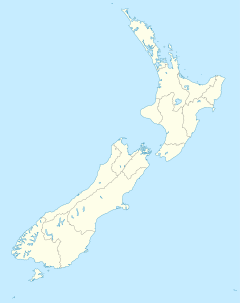
Lake Parangi is in the Waikato region of the North Island.
| Lake Parangi | |
|---|---|
 Lake Parangi | |
| Location | Otorohanga District, Waikato region, North Island |
| Coordinates | 38°2′15″S 174°48′41″E |
| Type | supertrophic |
| Primary outflows | seepage |
| Catchment area | 122 ha (300 acres) |
| Basin countries | New Zealand |
| Surface area | 12.18 ha (30.1 acres) |
| Max. depth | 17.6 m (58 ft) |
| Surface elevation | 46 m (151 ft) |
Biota
Lake Parangi has freshwater mussels, eels, pondweed Potamogeton ochreatus and watermilfoil Myriophyllum triphyllum. Catfish have been introduced and water quality is deteriorating.[3] Canadian Waterweed has invaded much of the lake.[4]
External links
See also
List of lakes in New Zealand
References
- Water Quality Assessment of 17 Waikato Lakes Using Rotifer Community Composition 2008 page 5
- "RESTFUL KAWHIA. EVENING POST". paperspast.natlib.govt.nz. 29 Mar 1937. Retrieved 2021-10-22.
{{cite web}}: CS1 maint: url-status (link) - Waikato Region – Lake Ecosystems 2011 report page 237 Archived 2013-10-05 at the Wayback Machine
- The Condition of 43 Lakes in the Waikato Region Using LakeSPI 2008 at 4.19
Текст в блоке "Читать" взят с сайта "Википедия" и доступен по лицензии Creative Commons Attribution-ShareAlike; в отдельных случаях могут действовать дополнительные условия.
Другой контент может иметь иную лицензию. Перед использованием материалов сайта WikiSort.org внимательно изучите правила лицензирования конкретных элементов наполнения сайта.
Другой контент может иметь иную лицензию. Перед использованием материалов сайта WikiSort.org внимательно изучите правила лицензирования конкретных элементов наполнения сайта.
2019-2025
WikiSort.org - проект по пересортировке и дополнению контента Википедии
WikiSort.org - проект по пересортировке и дополнению контента Википедии