geo.wikisort.org - Reservoir
Lake Managua (Spanish: Lago de Managua, [maˈnaɣwa]), also known as Lake Xolotlán (Lago Xolotlán), is a lake in Nicaragua. At 1,042 km², it is approximately 65 kilometres (40 mi) long and 25 kilometres (16 mi) wide. Similarly to the name of Lake Nicaragua, its other name comes from the Nahuatl language, possibly from the Spanish Tlaxcalan and Mexica allies or the Nawat Nicarao that were already there in today Rivas Department.[citation needed] The city of Managua, the capital of Nicaragua, lies on its southwestern shore.
| Lake Managua | |
|---|---|
 1986 (north is to the left) | |
 Lake Managua | |
| Coordinates | 12°20′N 86°25′W |
| Native name | |
| Basin countries | Nicaragua |
| Max. length | 65 km (40 mi) |
| Max. width | 25 km (16 mi) |
| Surface area | 1,024 km2 (395 sq mi) |
| Average depth | 9.5 m (31 ft) |
| Max. depth | 20 m (66 ft) |
| Surface elevation | 39 m (128 ft) |
| Islands | Momotombito |
| Settlements | Managua |
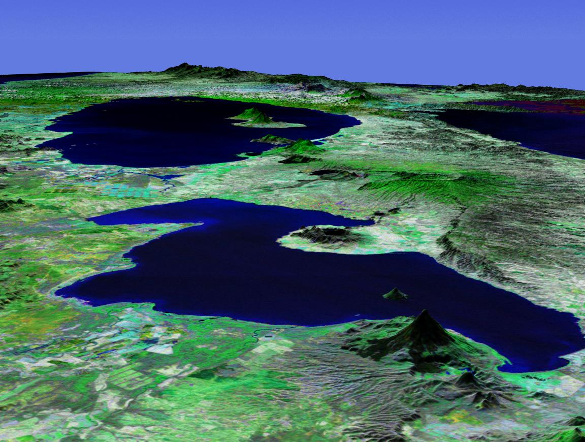
Islands
There are two uninhabited lake islands:
- Momotombito, a volcanic island. There is another nearby volcano, on the mainland: Momotombo.
- Isla Rosa, an islet
Floodings
The level of Lake Managua raises significantly during the periods of heavy rain. The highest water level was recorded during the flooding of 1933.[1]
The lake rose 3 metres (10 ft) in five days during Hurricane Mitch in 1998, destroying the homes of many who lived on its edge. An even higher flooding occurred in September/October 2010.[1] Since then, the city has prohibited residential use of the most flood-prone areas, those with the elevation below 42.76 meters above sea level.[1]
Pollution
Lake Managua has been described by some authors as "the most contaminated lake in Central America."[1] The lake has been severely polluted, mostly by decades of sewage being dumped into the lake.[2] The city sewers have drained into the lake since 1927.[1] It was only in 2009 that a modern wastewater treatment plant (built and operated by the British company Biwater) was opened in Managua, but even it treats only 40% of the city's wastewater.[1]
The lake today has no stable outlet, with only occasional floods to Lake Nicaragua through the Tipitapa River. Pollutants are thus concentrated.[3] Despite the pollution, some of the people of Managua still live along the lake's shores and eat the fish.[1]
In 2007 the malecón area was dredged, and the sediment hauled off on barges. A strong odor which permeated the area from the sediment disappeared. A stone rip-rap and concrete wharf was constructed, and a sightseeing boat called La Novia de Xolotlán makes hour-long lake tours when there are sufficient tourists.
Wildlife
About 20 fish species still survive in Lake Managua.[1]
While joined to Lake Nicaragua, the bull sharks of that lake cannot migrate to Lake Managua due to a 12-foot-high (3.7 m) waterfall on the Tipitapa River.[3]
Gallery
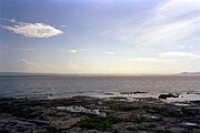 Lake view from Tipitapa (2003)
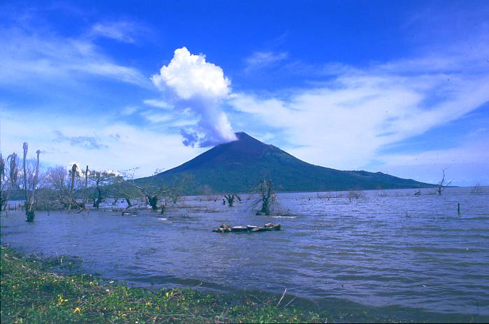
 View from Tipitapa (2003). Momotombo and Momotombito Volcanoes in the background
 Momotombo Volcano on the lakeshore


References
- Douglas Haynes, [The Lake at the Bottom of the Bottom]. VQR, Summer 2011
- Hazel Plunkett. Nicaragua: A Guide to the People, Politics and Culture. Interlink Books, Dec 1, 2001. pg. 71
- Thorson, Thomas B., "The Status of the Lake Nicaragua Shark: An Updated Appraisal" (1976). Investigations of the Ichthyofauna of Nicaraguan Lakes.Paper 41.
External links
Authority control | |
|---|---|
| General |
|
| National libraries | |
На других языках
[de] Managuasee
Der Managuasee (span. Lago de Managua), auch Xolotlán, ist einer der beiden großen Süßwasserseen des mittelamerikanischen Staates Nicaragua. Er liegt am Vulkan Momotombo (1258 m), erreicht eine Länge von fast 60 Kilometern und ist bis zu 32 Kilometer breit. Seine Fläche beträgt etwa 1134 Quadratkilometer. Im Südosten ist er über den Río Tipitapa mit dem Nicaraguasee verbunden. Im Südwesten ragt die Halbinsel Chiltepe mit dem Vulkankomplex Apoyeque etwa zehn Kilometer in den See hinein.- [en] Lake Managua
[es] Lago Xolotlán
El lago Xolotlán o lago de Managua está localizado en el oeste de Nicaragua, en la región de las tierras bajas del país. Es el segundo lago más grande del país y de América central, con una extensión de 1049 km², una longitud de 65 km y una anchura máxima de 58 km. La profundidad máxima es de 20 m y la media de 9,5 m. Está localizado a una altitud de 39 m s. n. m.. La ciudad de Managua se asienta en su costa sureste.[fr] Lac de Managua
Le lac de Managua (également connu comme lac Xolotlán,(en langue nahuat) ou lago de Managua en espagnol) est un lac situé au Nicaragua.[it] Lago di Managua
Il lago di Managua è un lago situato in Nicaragua. Si trova a un'altitudine di 39 m s.l.m., e ha una superficie di 1.042 km². La città di Managua, la capitale del Nicaragua, si trova sulla sua sponda sud-ovest.[ru] Манагуа (озеро)
Мана́гуа[1] (исп. Lago de Managua, Lago Xolotlán) — крупное пресноводное озеро тектонического происхождения в государстве Никарагуа. Приблизительные размеры озера: 60 км в длину и 32 км в ширину. Как и в случае с озером Никарагуа, его название было придумано испанскими конкистадорами, которые соединили слово «Mangue» (их название племен группы манкеме) и agua («вода»). Город Манагуа, столица Никарагуа, расположен на юго-западном берегу озера. Площадь поверхности — 1035 км².[источник не указан 448 дней] Высота над уровнем моря — 37 м.[источник не указан 448 дней]Другой контент может иметь иную лицензию. Перед использованием материалов сайта WikiSort.org внимательно изучите правила лицензирования конкретных элементов наполнения сайта.
WikiSort.org - проект по пересортировке и дополнению контента Википедии