geo.wikisort.org - Reservoir
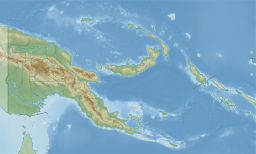
Lake Kutubu is the second-largest lake in Papua New Guinea,[2] after Lake Murray, and, at 800 m above sea level,[2] the largest upland body of water,[3] with an area of 49.24 km²,[2] and a total catchment area of 250 km².[3] Lake Kutubu and Lake Sentani form an ecoregion on the WWF's Global 200.[4] Kutubu lies in the Southern Highlands Province of Papua New Guinea, east of the Kikori River into which it drains, and about 50 km southwest of Mendi, the provincial capital. It is one of the few lakes in the country that occurs in a depression in the rugged interior mountains.[5] The lake has a few islands, the largest of which is Wasemi in its northern part. The water of Lake Kutubu, fed by several streams originating mostly from underground sources,[4] is clear and reaches a depth of 70 m (230 feet). The catchment is inhabited by two main ethnic groups, the Foe to the south and the Fasu to the north. Thirty-three villages lie in the catchment area, with a total estimated population of 10,885.[3]
| Lake Kutubu | |
|---|---|
 | |
 Lake Kutubu | |
| Location | Nipa-Kutubu District, Southern Highlands Province |
| Coordinates | 6°24′S 143°20′E |
| Primary inflows | underground sources, several streams, largest is Hamua Creek |
| Primary outflows | Soro River |
| Catchment area | 250 km2 (97 sq mi) |
| Basin countries | Papua New Guinea |
| Max. length | 19 km (12 mi) |
| Max. width | 4.5 km (2.8 mi) |
| Surface area | 49.24 km2 (19.01 sq mi) |
| Max. depth | 70 m (230 ft) |
| Surface elevation | 808 m (2,651 ft) |
Ramsar Wetland | |
| Designated | 25 September 1998 |
| Reference no. | 961[1] |

The lake gave its name to the nearby Kutubu Oil Project, Papua New Guinea's first commercial oilfield development, operated by Oil Search Limited, and which began production in 1992.[6] The development has supported the local economy, and caused a general in-migration to the area, as well as ecological problems resulting from rapid population growth, including pollution, forest destruction and overfishing. A proposed gas pipeline and road are expected to exacerbate these problems unless they are well-managed.[3]
Fauna
Lake Kutubu includes 13 endemic fish species, making it the most unusual lacustrine habitat for fishes in the New Guinea-Australia region.[3] The endemic fish species are:[7][8]
- Kutubu tandan (Oloplotosus torobo)
- Lake Kutubu rainbowfish (Melanotaenia lacustris)
- Kutubu hardyhead (Craterocephalus lacustris)
- Adamson's grunter (Hephaestus adamsoni)
- Black mogurnda (Mogurnda furva)
- Lake Kutubu mogurnda (Mogurnda kutubuensis)
- Mogurnda maccuneae
- Mogurnda mosa
- Blotched mogurnda (Mogurnda spilota)
- Variegated mogurnda (Mogurnda variegata)
- Striped mogurnda (Mogurnda vitta)
- Two undescribed species of Glossogobius (tentatively known as "new sp. 8" and "new sp. 12")[8]
Additionally, the Parastacid crayfish Cherax papuanus is endemic to the lake.[9]
Conservation
Because of its biodiversity and ecological significance, the area has been designated a "Wetland of International Significance" by the Ramsar Convention.[2] The area included in this designation matches the Lake Kutubu Wildlife Management Area[2] (240.57 km²).[10] The area is undergoing study by the World Wildlife Fund and the drafting of a catchment management plan has commenced, which is anticipated to become a model for other catchments in Papua New Guinea.[11] The project is to be completed by December 2007.[12] The Lake Kutubu area is also included in the tentatively listed Kikori River Basin - Great Papuan Plateau World Heritage Site.[10]
Languages
Kutubuan and other Trans-New Guinea languages are spoken in the region.
See also
Notes
- "Lake Kutubu". Ramsar Sites Information Service. Retrieved 25 April 2018.
- Lake Kutubu at Ramsar site
- Pilot and Demonstration Activities: Integrated Catchment Management in Lake Kutubu, Papua New Guinea at Asian Development Bank website
- Lakes Kutubu and Sentani at WWF
- Brian Essai. Papua and New Guinea: A Contemporary Survey. Melbourne: Oxford University Press, 1961. Page 21.
- Kutubu Archived 2007-03-16 at the Wayback Machine on Oil Search Limited website
- List taken from Lakes Kutubu and Sentani - A Global Ecoregion from the WWF, although it reports a figure of 11 species.
- Polhemus, D.A., R.A. Englund, and G.R. Allen (2004). Freshwater Biotas of New Guinea and Nearby Islands: Analysis of Endemism. Bernice Pauahi Bishop Museum, Conservation International
- Austin, C.M. (2010). "Cherax papuanus". IUCN Red List of Threatened Species. 2010: e.T153660A4528294. doi:10.2305/IUCN.UK.2010-3.RLTS.T153660A4528294.en.
- Kikori River Basin - Great Papuan Plateau at World Heritage Sites tentative lists
- Lake Kutubu Catchment Management Plan: Project Inception Report Archived 2007-06-24 at the Wayback Machine, page 3.
- Lake Kutubu Catchment Management Plan: Project Inception Report Archived 2007-06-24 at the Wayback Machine, page 5
External links
- Lake Kutubu Catchment Management Plan: Project Inception Report, also includes topographic map on Page 12
- Map of Lake Kutubu catchment produced by WWF
- Lake Kutubu - newest Ramsar site in Papua New Guinea
- Wetlands documentation page
Authority control | |
|---|---|
| General |
|
| National libraries | |
На других языках
[de] Lake Kutubu
Der Lake Kutubu ist ein überwiegend Grundwasser gespeister See mit einer hohen Biodiversität in der Southern Highlands Province von Papua-Neuguinea. Er liegt östlich des Kikori River, zu dessen Einzugsgebiet er gehört, 50 km südwestlich von Mendi, der Hauptstadt dieser Provinz.- [en] Lake Kutubu
[es] Lago Kutubu
Lago Kutubu[1] es un lago en la provincia de Tierras Altas del Sur de Papúa Nueva Guinea. Se encuentra al este del río Kikori, en el que finalmente sus aguas van. Se trata de cuerpo de agua a unos 50 km al suroeste de Mendi, la capital provincial. Es uno de los pocos lagos en el país que se encuentra en una depresión en las escarpadas montañas del interior.[2] Es el segundo lago más grande de Papúa Nueva Guinea,[3] después del Lago Murray, y a 800 metros sobre el nivel del mar, es el mayor lago de montaña. El área del lago es de 49,24 kilómetros cuadrados, mientras que el área total de la cuenca es de 250 km². Los lagos Kutubu y Sentani forma una ecorregión de global.[4][fr] Lac Kutubu
Le lac Kutubu est un lac de montagne des Hautes-Terres méridionales en Papouasie-Nouvelle-Guinée. Il se situe à l'est du fleuve Kikori, qui lui sert d'exutoire. Il se trouve à environ 50 km au sud-ouest de Mendi, la capitale de la province.[it] Lago Kutubu
Il lago Kutubu è un lago della Papua Nuova Guinea, nella provincia degli Altopiani del Sud.[ru] Кутубу
Кутубу[1] (англ. Lake Kutubu) — озеро в Папуа — Новой Гвинее, расположенное в провинции Сатерн-Хайлендс. Находится к востоку от реки Кикори, в которое впоследствии сбрасывает свою воду. Примерно в 50 км к северо-востоку от озера расположен город Менди, являющийся провинциальной столицей. Кутубу — одно из немногих озёр в стране, расположенных в низменности среди горной местности.[4] Оно является вторым по площади озером Папуа — Новой Гвинеи, уступая лишь озеру Марри,[2] и крупнейшим горным озером страны[3] (высота над уровнем моря составляет 800 м[2]). Площадь водной поверхности Кутубу составляет 49,24 км²[2], а водосбора — 250 км².[3] Вместе с озером Сентани Кутубу выделен Всемирным фондом дикой природы в самостоятельный экорегион.[5]Другой контент может иметь иную лицензию. Перед использованием материалов сайта WikiSort.org внимательно изучите правила лицензирования конкретных элементов наполнения сайта.
WikiSort.org - проект по пересортировке и дополнению контента Википедии