geo.wikisort.org - Reservoir
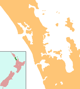
Lake Kereta lies at the South Head peninsula of the Kaipara Harbour, in the Rodney District, along the west coast of the North Island of New Zealand.[1] The surface area of the lake is about 32 hectares (79 acres) with a maximum depth of 1.5 metres (4 ft 11 in) and water temperature of about 21.1 °C (70.0 °F).
| Lake Kereta | |
|---|---|
 Kunzea robusta (rawirinui) along the shores of Lake Kereta | |
 Lake Kereta | |
| Location | Auckland Region, North Island, New Zealand |
| Coordinates | 36.5935°S 174.2811°E |
| Primary inflows | None |
| Primary outflows | None |
| Basin countries | New Zealand |
| Surface area | 32 ha (79 acres) |
| Max. depth | 1.5 metres (4 ft 11 in) |
The lake is shallow and less than 250 metres (820 ft) wide, stretching slightly more than one kilometre (0.62 mi) in a north-westerly direction; there are no streams or rivers flowing into or out of it. It is primarily filled by underground water, and losses are due to evaporation from the surface of the lake.[2]
See also
References
- "Place name detail: Lake Kereta". New Zealand Gazetteer. New Zealand Geographic Board. Retrieved 17 March 2018.
- New Zealand Government. "Regional lakes - Lake Kereta". Auckland Regional Council. Archived from the original on 18 September 2010. Retrieved 8 October 2010.
This Auckland Region-related geography article is a stub. You can help Wikipedia by expanding it. |
Текст в блоке "Читать" взят с сайта "Википедия" и доступен по лицензии Creative Commons Attribution-ShareAlike; в отдельных случаях могут действовать дополнительные условия.
Другой контент может иметь иную лицензию. Перед использованием материалов сайта WikiSort.org внимательно изучите правила лицензирования конкретных элементов наполнения сайта.
Другой контент может иметь иную лицензию. Перед использованием материалов сайта WikiSort.org внимательно изучите правила лицензирования конкретных элементов наполнения сайта.
2019-2025
WikiSort.org - проект по пересортировке и дополнению контента Википедии
WikiSort.org - проект по пересортировке и дополнению контента Википедии