geo.wikisort.org - Reservoir
Lake Güija is a lake in Central America. The lake is situated on the border between Guatemala and El Salvador and has an area of 45 km2, of which approximately 32 km2 lies in El Salvador.[2][3]
| Lake Güija | |
|---|---|
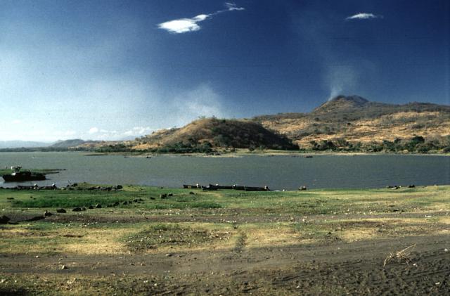 Lake Güija with Volcán de San Diego in the upper right | |
 Lake Güija | |
| Location | Jutiapa, Metapan, Santa Ana |
| Coordinates | 14°16′N 89°31′W |
| Type | Volcanogenic lake |
| Native name | Lago de Güija (Spanish) |
| Primary inflows | Ostúa River |
| Basin countries | Guatemala, El Salvador |
| Surface area | 45 km2 (17 sq mi) |
| Surface elevation | 430 m (1,410 ft) |
Ramsar Wetland | |
| Official name | Complejo Güija |
| Designated | 16 December 2010 |
| Reference no. | 1924[1] |
The lake is of volcanic origin and was formed by a large basaltic lava flow from Volcán de San Diego in the San Diego volcanic field which blocked the Güija depression's original drainage.[4] Lake Güija is fed by the Ostúa, Angue and Cusmapa rivers and is drained on its southeastern side by the río Desagüe, a tributary of the río Lempa. The lake is surrounded by the volcanic cones of the Mita, San Diego and Cerro Quemado. The Salvadoran side of the lake has several small isles: Teotipa, Cerro de Tule and Iguatepec, where a substantial number of pre-Columbian céramics[clarification needed] have been discovered since excavations started in 1924. Bosque San Diego La Barra lies on the eastern side of the lake.
World Heritage Status
This site was added to the UNESCO World Heritage Tentative List on September 21, 1992, in the Mixed (Cultural + Natural) category.[5]
References
- "Complejo Güija". Ramsar Sites Information Service. Retrieved 25 April 2018.
- "Lago de Güija". CTPT (in Spanish). SICA. Archived from the original on 8 March 2009. Retrieved 15 July 2008.
- Herrera, Néstor (2005). "Evaluación Ambiental del complejo Lago de Güija - Informe final" (PDF). MARN. Retrieved 15 July 2008.
- "San Diego Volcano". GVP. Smithsonian Institution. Retrieved 18 July 2008.
- Lake Guija - UNESCO World Heritage Centre
External links
| Authority control |
|
|---|
This Guatemala location article is a stub. You can help Wikipedia by expanding it. |
This El Salvador location article is a stub. You can help Wikipedia by expanding it. |
На других языках
[de] Lago de Güija
Der maximal 45 km² große und von kleineren Vulkanbergen umstandene Lago de Güija ist ein ca. 430 bis 440 m hoch gelegener Grenzsee zwischen den mittelamerikanischen Staaten Guatemala und El Salvador. Auf salvadorianischer Seite liegt das Wasserkraftwerk Hidroeléctrica Guajoyo.- [en] Lake Güija
[es] Lago de Güija
El lago de Güija es un lago de América Central cuya superficie es compartida por El Salvador y Guatemala. Está ubicado en la frontera noroeste de El Salvador y el este de Guatemala, entre el departamento salvadoreño de Santa Ana y el departamento guatemalteco de Jutiapa, a una altura de 430 m s. n. m. (metros sobre el nivel del mar). El lago tiene una extensión aproximada de 45 km² (kilómetros cuadrados) y es compartida por ambos países El Salvador cuenta con el 74 % de su extensión y Guatemala con el otro 26 %[fr] Lac de Güija
Le lac de Güija est un lac d'Amérique centrale. Traversé par la frontière entre le Guatemala et le Salvador, il a une superficie de 45 km2, dont 32 km2 au Salvador et 13 km2 au Guatemala. Il est proche du volcan Chingo.[it] Lago di Guija
Il lago di Guija si trova nel confine fra El Salvador e il Guatemala. Questo lago è di origine vulcanica e si trova ad un'altitudine inferiore ai 500 metri d'altitudine.Другой контент может иметь иную лицензию. Перед использованием материалов сайта WikiSort.org внимательно изучите правила лицензирования конкретных элементов наполнения сайта.
WikiSort.org - проект по пересортировке и дополнению контента Википедии