geo.wikisort.org - Reservoir
Laguna Salada (Spanish, "salty lagoon") is a vast dry lake some 10 meters below sea level in the Sonoran Desert of Baja California, 30 km (19 mi) southwest of Mexicali.[1] This lake was called "Ha wi mək" in Cocopah language and "Ha-sa-ai" in Kumeyaay language.[citation needed] The lake's shape vaguely resembles a rhombus. When dry, the flatness of the exposed lake bed sediments makes it a favoured location for recreational driving. It is also notorious for its dust storms when dry, usually the result of monsoonal thunderstorms during the summer. During times of significant rain the lagoon can fill completely with water, leaving the unpaved road along its west bank as the only means of traversing the area. Flanked by the Sierra de Los Cucapah and the Sierra de Juárez mountain ranges, the lake is approximately 60 km (37 mi) long and 17 km (11 mi) at its widest point.
| Laguna Salada | |
|---|---|
 | |
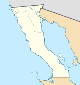 Laguna Salada Location in Baja California  Laguna Salada Location in Mexico | |
| Location | Sonoran Desert Mexicali Municipality, Baja California |
| Coordinates | 32.36°N 115.65°W |
| Lake type | Endorheic basin |
| Etymology | Salty lagoon in Spanish |
| Primary inflows | rain dependent |
| Primary outflows | Terminal (evaporation) |
| Basin countries | Mexico |
| Max. length | 60 km (37 mi) |
| Max. width | 17 km (11 mi) |
| Shore length1 | 250 km (160 mi) |
| 1 Shore length is not a well-defined measure. | |
Tectonic activity
The lake itself is located on the bottom of a shallow depression, a graben, which is linked to the San Andreas Fault, and the East Pacific Rise as part of the Laguna Salada Fault. This fault is connected to the Salton Trough fault which holds a similar depression, the Salton Sink. This sink is bigger than Laguna Salada and contains the Salton Sea.[2] The 2010 Baja California earthquake occurred here.
See also
- Lake Cahuilla - prehistoric lake near Laguna Salada
References
- "Land Below Sea Level". By David K. Lynch, Thule Scientific.
- "Geology of the Salton Trough" (PDF). David L. Alles, Western Washington University.
- Carlos Fiesta. Ocean Odyssey. Palos Verdes Estates, California: Mexico Expo Travel. Retrieved 2009-09-17.
- Becky Dorsey (2003). "Pleistocene to Holocene Laguna Salada". University of Oregon. Archived from the original on 2008-05-13. Retrieved 2009-09-17.
- G Jimenez; et al. (2000). "Preliminary Study of the Fishery in Laguna Salada, Baja California". University of San Diego. Retrieved 2009-09-17.
External links
- Satellite Photo (Google Maps)
- Vol. 44, Num. 1, pp. 103-111, A technical paper by Juan Contreras, Arturo Martín-Barajas and Juan Carlos Herguera on sedimentation of the LS-basin. Published in Geofísica Internacional (2005)
←
На других языках
- [en] Laguna Salada (Mexico)
[es] Laguna Salada (Baja California)
La Laguna Salada es una depresión arenosa que comienza en la inmediación suroeste del cerro El Centinela y se extiende hacia el sur por entre la sierra Cucapá y la sierra de Juárez, dentro del municipio de Mexicali, B. C., México. En la actualidad esta región es la zona más baja de todo el país con una altitud de 12 metros bajo el nivel medio del mar.[2][fr] Laguna Salada (Mexique)
La laguna Salada est un lac salé situé en Basse-Californie, dans le désert de Sonora à 10 mètres sous le niveau de la mer. Elle mesure 17 km de large pour 60 km de long.Другой контент может иметь иную лицензию. Перед использованием материалов сайта WikiSort.org внимательно изучите правила лицензирования конкретных элементов наполнения сайта.
WikiSort.org - проект по пересортировке и дополнению контента Википедии