geo.wikisort.org - Reservoir
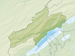
Lac de Moron is a reservoir formed by damming the river Doubs on the border of France and Switzerland. It can be reached from Les Planchettes or Les Brenets in the Canton of Neuchâtel (Switzerland) and from Le Barboux in the Doubs department (France).
| Lac de Moron | |
|---|---|
 | |
| Location | Canton of Neuchâtel (CH), Doubs department (F) |
| Coordinates | 47°5′29″N 6°44′27″E |
| Type | reservoir |
| Primary inflows | Doubs |
| Primary outflows | Doubs |
| Catchment area | 911 km2 (352 sq mi) |
| Basin countries | Switzerland, France |
| Max. length | 3.3 km (2.1 mi) |
| Surface area | 0.69 km2 (0.27 sq mi) |
| Max. depth | 59 m (194 ft) |
| Water volume | 20.6 million cubic metres (16,700 acre⋅ft) |
| Surface elevation | 716 m (2,349 ft) |
 | |
The reservoir has a volume of 20.6 million m³ and its surface area is 0.69 km2 (0.27 sq mi). The arch dam Châtelot was completed in 1953.
See also
External links
 Media related to Lac de Moron at Wikimedia Commons
На других языках
[de] Lac de Moron
Der Lac de Moron ist ein Stausee im Jura an der Landesgrenze zwischen der Schweiz und Frankreich. Der See nimmt seinen Anfang ab Saut du Doubs, einem imposanten 27 Meter hohen Wasserfall und hat eine auffallend grünliche Farbe.- [en] Lac de Moron
[fr] Lac de Moron
Le lac de Moron est un lac de retenue artificielle, formé par le barrage du Châtelot sur le Doubs dans le massif du Jura à la frontière entre la France et la Suisse.Текст в блоке "Читать" взят с сайта "Википедия" и доступен по лицензии Creative Commons Attribution-ShareAlike; в отдельных случаях могут действовать дополнительные условия.
Другой контент может иметь иную лицензию. Перед использованием материалов сайта WikiSort.org внимательно изучите правила лицензирования конкретных элементов наполнения сайта.
Другой контент может иметь иную лицензию. Перед использованием материалов сайта WikiSort.org внимательно изучите правила лицензирования конкретных элементов наполнения сайта.
2019-2025
WikiSort.org - проект по пересортировке и дополнению контента Википедии
WikiSort.org - проект по пересортировке и дополнению контента Википедии


