geo.wikisort.org - Reservoir
Lac de Mauvoisin is a reservoir in the canton of Valais, Switzerland. The reservoir is formed by the Mauvoisin Dam, which is 250 metres (820 ft) high. The dam is the 11th highest in the world, and the 6th highest arch dam. It was built in 1951–1957, and raised by 13.5 metres (44 ft) in 1991.
| Lac de Mauvoisin | |
|---|---|
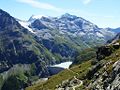
 View of the lake from the dam, July 2008 | |
Lac de Mauvoisin  Lac de Mauvoisin  Lac de Mauvoisin | |
| Location | Valais |
| Coordinates | 45°59′53″N 7°20′58″E |
| Type | reservoir |
| Primary outflows | Dranse de Bagnes |
| Catchment area | 113.5 km2 (43.8 sq mi) |
| Basin countries | Switzerland |
| Max. length | 4.9 km (3.0 mi) |
| Surface area | 2.08 km2 (0.80 sq mi) |
| Max. depth | 180 m (590 ft) |
| Surface elevation | 1,961 m (6,434 ft) |
 | |
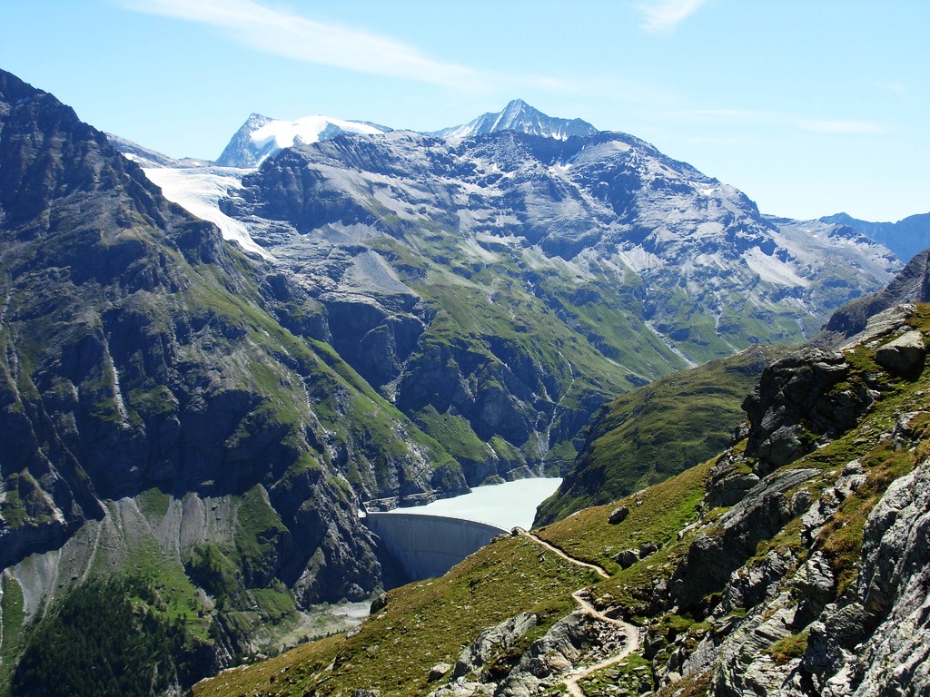
The reservoir lies in the upper Val de Bagnes, between the massif of the Grand Combin, one of the highest mountains of the Alps, and La Ruinette. The highest peak visible from the lake is the Combin de la Tsessette (4,135 metres (13,566 ft)).
Gallery
 Mauvoisin Dam, with Mont Blanc de Cheilon in the background
 Dranse de Bagnes, a stream flowing from the Mauvoisin lake

See also
External links
This article includes a list of references, related reading or external links, but its sources remain unclear because it lacks inline citations. (November 2014) |
- Swiss Dams: Profile of Mauvoisin
 Media related to Lac de Mauvoisin at Wikimedia Commons
Authority control | |
|---|---|
| General |
|
| National libraries | |
This article related to a lake in Valais is a stub. You can help Wikipedia by expanding it. |
На других языках
[de] Lac de Mauvoisin
Der Lac de Mauvoisin ist ein Stausee, der zuhinterst im Val de Bagnes, im Südwesten des Schweizer Kantons Wallis liegt. Neben der Energienutzung schützt der Stausee das Val de Bagnes vor Flutwellen, die durch Abbrüche des Giétrozgletscher verursacht werden können.[1]- [en] Lac de Mauvoisin
[it] Lago di Mauvoisin
Il lago di Mauvoisin (in francese Lac de Mauvoisin) è un bacino artificiale che si trova nella valle di Bagnes, nel distretto di Entremont, nel canton Vallese svizzero.Текст в блоке "Читать" взят с сайта "Википедия" и доступен по лицензии Creative Commons Attribution-ShareAlike; в отдельных случаях могут действовать дополнительные условия.
Другой контент может иметь иную лицензию. Перед использованием материалов сайта WikiSort.org внимательно изучите правила лицензирования конкретных элементов наполнения сайта.
Другой контент может иметь иную лицензию. Перед использованием материалов сайта WikiSort.org внимательно изучите правила лицензирования конкретных элементов наполнения сайта.
2019-2025
WikiSort.org - проект по пересортировке и дополнению контента Википедии
WikiSort.org - проект по пересортировке и дополнению контента Википедии