geo.wikisort.org - Reservoir
Ell Pond is a kettle hole in Hopkinton, Washington County, Rhode Island. It is surrounded by a swamp of red maple and Atlantic white cypress, and by steep granitic monadnocks. The small area contains communities of both hydrophytic and xeric plants, which makes it ideal for ecological research and education. It was designated a National Natural Landmark in May 1974.[1] In 1972, The Nature Conservancy purchased 50 acres (20 ha) including the pond to extend 218 acres (88 ha) of protected land owned by the Audubon Society of Rhode Island and the 1,002 acres (405 ha) of Rockville Wildlife Management Area owned by the state.[2] The preserve is jointly managed by all three entities. There are hiking trails in the preserve, but Ell pond is specifically not reachable due to its fragile environment.
| Ell Pond | |
|---|---|
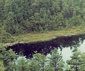 Ell Pond in Rhode Island. | |
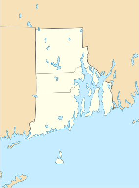 Map of Rhode Island | |
| Location | Hopkinton, Rhode Island |
| Coordinates | 41°30′19″N 71°46′58″W |
| Area | 50 acres (20 ha) |
| Established | 1972 |
U.S. National Natural Landmark | |
| Designated | 1974 |
References
External links
- Ell Pond The Nature Conservancy
- Audubon Society of Rhode Island Long Pond preserve
This Rhode Island state location article is a stub. You can help Wikipedia by expanding it. |
Другой контент может иметь иную лицензию. Перед использованием материалов сайта WikiSort.org внимательно изучите правила лицензирования конкретных элементов наполнения сайта.
WikiSort.org - проект по пересортировке и дополнению контента Википедии