geo.wikisort.org - Reservoir
Dhoki Dam (Marathi: ढोकी धरण), is an earth-fill dam on Kalu river in Dhoki village in Parner taluka of Ahmednagar district of state of Maharashtra in India.
| Dhoki Dam | |
|---|---|
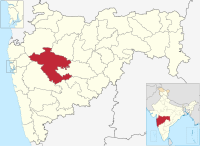
 Location of Dhoki Dam in Maharashtra | |
| Official name | Dhoki Dam |
| Location | Dhoki, Parner India |
| Coordinates | 19°10′21″N 74°25′5″E |
| Opening date | 1981 |
| Owner(s) | Government of Maharashtra, India |
| Dam and spillways | |
| Type of dam | Earth-fill (Earthen) |
| Impounds | Kalu River |
| Height | 17.33 m (56.9 ft) |
| Length | 397 m (1,302 ft) |
| Reservoir | |
| Creates | Dhoki lake |
| Total capacity | 1,240 km3 (300 cu mi) |
| Surface area | 290 km2 (110 sq mi) |
Specifications
The height of the dam above lowest foundation is 17.33 m (56.9 ft) while the length is 397 m (1,302 ft). The gross storage capacity is 1,270 km3 (300 cu mi).[1]
Purpose
- Irrigation
- Drinking water for nearest villages
See also
- Dams in Maharashtra
References
- Specifications of large dams in India Archived July 21, 2011, at the Wayback Machine

Ahmednagar district topics | ||
|---|---|---|
| History |
|  |
| Geography | ||
| Talukas | ||
| Cities and towns | ||
| Monuments |
| |
| Education |
| |
| Lok Sabha constituencies |
| |
| Vidhan Sabha constituencies |
| |
| Dams in District | ||
Текст в блоке "Читать" взят с сайта "Википедия" и доступен по лицензии Creative Commons Attribution-ShareAlike; в отдельных случаях могут действовать дополнительные условия.
Другой контент может иметь иную лицензию. Перед использованием материалов сайта WikiSort.org внимательно изучите правила лицензирования конкретных элементов наполнения сайта.
Другой контент может иметь иную лицензию. Перед использованием материалов сайта WikiSort.org внимательно изучите правила лицензирования конкретных элементов наполнения сайта.
2019-2026
WikiSort.org - проект по пересортировке и дополнению контента Википедии
WikiSort.org - проект по пересортировке и дополнению контента Википедии