geo.wikisort.org - Reservoir
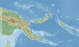
The Chambri Lakes are a series of swamps and shallow water canals in the East Sepik Province of Papua New Guinea that are seasonally filled by the flooding of the Sepik and Ramu rivers in vast area of 216 km2 (83 sq mi). During the northwest monsoon season, from September to March, occurs overflow of two of the Sepik's tributaries and vast Chambri Lake is created. The Chambri Lakes form in the middle Sepik, between the village of Pagwi and the junction of the Yuat River with the Sepik. The inhabitants of the Chambri Lakes are renowned for their artistry.[5] The Chambri language is spoken in the Chambri Lakes region.
| Chambri Lake[1] | |
|---|---|
 Chambri Lake[4] | |
| Coordinates | 4°16′S 143°7′E |
| Basin countries | Papua New Guinea |
References
- Chambri Lake: Papua New Guinea National Geospatial-Intelligence Agency, Bethesda, MD, USA
- Chambri Lake: Papua New Guinea National Geospatial-Intelligence Agency, Bethesda, MD, USA
- Chambri Lake: Papua New Guinea National Geospatial-Intelligence Agency, Bethesda, MD, USA
- Chambri Lake: Papua New Guinea National Geospatial-Intelligence Agency, Bethesda, MD, USA
- Chambri Lake Villages, East Sepik Province, Papua New Guinea Art-Pacific Guide to Sepik River Carvings
| Authority control |
|
|---|
This Papua New Guinea–related geography article is a stub. You can help Wikipedia by expanding it. |
Текст в блоке "Читать" взят с сайта "Википедия" и доступен по лицензии Creative Commons Attribution-ShareAlike; в отдельных случаях могут действовать дополнительные условия.
Другой контент может иметь иную лицензию. Перед использованием материалов сайта WikiSort.org внимательно изучите правила лицензирования конкретных элементов наполнения сайта.
Другой контент может иметь иную лицензию. Перед использованием материалов сайта WikiSort.org внимательно изучите правила лицензирования конкретных элементов наполнения сайта.
2019-2025
WikiSort.org - проект по пересортировке и дополнению контента Википедии
WikiSort.org - проект по пересортировке и дополнению контента Википедии