geo.wikisort.org - Reservoir
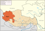
Bangda Lake (Tibetan: པང་བཏགས་མཚོ, Wylie: pang btags mtsho; Chinese: 邦达错; pinyin: Bāngdá Cuò),[lower-alpha 1] formerly called Yeshil Kul,[2][lower-alpha 2] is a glacial lake in Ngari Prefecture in the northwest of the Tibet Autonomous Region of China. It lies south of the western Kunlun Mountains, only a few kilometres to the southeast of Guozha Lake (Lake Lighten).[2]
| Bangda Lake | |
|---|---|
| Yeshil Kul | |
 Bangda Lake | |
| Location | Rutog County, Ngari Prefecture, Tibet Autonomous Region, China |
| Coordinates | 34°56′56″N 81°34′16″E |
| Catchment area | 3,314.5 km2 (1,300 sq mi) |
| Basin countries | China |
| Max. length | 15 km (9 mi) |
| Max. width | 9.7 km (6 mi) |
| Surface area | 106.5 km2 (0 sq mi) |
| Surface elevation | 4,902 m (16,083 ft) |
| References | [1] |
Located at an altitude of 4902 metres, the Bangda Lake covers an area of 106 square kilometres with a maximum depth of 21.6 metres and contains 90 glaciers.[3]


Notes
- Other forms include Bangdag or Bangdacuo.
- Variations include Yashil Kul, Yashil Tso, Yashil Cho, Yahsierh Tso.
References
- Sumin, Wang; Hongshen, Dou (1998). Lakes in China. Beijing: Science Press. p. 416. ISBN 7-03-006706-1.
- Hedin, Sven (1999), Trans Himalayas - Discoveries and Adventures in Tibet - 3 Vols., Asian Educational Services, pp. 19–, ISBN 978-81-206-1416-1
- Li, Shijie; Shi, Yafeng (1992). "Glacial and lake fluctuations in the area of the west Kunlun mountains during the last 45 000 years". Annals of Glaciology. 16: 79–84. doi:10.3189/1992AoG16-1-79-84. ISSN 0260-3055.
Текст в блоке "Читать" взят с сайта "Википедия" и доступен по лицензии Creative Commons Attribution-ShareAlike; в отдельных случаях могут действовать дополнительные условия.
Другой контент может иметь иную лицензию. Перед использованием материалов сайта WikiSort.org внимательно изучите правила лицензирования конкретных элементов наполнения сайта.
Другой контент может иметь иную лицензию. Перед использованием материалов сайта WikiSort.org внимательно изучите правила лицензирования конкретных элементов наполнения сайта.
2019-2025
WikiSort.org - проект по пересортировке и дополнению контента Википедии
WikiSort.org - проект по пересортировке и дополнению контента Википедии
