geo.wikisort.org - Stillgewässer
Der Chiuta-See ist ein zur Provinz Niassa, Mosambik und zum größeren Anteil zum Distrikt Machinga, Malawi gehörender flacher See 20 Kilometer nördlich des Chilwa-Sees.
| Chiuta-See | ||
|---|---|---|
 | ||
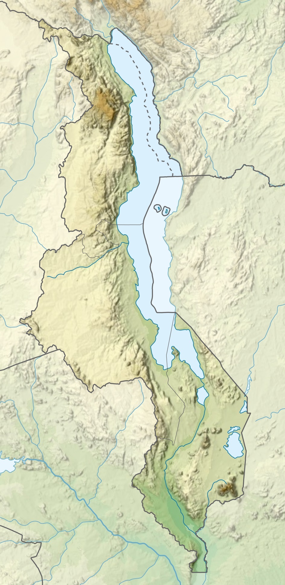
| Satellitenaufnahme der Grenzregion mit den dortigen Seen | ||
| Geographische Lage | ||
| Zuflüsse | Lifune, Chifundu, Mpili | |
| Abfluss | Lugenda (zeitweise) | |
| Orte am Ufer | keine | |
| Daten | ||
| Koordinaten | 14° 49′ 2,53″ S, 35° 51′ 13,97″ O | |
| ||
| Höhe über Meeresspiegel | 620 m | |
| Fläche | ca. 25–200 km² | |
| Mittlere Tiefe | 3–5 m | |
Beschreibung
Bei höchstem Wasserstand hat der 3–13 km breite und 64 km lange See eine Ausdehnung von über 200 km², von denen Mosambik einen Anteil von 49 km² hat. Es wird vermutet, dass im Pleistozän eine Verbindung mit dem Chilwa-See bestand, von dem wahrscheinlich bis heute unter bis zehn Meter hohem Sand ein unterirdischer Zufluss besteht. Nach Norden ist der Chiuta-See bei hohem Wasserstand durch eine sumpfige Enge mit dem ebenso fischreichen länglichen Amaramba-See verbunden, von dem der Lugenda abfließt. Im See gibt es einige kleine Inseln.
Quellen
- http://www.academia.edu/2748511/Fisheries_co-management_in_Malawi_Lake_Chiuta_re-visit_case_study
- http://www.worldwildlife.org/who/media/press/2007/WWFPresitem6300.html
- https://tamis.dai.com/compass.nsf/7cdb8b093916c1f2422567cd00424fe6/497d6462f51f43df42256aab00424edf?OpenDocument
- http://www.indiana.edu/~voconf/papers/thomson_voconf.pdf
На других языках
- [de] Chiuta-See
[en] Lake Chiuta
Lake Chiuta is a shallow lake on the border between Malawi and Mozambique. It lies to the north of Lake Chilwa and to the south of Lake Amaramba, which has no outlet, and the lakes are separated by a sandy ridge. Both lakes lie in a graben which runs northeast–southwest, east of the main African Rift Valley.[fr] Lac Chiuta
Le lac Chiuta est un lac peu profond situé à la frontière entre le Malawi et le Mozambique. Il est au nord du lac Chilwa et au sud du lac Amaramba, qu'il alimente ; les deux lacs sont séparés par une crête sableuse. Ils se trouvent dans un graben orienté nord-est—sud-ouest, à l'est de la vallée du Grand Rift.[it] Lago Chiuta
Il lago Chiuta è un lago poco profondo al confine tra il Malawi e Mozambico. Si trova a nord del lago Chilwa e a sud del lago Amaramba, che non ha sbocco, ed i laghi sono separati da una cresta di sabbia. Entrambi i laghi si trovano in una fossa che corre a nordest-sudovest, a est della principale Rift Valley africana. Il lago Chiuta è profondo 3-4 metri e varia la sua estensione da 25 a 130 chilometri quadrati, a seconda della stagione e delle precipitazioni. I laghi Chiuta e Amaramba sono collegati in modo intermittente al fiume Lujenda, un affluente del fiume Ruvuma.[ru] Чиута (озеро)
Чиута — небольшое озеро на границе Малави и Мозамбика. Расположено к северу от озера Чилва и к югу от бессточного озера Амарамба (англ.) (рус.. Озера разделены песчаным хребтом. Оба озера находятся в грабене, который простирается с северо-востока на юго-запад, к востоку от Восточно-Африканской рифтовой долины.Текст в блоке "Читать" взят с сайта "Википедия" и доступен по лицензии Creative Commons Attribution-ShareAlike; в отдельных случаях могут действовать дополнительные условия.
Другой контент может иметь иную лицензию. Перед использованием материалов сайта WikiSort.org внимательно изучите правила лицензирования конкретных элементов наполнения сайта.
Другой контент может иметь иную лицензию. Перед использованием материалов сайта WikiSort.org внимательно изучите правила лицензирования конкретных элементов наполнения сайта.
2019-2025
WikiSort.org - проект по пересортировке и дополнению контента Википедии
WikiSort.org - проект по пересортировке и дополнению контента Википедии