geo.wikisort.org - Горы
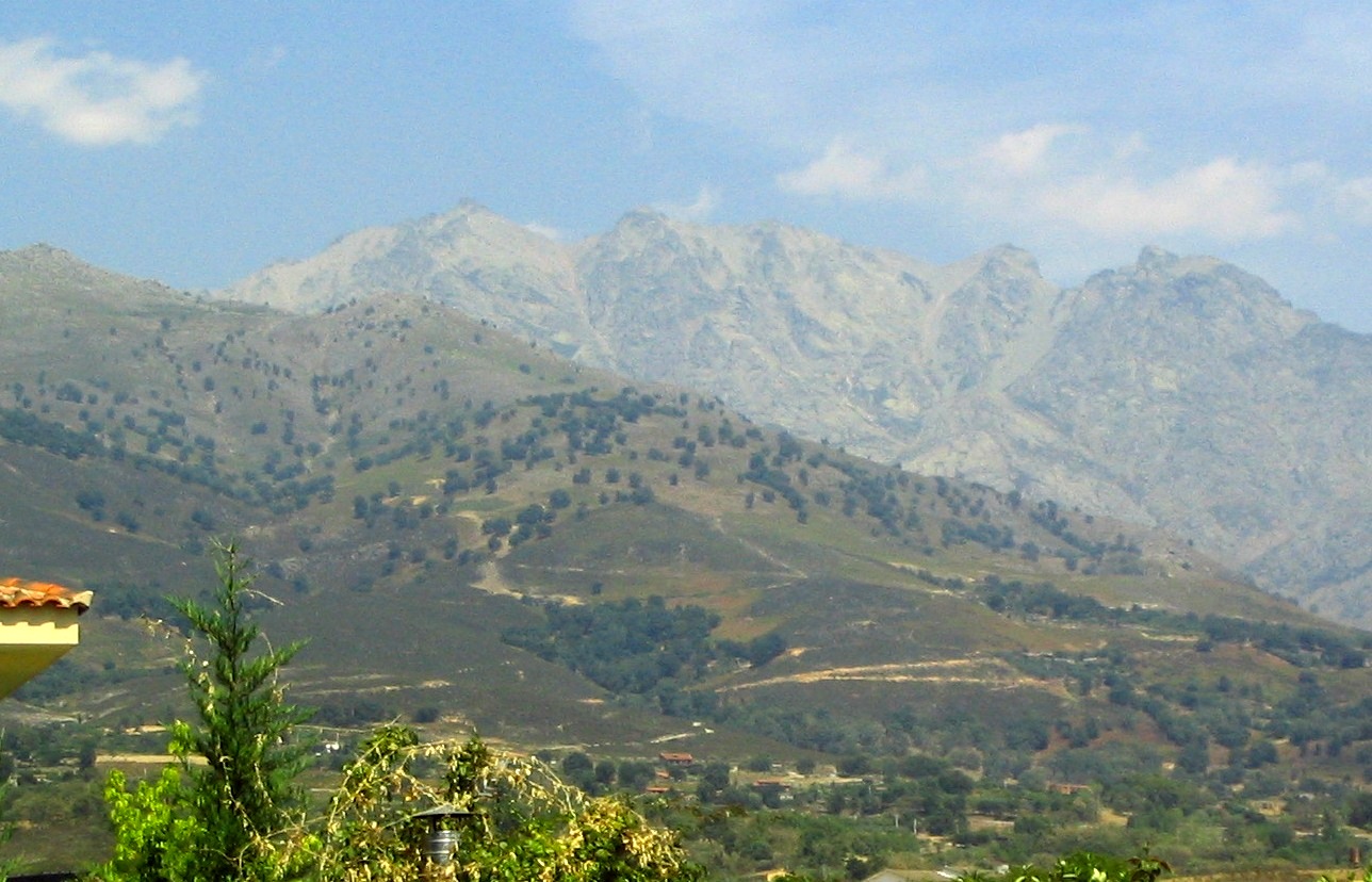
Сье́рра-де-Гре́дос (исп. Sierra de Gredos) — горный хребет в Испании.
| Сьерра-де-Гредос | |
|---|---|
| исп. Sierra de Gredos | |
 Альмансор, высшая точка всей Центральной Кордильеры | |
| Характеристики | |
| Площадь | 3500 км² |
| Длина | 120 км |
| Ширина | 30 км |
| Высшая точка | |
| Абсолютная высота | 2592 м |
| Расположение | |
| 40°18′ с. ш. 5°05′ з. д.HGЯO | |
| Страна |
|
| Горная система | Центральная Кордильера |

Самая высокая точка — гора Альмансор (2592 м), которая является высочайшим пиком всей системы Центральной Кордильеры. Геологически массив сложен гранитами. Сьерра-де-Гредос расположен юго-западнее хребта Сьерра-де-Гвадаррама и восточнее гор Сьерра-де-Бехар. Занимает территории провинций Авила, Касерес, Мадрид и Толедо.
Примечания
Литература
- Гредос // Энциклопедический словарь Брокгауза и Ефрона : в 86 т. (82 т. и 4 доп.). — СПб., 1890—1907.
- Сьерра-де-Гредос // Стилтон — Татартуп. — М. : Советская энциклопедия, 1956. — С. 422. — (Большая советская энциклопедия : [в 51 т.] / гл. ред. Б. А. Введенский ; 1949—1958, т. 41).
В статье есть список источников, но не хватает сносок. |
| ||||
На других языках
[de] Sierra de Gredos
Die Sierra de Gredos ist der zentrale und mit dem Pico Almanzor (2592 m) auch der höchste Teilabschnitt des Kastilischen Scheidegebirges.[en] Sierra de Gredos
The Sierra de Gredos is a mountain range in central Spain that spans the provinces of Ávila, Salamanca, Cáceres, Madrid, and Toledo. It is part of the much larger Sistema Central of mountain ranges. Its highest point is Pico Almanzor, at 2,592 metres and it has been declared a natural park by the Autonomous Community of Castile and León. The Sierra de Gredos is one of the most extensive mountain ranges of the Central System; it comprises five river valleys: the Alto Tormes, the Alto Alberche, the Tiétar Oriental, the Tiétar Occidental y la Vera, and the Valle del Ambroz. The first known inhabitants were the Vettones, a pre-Roman Celtic people. The central part of the range encomprises the Sierra de Gredos Regional Park.[es] Sierra de Gredos
La sierra de Gredos es una sierra perteneciente al sistema Central, en la península ibérica, situada entre las provincias españolas de Salamanca, Cáceres, Ávila, Madrid y Toledo. Su máxima altitud se da en la provincia de Ávila en el Pico Almanzor a 2592 m s. n. m.. Gredos es una de las sierras más extensas del sistema Central y en torno a sus grandes moles graníticas basculan cuatro comunidades autónomas: Castilla y León, Castilla-La Mancha, Comunidad de Madrid y Extremadura. Se extiende de este a oeste desde San Martín de Valdeiglesias a Hervás y de norte a sur del valle del Tormes a Rosarito. Parte de la sierra está declarada parque regional de la Sierra de Gredos.[fr] Sierra de Gredos
La sierra de Gredos est un massif montagneux d'Espagne appartenant au Système central, située entre les provinces d'Ávila, Cáceres, Madrid et Tolède. Son point culminant est le pic Almanzor, dans la province d'Ávila, à 2 591 mètres d'altitude. Elle englobe un parc régional. Gredos est le massif principal du Système central. Elle comprend cinq vallées fluviales : Alto Tomes, Alto Alberche, Tiétar Oriental, Tiétar Occidental et la Vera, et la vallée de Ambroz.[it] Sierra de Gredos
La sierra de Gredos è una catena montuosa della Spagna appartenente al Sistema Centrale, situata tra le provincie di Ávila, Cáceres, Madrid e Toledo. È stata dichiarata "parco regionale".- [ru] Сьерра-де-Гредос
Текст в блоке "Читать" взят с сайта "Википедия" и доступен по лицензии Creative Commons Attribution-ShareAlike; в отдельных случаях могут действовать дополнительные условия.
Другой контент может иметь иную лицензию. Перед использованием материалов сайта WikiSort.org внимательно изучите правила лицензирования конкретных элементов наполнения сайта.
Другой контент может иметь иную лицензию. Перед использованием материалов сайта WikiSort.org внимательно изучите правила лицензирования конкретных элементов наполнения сайта.
2019-2026
WikiSort.org - проект по пересортировке и дополнению контента Википедии
WikiSort.org - проект по пересортировке и дополнению контента Википедии