geo.wikisort.org - Горы
Вильдштрубель (нем. Wildstrubel) — покрытая глетчерами горная цепь в Бернских Альпах, в Швейцарии.
| Вильдштрубель | |
|---|---|
| нем. Wildstrubel | |
 Вид на Вильдштрубель и Энгстлигенальп с севера. | |
| Высшая точка | |
| Абсолютная высота | 3243[1] м |
| Относительная высота | 814 м |
| Первое восхождение | 1856 г. (Эдмунд фон Фелленберг) |
| Расположение | |
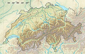
| 46°24′01″ с. ш. 7°31′43″ в. д.HGЯO | |
| Страна |
|
| Кантоны | Вале, Берн |
| Горная система | Альпы |
| Хребет или массив | Бернские Альпы |

География
Вильдштрубель лежит между долинами Ленк и Адельбоден на севере и долиной Роны на юге, главный массив Бернских Альп находится южнее его. Через Вильдштрубель проходит граница между кантонами Берн и Вале. Вильдштрубель состоит из трёх приблизительно равновысотных вершин:
- собственно Вильдштрубель (выс. 3243,5 м);
- Митлерер Гипфель (выс. 3243,5 м);
- Гроссштрубель (выс. 3243 м).
Восточные и западные склоны Вильдштрубеля обрывисты и почти отвесны, на юго-востоке он переходит в гигантский глетчер, воды с которого через Леммеренальп стекают в озеро Даубензее. На его южной стороне также находится обширный глетчер Плейн-Морт (Glacier de la Plaine Morte). Северо-западнее Вильдштрубеля находится вершина Аммертенхорн (выс. 2666 м).
Примечания
- Peakbagger.com. Дата обращения: 16 декабря 2012. Архивировано 25 июня 2012 года.
Ссылки
- Вильдштрубель, иллюстрированная документация (недоступная ссылка). Архивировано 26 августа 2009 года.
- Вильдштрубель на карте + панорамный вид (недоступная ссылка)
- Summitpost.org
На других языках
[de] Wildstrubel
Der Wildstrubel ist eine vergletscherte Gebirgsgruppe der Berner Alpen in der Schweiz. Er liegt zwischen Lenk und Adelboden im Norden sowie dem Rhonetal im Süden. Ein historischer Name für ihn lautet Breiteis. Obwohl er dem Hauptkamm der Berner Alpen nördlich vorgelagert ist, verläuft über ihn die Grenze zwischen den Kantonen Bern und Wallis, die hier über den Gemmipass nach Norden ausgreift.[en] Wildstrubel
The Wildstrubel (3,244 metres (10,643 ft)) is a mountain of the Alps, straddling the border between the Swiss cantons of Bern and Valais. It forms a large glaciated massif, about 15 km wide, extending between the Rawil Pass and the Gemmi Pass. Along with the Muverans, the Diablerets and the Wildhorn, the Wildstrubel is one of the four distinct mountain massifs of the Bernese Alps that lie west of the Gemmi Pass. The massif of the Wildstrubel is at the centre between the valleys of Simmental (BE), Engstligental (BE) and the Rhone (VS), the exact location of the tripoint being the summit of the Schneehorn.[6] It comprises several distinct summits, including (from west to east) the Wetzsteinhorn, the Rohrbachstein, the Weisshorn, the Pointe de la Plaine Morte, Mont Bonvin, the Trubelstock and the Schneehorn. The main crest with the almost equally high summits of the Mittelgipfel (3,243.5 m) and the Grossstrubel (3,243 m) forms an amphitheatre oriented eastward which ends at the Steghorn and the Daubenhorn. This area encloses the Wildstrubel Glacier. To the southwest, the Wildstrubel overlooks the high plateau of the Plaine Morte Glacier, which also includes an unnamed lake below the Schneehorn.[fr] Wildstrubel
Le Wildstrubel est un sommet du massif des Alpes bernoises culminant à 3 244 m d'altitude, à cheval sur le canton de Berne et le canton du Valais, en Suisse.[it] Wildstrubel
Il Wildstrubel (3.243 m s.l.m.[1]) è una montagna delle Alpi Bernesi. Si trova a cavallo tra il Canton Vallese ed il Canton Berna.- [ru] Вильдштрубель
Текст в блоке "Читать" взят с сайта "Википедия" и доступен по лицензии Creative Commons Attribution-ShareAlike; в отдельных случаях могут действовать дополнительные условия.
Другой контент может иметь иную лицензию. Перед использованием материалов сайта WikiSort.org внимательно изучите правила лицензирования конкретных элементов наполнения сайта.
Другой контент может иметь иную лицензию. Перед использованием материалов сайта WikiSort.org внимательно изучите правила лицензирования конкретных элементов наполнения сайта.
2019-2026
WikiSort.org - проект по пересортировке и дополнению контента Википедии
WikiSort.org - проект по пересортировке и дополнению контента Википедии