geo.wikisort.org - Montagne
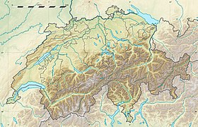
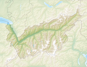
Le Wildstrubel est un sommet du massif des Alpes bernoises culminant à 3 244 m d'altitude, à cheval sur le canton de Berne et le canton du Valais, en Suisse.
| Wildstrubel | |
 Le Wildstrubel depuis le Simmental | |
| Géographie | |
|---|---|
| Altitude | 3 244 m[1] |
| Massif | Alpes bernoises (Alpes) |
| Coordonnées | 46° 24′ 01″ nord, 7° 31′ 43″ est[1] |
| Administration | |
| Pays | |
| Cantons | Berne Valais |
| Arrondissement District |
Haut-Simmental - Gessenay Loèche |
| Ascension | |
| Première | par Edmund von Fellenberg avec Jakob Tritten |
| Voie la plus facile | par la cabane de Lämmeren depuis le col de la Gemmi |
| Géologie | |
| Roches | Roches sédimentaires |
| modifier |
|
Il présente trois cimes d'altitude très proche, sur une arête de 3,5 km de long :
- le sommet ouest appelé Wildstrubel ou Lenkerstrubel (3 244 m)[1] ;
- le sommet central, appelé Mittelgipfel (3 243,5 m)[1] ;
- le sommet est, appelé Grossstrubel (3 243 m)[1].
Il domine le glacier de la Plaine Morte au sud.
Ascension

La première ascension d'un sommet du Wildstrubel a probablement été faite durant l'été 1855 par le docteur M. Schmid avec le chasseur de cristaux Jakob Tritten, sans qu'on ait plus de détails sur cette ascension[2]. La première ascension sûre est celle de Edmund von Fellenberg avec Jakob Tritten, le [3]. Le , Thomas W. Hinchcliff et Bradshaw Smith avec le guide chamoniard Zacharie Cachat rejoignirent, après avoir atteint le sommet ouest, le Mittelgipfel, qui leur semblait le plus élevé[4].
Notes et références
- Visualisation sur Swisstopo.
- Gottlieb Studer, Über Eis und Schnee: Die höchsten Gipfel der Schweiz und die Geschichte ihrer Besteigung, Vol. 1, Schmid, Francke & Company, 1896, p. 522
- Edmund von Fellenberg, « Die Ersteigung des Wildstrubels », Berner Taschebuch auf das Jahr 1864, Bern, 1864, pp. 360-372
- Thomas W. Hinchcliff, « The Wildstrubel and Oldenhorn », dans Peaks, passes, and glaciers: a series of excursions by members of the Alpine, Londres, 1860, pp. 228-246
- Portail de la montagne
- Portail des Alpes
- Portail de la géographie de la Suisse
- Portail de l’Espace Mittelland
- Portail du Valais
На других языках
[de] Wildstrubel
Der Wildstrubel ist eine vergletscherte Gebirgsgruppe der Berner Alpen in der Schweiz. Er liegt zwischen Lenk und Adelboden im Norden sowie dem Rhonetal im Süden. Ein historischer Name für ihn lautet Breiteis. Obwohl er dem Hauptkamm der Berner Alpen nördlich vorgelagert ist, verläuft über ihn die Grenze zwischen den Kantonen Bern und Wallis, die hier über den Gemmipass nach Norden ausgreift.[en] Wildstrubel
The Wildstrubel (3,244 metres (10,643 ft)) is a mountain of the Alps, straddling the border between the Swiss cantons of Bern and Valais. It forms a large glaciated massif, about 15 km wide, extending between the Rawil Pass and the Gemmi Pass. Along with the Muverans, the Diablerets and the Wildhorn, the Wildstrubel is one of the four distinct mountain massifs of the Bernese Alps that lie west of the Gemmi Pass. The massif of the Wildstrubel is at the centre between the valleys of Simmental (BE), Engstligental (BE) and the Rhone (VS), the exact location of the tripoint being the summit of the Schneehorn.[6] It comprises several distinct summits, including (from west to east) the Wetzsteinhorn, the Rohrbachstein, the Weisshorn, the Pointe de la Plaine Morte, Mont Bonvin, the Trubelstock and the Schneehorn. The main crest with the almost equally high summits of the Mittelgipfel (3,243.5 m) and the Grossstrubel (3,243 m) forms an amphitheatre oriented eastward which ends at the Steghorn and the Daubenhorn. This area encloses the Wildstrubel Glacier. To the southwest, the Wildstrubel overlooks the high plateau of the Plaine Morte Glacier, which also includes an unnamed lake below the Schneehorn.- [fr] Wildstrubel
[it] Wildstrubel
Il Wildstrubel (3.243 m s.l.m.[1]) è una montagna delle Alpi Bernesi. Si trova a cavallo tra il Canton Vallese ed il Canton Berna.[ru] Вильдштрубель
Вильдштрубель (нем. Wildstrubel) — покрытая глетчерами горная цепь в Бернских Альпах, в Швейцарии.Другой контент может иметь иную лицензию. Перед использованием материалов сайта WikiSort.org внимательно изучите правила лицензирования конкретных элементов наполнения сайта.
WikiSort.org - проект по пересортировке и дополнению контента Википедии


