geo.wikisort.org - Montagne
Lo Schalihorn (3.974 m s.l.m.) è una montagna delle Alpi del Weisshorn e del Cervino nelle Alpi Pennine. È collocato nello svizzero Canton Vallese tra la Mattertal e la Val d'Anniviers.
| Schalihorn | |
|---|---|
 | |
| Stato | |
| Cantone | |
| Altezza | 3 974 m s.l.m. |
| Prominenza | 225 m |
| Catena | Alpi |
| Coordinate | 46°05′03.5″N 7°42′17.8″E |
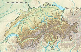
| Mappa di localizzazione | |
| Dati SOIUSA | |
| Grande Parte | Alpi Occidentali |
| Grande Settore | Alpi Nord-occidentali |
| Sezione | Alpi Pennine |
| Sottosezione | Alpi del Weisshorn e del Cervino |
| Supergruppo | Catena Weisshorn-Zinalrothorn |
| Gruppo | Gruppo del Weisshorn |
| Codice | I/B-9.II-D.8 |
Caratteristiche

Si trova lungo la cresta che congiunge il Weisshorn con il Zinalrothorn; il Moming Pass (3.777 m) lo separa dal Zinalrothorn mentre il Schalijoch (3.750 m) lo divide dal Weisshorn.
La montagna fa parte della cosiddetta corona imperiale, insieme di montagne che formano un ferro di cavallo: Les Diablons (3.609 m), il Bishorn (4.153 m), il Weisshorn (4.505 m), lo Schalihorn (3.974 m), lo Zinalrothorn (4.221 m), il Trifthorn (3.728 m), l'Obergabelhorn (4.062 m), il Mont Durand (3.712 m), la Pointe de Zinal (3.790 m), la Dent Blanche (4.356 m), il Grand Cornier (3.961 m), il Pigne de la Lé (3.396 m), la Garde de Bordon (3.310 m), ed al centro di questa gigantesca parabola il Monte Besso (3.667 m).
Salita alla vetta
La via normale di salita alla vetta parte dalla Rothornhütte.
Altri progetti
 Wikimedia Commons contiene immagini o altri file su Schalihorn
Collegamenti esterni
- Lo Schalihorn su hikr.org, su hikr.org.
На других языках
[de] Schalihorn
Das Schalihorn ist ein 3974 m ü. M. hoher Berg im Schweizer Kanton Wallis. Es liegt zwischen Täsch und Zinal. Innerhalb der Walliser Alpen wird es zur Weisshorngruppe gezählt. Der Gipfel liegt auf dem Grat, der das Mattertal vom Val d’Anniviers trennt. Dieser setzt sich nach Süden über den Hohlichtpass (3734m), die Pointe Nord de Moming (3863m), den Col de Moming (3717m) und die Pointe Sud de Moming (3963m) zum höheren Zinalrothorn fort, während der Grat nach Norden zum Schalijoch (3748m) verläuft und danach über den Schaligrat zum Gipfel des Weisshorns, des höchsten und bekanntesten Gipfels westlich des Mattertals, ansteigt.[en] Schalihorn
The Schalihorn (3,975 m) is a mountain of the Swiss Pennine Alps, located between Zinal and Täsch in the canton of Valais. It is separated from the Zinalrothorn by the Moming Pass (3,777 m) and from the Weisshorn by the Schalijoch (3,750 m).[fr] Schalihorn
Le Schalihorn (3 974 mètres) est un sommet des Alpes valaisannes, entre le Zinalrothorn et le Weisshorn.- [it] Schalihorn
Другой контент может иметь иную лицензию. Перед использованием материалов сайта WikiSort.org внимательно изучите правила лицензирования конкретных элементов наполнения сайта.
WikiSort.org - проект по пересортировке и дополнению контента Википедии

