geo.wikisort.org - Montagne
Il Monte Rogoria, detto anche Rogorio o Motto Croce, è una montagna delle Prealpi Luganesi, nella sezione delle Prealpi Varesine. È situata sul confine tra il Canton Ticino (Svizzera) e la Lombardia (Italia) con un'altitudine di 1184 m.
| Monte Rogoria | |
|---|---|
 | |
| Stati | |
| Regione | |
| Provincia | |
| Altezza | 1 184 m s.l.m. |
| Prominenza | 67 m |
| Isolamento | 0,42 km |
| Catena | Alpi |
| Coordinate | 46°01′21.5″N 8°49′14.84″E |
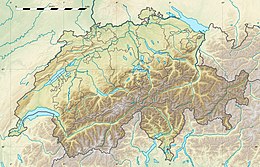
| Mappa di localizzazione | |
| Dati SOIUSA | |
| Grande Parte | Alpi Occidentali |
| Grande Settore | Alpi Nord-occidentali |
| Sezione | Prealpi Luganesi |
| Sottosezione | Prealpi Varesine |
| Supergruppo | Catena Tamaro-Gambarogna-Lema |
| Gruppo | Gruppo del Tamaro |
| Sottogruppo | Gruppo del Lema |
| Codice | I/B-11.II-A.1.c |
Descrizione
La vegetazione sulla cima, che domina il lago Maggiore e le isole Borromee, è composta da faggi.
Bibliografia
- Plinio Grossi, Il Malcantone, riedizione della Guida Galli-Tamburini, Fontana Print S. A., Pregassona 1984.
- Santino Trezzini, Cronistoria di Astano, Consiglio Parrocchiale Astano, 2010.
Voci correlate
- Astano
- Dumenza
- Monte Lema
Altri progetti
 Wikimedia Commons contiene immagini o altri file su Monte Rogoria
Collegamenti esterni
- Astano su geofinder.ch, su geofinder.ch.
На других языках
[de] Monte Rogòria
Der Monte Rogòria, auch Monte Rogorio oder Motto Croce genannt, ist ein Berg (1184 m ü. M.) in den Vareser Voralpen, die Teil der Luganer Voralpen sind. Er befindet sich im Grenzgebiet zwischen dem Tessin (Schweiz) und der Lombardei (Italien) am Fusse des Monte Lemas.[en] Monte Rogoria
Monte Rogoria (also known as Monte Rogorio or Motto Croce) is a mountain of the Lugano Prealps, located on the border between Switzerland and Italy, north of Astano, at the foot of the Monte Lema. The summit and the majority of the mountain are in the Swiss canton of Ticino, whilst a part of the north-western flank lies in the Italian region of Lombardy. It has an elevation of 1,184 metres above sea level. The view from the summit of the mountain encompasses the Lake Maggiore, the Borromean Islands and the Monte Rosa massif. There is no official hiking trail leading to the summit itself, but there are trails to the mountain pass Forcola respectively Passo di Monte Faëta at an altitude of 1,117 metres located close to the summit plateau. Starting points are: Astano, Miglieglia and Dumenza.[1][2]- [it] Monte Rogoria
Текст в блоке "Читать" взят с сайта "Википедия" и доступен по лицензии Creative Commons Attribution-ShareAlike; в отдельных случаях могут действовать дополнительные условия.
Другой контент может иметь иную лицензию. Перед использованием материалов сайта WikiSort.org внимательно изучите правила лицензирования конкретных элементов наполнения сайта.
Другой контент может иметь иную лицензию. Перед использованием материалов сайта WikiSort.org внимательно изучите правила лицензирования конкретных элементов наполнения сайта.
2019-2025
WikiSort.org - проект по пересортировке и дополнению контента Википедии
WikiSort.org - проект по пересортировке и дополнению контента Википедии

