geo.wikisort.org - Montagne
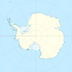
Le montagne di Freyberg sono un gruppo montuoso situato nella Terra della Regina Vittoria, in Antartide. In particolare queste montagne si trovano nell'entroterra sia della costa di Oates che della costa di Pennell e sono delimitate a ovest dal ghiacciaio Rennick, a nord dalle montagne di Bowers, a est dal ghiacciaio Black e a sud dal nevaio Evans. Tra le formazioni maggiori di questo gruppo montuoso spiccano la dorsale Salamander, a est, e la dorsale Alamein, a ovest, due catene separate dal ghiacciaio Canham, aventi entrambe diverse cime di altezza superiore ai 2.500 m s.l.m., come i monti Staley e Apolotok, nella prima, e il monte Camelot, nella seconda.
Storia
Le montagne di Freyberg sono state così battezzate dal reparto settentrionale della spedizione neozelandese di ricognizione geologica in Antartide svoltasi nel 1963-64, in onore del famoso generale neozelandese Lord Bernard Freyberg.[1]
Note
- (EN) Montagne di Freyberg, in Geographic Names Information System, USGS.
Collegamenti esterni
- (EN) Montagne di Freyberg, su Geographic Names Information System per l'Antartico, USGS.
На других языках
[de] Freyberg Mountains
Die Freyberg Mountains sind eine Gruppe von Bergen im nördlichen Viktorialand, die vom Rennick-Gletscher, den Bowers Mountains, dem Black-Gletscher und dem Evans-Firnfeld umgeben sind. Höchste Erhebung ist Mount Camelot mit 2590 m.[en] Freyberg Mountains
The Freyberg Mountains (.mw-parser-output .geo-default,.mw-parser-output .geo-dms,.mw-parser-output .geo-dec{display:inline}.mw-parser-output .geo-nondefault,.mw-parser-output .geo-multi-punct{display:none}.mw-parser-output .longitude,.mw-parser-output .latitude{white-space:nowrap}72°15′S 163°45′E) are a group of mountains in Victoria Land, Antarctica, bounded by Rennick Glacier, Bowers Mountains, Black Glacier, and Evans Neve. Named for New Zealand's most famous General, Lord Bernard Freyberg, by the Northern Party of New Zealand Geological Survey Antarctic Expedition (NZGSAE), 1963-64.[1] This mountain group includes the Alamein Range. These topographical features all lie situated on the Pennell Coast, a portion of Antarctica lying between Cape Williams and Cape Adare.[fr] Chaîne Freyberg
La chaîne Freyberg (en anglais : Freyberg Mountains) est une chaîne de montagnes située en Antarctique.- [it] Montagne di Freyberg
Другой контент может иметь иную лицензию. Перед использованием материалов сайта WikiSort.org внимательно изучите правила лицензирования конкретных элементов наполнения сайта.
WikiSort.org - проект по пересортировке и дополнению контента Википедии

