geo.wikisort.org - Montagne
Il monte Iremel' (in russo: Иремель?, in baschiro: Ирәмәл) è il secondo per altezza nella parte meridionale degli Urali meridionali, con 1 589 m. È situato nella repubblica autonoma della Baschiria (Federazione Russa).
| Iremel' | |
|---|---|
 | |
| Stato | |
| Regione | Baschiria |
| Altezza | 1 589 m s.l.m. |
| Catena | Urali meridionali |
| Coordinate | 54°30′54″N 58°50′24″E |
| Mappa di localizzazione | |
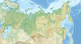 Iremel' | |
Oltre alla cima principale, il Bol'šoj Iremel' (Grande Iremel'), esiste una cima secondaria, chiamata Malyj Iremel' (Piccolo Iremel', 1 449 m). Le due cime sono separate da una sella larga circa 1 km e alta 1 200-1 250 m.
Ai piedi del massiccio sorgono le sorgenti di alcuni piccoli fiumi appartenenti al bacino del fiume Belaja, importante fiume della Russia appartenente al bacino del Volga, del quale è tributario attraverso la Kama. La Belaja ha origine dalle paludi a est del monte Iremel'.
Altri progetti
 Wikimedia Commons contiene immagini o altri file su Iremel
На других языках
[de] Iremel
Der Iremel (Baschkirisch Ирәмәл) (Uralgebirge, Russland) ist der zweithöchste Berg (1586 m) im Südural, der nur vom Berg Jamantau (1640 m) übertroffen wird. Die Iremelskaja Podkowa (wörtlich Hufeisen) besteht aus dem Bolschoi Iremel (wörtlich Großer Iremel), dem Maly Iremel (wörtlich Kleiner Iremel), Kabantschik (wörtlich Wildschweinchen) und Scherebtschik (wörtlich Hengstchen). Einer Legende nach verkörpert der Bolschoi Iremel einen Mann, der Maly Iremel – seinen Sohn, Kabantschik und Scherebtschik – sind ihre Haustiere. Das Iremel-Gebirge hat ein einzigartiges Klima – sehr oft schlägt das Wetter um, starke Winde (9,5–13 m/s) und im Winter Schneestürme (35–63 Tage lang). Die Schneedecke beträgt ca. 80–100 Zentimeter. Bis zu 200 Tagen im Jahr ist es nebelig in diesem Gebirge.[en] Iremel
Iremel (Bashkir: Ирәмәл, Russian: Иремель) is a compact mountain ridge in the Southern Ural Mountains in the republic of Bashkortostan, Russian Federation (bordering with Chelyabinsk Oblast to the north-west). The highest peak, Bolshoy Iremel (Big Iremel), or simply Iremel, stands at 1589 metres (5200 ft) high. Maly Iremel (Small Iremel), 6 kilometers north-east, stands at 1449 meters. It is the source of the River Belaya.[1][2]- [it] Iremel'
[ru] Иремель
Иреме́ль (башк. Ирәмәл) — вторая по высоте вершина Южного Урала, расположена на северо-востоке Белорецкого района Башкортостана[1], северо-западные склоны находятся в границах Катав-Ивановского района Челябинской области.Текст в блоке "Читать" взят с сайта "Википедия" и доступен по лицензии Creative Commons Attribution-ShareAlike; в отдельных случаях могут действовать дополнительные условия.
Другой контент может иметь иную лицензию. Перед использованием материалов сайта WikiSort.org внимательно изучите правила лицензирования конкретных элементов наполнения сайта.
Другой контент может иметь иную лицензию. Перед использованием материалов сайта WikiSort.org внимательно изучите правила лицензирования конкретных элементов наполнения сайта.
2019-2026
WikiSort.org - проект по пересортировке и дополнению контента Википедии
WikiSort.org - проект по пересортировке и дополнению контента Википедии