geo.wikisort.org - Montagne
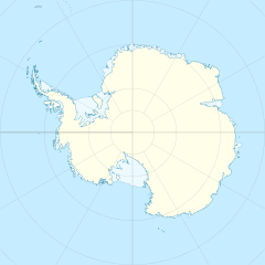
I colli Denton sono una catena montuosa situata nella regione centro-occidentale della Dipendenza di Ross, sulla costa di Scott, in Antartide. La catena dei colli Denton, che fa parte della catena dei monti Transantartici, è orientata in direzione nord-est/sud-ovest, nella quale si estende per circa 45 km, arrivando a una larghezza massima di circa 17 km, ed è costeggiata a ovest e a nord dal ghiacciaio Blue, che la separa dalla dorsale Royal Society, a sud dal ghiacciaio Howchin e dalla sella Armitage e a est dal grande ghiacciaio Koettlitz. La vetta più alta dei colli Denton è quella del monte Kowalczyk, situato poco a ovest del ghiacciaio Hobbs, il principale ghiacciaio della catena.[1]
| Colli Denton | |
|---|---|
 | |
| Continente | Antartide |
| Stati | |
| Catena principale | Monti Transantartici |
| Cima più elevata | Monte Kowalczyk (1690 m s.l.m.) |
| Lunghezza | 45 km |
| Larghezza | 17 km |
Storia
La catena è stata scoperta nel corso della spedizione Discovery, condotta negli anni 1901-04 dal capitano Robert Falcon Scott, e mappata più approfonditamente da membri del Programma Antartico statunitense e di quello neozelandese negli anni seguenti all'Anno Geofisico Internazionale, 1957-58. Nel 1999 i colli sono poi stati così battezzati dal Comitato consultivo dei nomi antartici in onore di George H. Denton, un professore del dipartimento di scienze della Terra dell'Università del Maine che, tra il 1958 e il 1999, condusse diverse ricerche geologiche nei Monti Transantartici e anche nei colli Denton, visitando l'Antartide più di 25 volte.[2]
Note
- Colli Denton, su sws.geonames.org, GeoNames.Org (cc-by), 20 gennaio 2008. URL consultato il 27 dicembre 2018.
- (EN) Colli Denton, in Geographic Names Information System, USGS.
Voci correlate
Collegamenti esterni
- (EN) Colli Denton, su Geographic Names Information System per l'Antartico, USGS.
На других языках
[de] Denton Hills
Die Denton Hills sind eine Gruppe schroffer Gebirgsausläufer, die sich über 38,5 km Länge und 14,5 km Breite östlich der Royal Society Range an der Scott-Küste des ostantarktischen Viktorialands erstrecken. Die Formation umfasst eine Reihe nach Osten ausgerichteter Gebirgskämme und Täler, die vom Howchin-Gletscher, dem Armitage-Sattel, dem Blue Glacier der Walcott Bay und der Küste begrenzt werden. Die höchsten Erhebungen, der 1690 m hohe Mount Kowalczyk und der 1634 m hohe Goat Mountain, ragen aus dem Gebirgskamm Hobbs Ridge im nördlichen Teil der Hills auf. Nach Süden fallen sie über den zentral gelegenen Gebirgskamm Kahiwi Maihao Ridge (1075 m) und die Xanadu Hills (820 m) am südlichen Ende allmählich ab. Das Gletschersystem der Hills, bestehend aus Hobbs-Gletscher, Blackwelder-Gletscher, Salmon-Gletscher, Garwood-Gletscher, Joyce-Gletscher, Rivard-Gletscher, Miers-Gletscher, Adams-Gletscher und Ward-Gletscher, ist auf dem Rückzug und hinterlässt zahlreiche Trockentäler.[en] Denton Hills
The Denton Hills (.mw-parser-output .geo-default,.mw-parser-output .geo-dms,.mw-parser-output .geo-dec{display:inline}.mw-parser-output .geo-nondefault,.mw-parser-output .geo-multi-punct{display:none}.mw-parser-output .longitude,.mw-parser-output .latitude{white-space:nowrap}78°5′S 163°55′E) are a group of rugged foothills, 24 nautical miles (44 km) long southwest–northeast and 9 nautical miles (17 km) wide, to the east of the Royal Society Range on the Scott Coast, Victoria Land. The feature comprises a series of eastward-trending ridges and valleys circumscribed by Howchin Glacier, Armitage Saddle, Blue Glacier, the coast, and Walcott Bay. The highest summits, Mount Kowalczyk at 1,703 metres (5,587 ft), and Goat Mountain at 1,634 metres (5,361 ft), rise from Hobbs Ridge in the northern part of the foothills. Elevations decrease southward as in Kahiwi Maihao Ridge, 1,045 metres (3,428 ft) high near the center of the group and the Xanadu Hills, 820 metres (2,690 ft) high at the southern end. The principal glaciers (Hobbs, Blackwelder, Salmon, Garwood, Joyce, Rivard, Miers, Adams, Ward) flow east but have receded, leaving several dry valleys.[1]- [it] Colli Denton
Другой контент может иметь иную лицензию. Перед использованием материалов сайта WikiSort.org внимательно изучите правила лицензирования конкретных элементов наполнения сайта.
WikiSort.org - проект по пересортировке и дополнению контента Википедии
